Questions and Answers
भूभागीय भूगोल का क्या महत्व है?
भूमि के दृश्य, सुविधाएँ और गतिशील प्रणालियों को समाहित करना।
भूभागीय भूगोल क्या समझता है?
भूमि, पानी, हवा और जीव जंतुओं के बीच के अंतराक्रियाओं का समझना।
क्या क्या रूप परिस्थितियों पर भूभागीय भूगोल केंद्रित है?
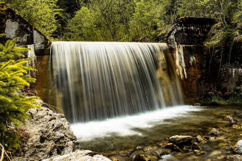
पर्वत, घाटी, पठार, डेल्टा
भूभागीय भूगोल के क्या मूल अवधारणाएं हैं?
Signup and view all the answers
भूभागीय भूगोल किस प्रकार के पैटर्न पर केंद्रित है?
Signup and view all the answers
भूभागीय भूगोल किस प्रकार के जल शरीरों पर केंद्रित है?
Signup and view all the answers
रिमोट सेंसिंग क्या है?
Signup and view all the answers
जिओग्राफिक सूचना प्रणाली (GIS) क्या है?
Signup and view all the answers
कार्टोग्राफी क्या है?
Signup and view all the answers
शोधकर्ता कैसे विश्लेषण करते हैं?
Signup and view all the answers
भू-भूगोलीय सूचना क्या है?
Signup and view all the answers
भूगोलीय सूचना प्रणाली (GIS) किसे सक्षम बनाती है?
Signup and view all the answers
Study Notes
Unraveling Physical Geography: From Landscapes to Processes
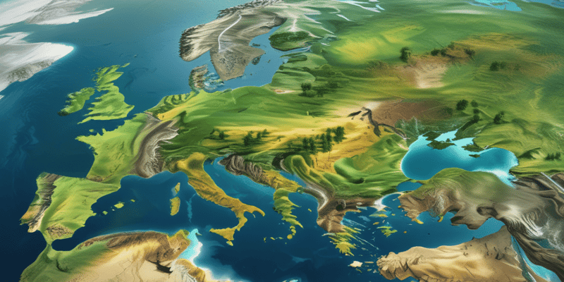
Physical geography is an essential component of the vast field of geography, encompassing the earth's landscapes, features, and dynamic systems. This branch focuses on understanding the interactions among land, water, air, and living organisms that shape our planet's surface and its evolution through time.
At its core, physical geography explores the following concepts:
- Landforms: Mountains, valleys, plateaus, deltas – the varied and beautiful shapes created by erosion, deposition, tectonic movements, and volcanism.
- Climatates: Patterns of precipitation, temperature, winds, and atmospheric pressure form distinct climatic regions around the globe.
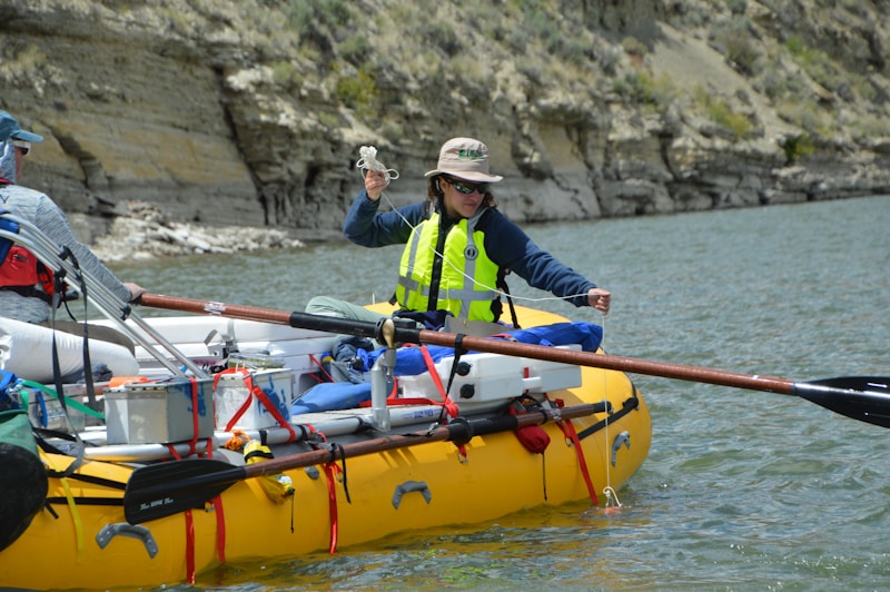
- Water bodies: Rivers, lakes, oceans, and glaciers define our landscape while shaping ecosystems, affecting weather patterns, and regulating Earth's thermodynamics.
- Soils: Comprising organic matter, minerals, gases, and liquids, soils serve as the medium for plant growth and naturally retain water, nutrients, and heat energy.
These geological forces interact continuously, creating feedback loops and influencing human societies and economies. By studying these interactions across scales ranging from microenvironments to the global atmosphere, physical geographers strive to better comprehend our planet's past, present, and potential futures.
To equip themselves with tools required to investigate these phenomena, researchers delve into a variety of fields:
- Remote sensing: Acquires digital images of Earth's surface and atmospheric conditions via satellites, aircraft, and drones, enabling geologists and ecologists alike to analyze this data and extract valuable information.
- Geographic information systems (GIS): Collect, store, manipulate, analyze, manage, and display geo-referenced data, empowering users to uncover spatial relationships and facilitate informed decision-making.
- Cartography: Produces maps designed to reveal geographical characteristics, aid navigation, interpret spatial patterns, and visualize global changes.
As part of their daily tasks, researchers collaborate with colleagues worldwide, utilizing state-of-the-art technologies and theoretical frameworks, to generate novel insights and expand our collective body of knowledge.
Regardless of whether you explore physical geography from an academic standpoint or as part of broader interests in conservation efforts or city planning, it offers endless opportunities to deepen your appreciation for our spectacular planet and contribute meaningfully to addressing pressing global challenges.
Studying That Suits You
Use AI to generate personalized quizzes and flashcards to suit your learning preferences.
Description
Explore the fundamental concepts of physical geography, including landforms, climates, water bodies, and soils. Learn about the tools used by researchers such as remote sensing, GIS, and cartography to study Earth's landscapes and dynamic systems.