Podcast
Questions and Answers
What is the major mountain range that runs along the eastern United States and into eastern Canada?
What is the major mountain range that runs along the eastern United States and into eastern Canada?
The Appalachian Mountains.
Identify the river that forms part of the border between the United States and Mexico.
Identify the river that forms part of the border between the United States and Mexico.
The Rio Grande.
Which lake, located in Utah, is known for its high salinity and serves as one of the largest saline lakes in the Western Hemisphere?
Which lake, located in Utah, is known for its high salinity and serves as one of the largest saline lakes in the Western Hemisphere?
The Great Salt Lake.
Name the two major mountain ranges located in the western United States known for their rugged terrain and natural beauty.
Name the two major mountain ranges located in the western United States known for their rugged terrain and natural beauty.
What are the five Great Lakes of North America, represented by the acronym HOMES?
What are the five Great Lakes of North America, represented by the acronym HOMES?
Study Notes
Mountain Ranges
- Appalachian Mountains: One of the oldest mountain ranges in North America, spanning from Canada to Alabama; known for its scenic beauty and biodiversity.
- Cascade Range: Located in the Pacific Northwest, stretches from British Columbia to Northern California; features volcanic peaks like Mount St. Helens and Mount Rainier.
- Coastal Range: Runs parallel to the Pacific Ocean, primarily found in California; characterized by rugged terrain and diverse ecosystems.
- Rocky Mountains: Extending from Canada to New Mexico; includes some of the highest peaks in North America, with significant geological and ecological diversity.
- Sierra Nevada Mountains: Located in California, famous for its breathtaking landscapes including Yosemite National Park and Lake Tahoe.
Deserts
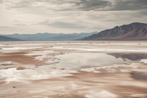
- Death Valley: Located in California, known for being one of the hottest places on Earth and is part of the Mojave Desert; features unique landscapes and diverse wildlife.
- Great Basin Desert: The largest desert in North America, spanning across Nevada and parts of Utah; characterized by its high elevation and cold desert climate.
- Mojave Desert: Found in California, Nevada, Utah, and Arizona; home to Joshua Trees and a variety of unique wildlife.
Rivers
- Colorado River: Major river in the western United States; carved the Grand Canyon and serves as a vital water source for several states.
- Mackenzie River: The longest river in Canada, flowing into the Arctic Ocean; essential for transportation and sustains various ecosystems.
- Mississippi River: One of the longest rivers in North America, flowing from Minnesota to Louisiana; critical for agriculture and transportation.
- Missouri River: A major tributary of the Mississippi River, it is the longest river in North America; crucial for economic activities and navigation.
- Rio Grande: Forms the border between the United States and Mexico; vital for water supply in the region.
- Ohio River: A tributary of the Mississippi River, providing important waterways for several states in the east.
- St. Lawrence River/St. Lawrence Seaway: Key waterway connecting the Great Lakes to the Atlantic Ocean; facilitates international shipping and trade.
- Yukon River: Extending through Canada and Alaska; historically significant during the Klondike Gold Rush for transportation and commerce.
Water Bodies
- Atlantic Ocean: The second-largest ocean; separates North America from Europe and Africa, influencing climate and weather patterns.
- Pacific Ocean: The largest ocean, lying to the west of the United States and Canada; significant for trade, fishing, and marine biodiversity.
- Hudson Bay: A large body of saltwater in northeastern Canada; significant for wildlife and has a unique climate and ecosystem.
- The Great Lakes: A group of five lakes: Huron, Ontario, Michigan, Erie, and Superior; they are the largest group of freshwater lakes in the world by total area.
- The Great Salt Lake: Located in Utah; one of the saltiest bodies of water in the world, offering unique ecosystems and recreational opportunities.
Studying That Suits You
Use AI to generate personalized quizzes and flashcards to suit your learning preferences.
Description
Test your knowledge of the physical geography of the US and Canada with this interactive map quiz. Identify features such as the Rocky Mountains, Great Lakes, and various rivers. Perfect for students looking to enhance their understanding of North American landscapes.