Podcast
Questions and Answers
What do city maps typically include?
What do city maps typically include?
- Weather conditions
- Streets and buildings (correct)
- Lakes and rivers
- Continents and countries
What does a scale on a map allow users to do?
What does a scale on a map allow users to do?
- Determine real distances on the map (correct)
- Visualize the topography of an area
- Identify the cardinal directions
- Estimate the time it takes to travel between locations
Which component of a map is used to indicate directions?
Which component of a map is used to indicate directions?
- Compass rose (correct)
- Scale
- Symbols
- Legends
When creating a personal map using graph paper, what does each square typically represent?
When creating a personal map using graph paper, what does each square typically represent?
What is the primary purpose of weather maps?
What is the primary purpose of weather maps?
What is an example of a creative way to enhance spatial awareness?
What is an example of a creative way to enhance spatial awareness?
Which of the following is NOT a feature typically found on a map?
Which of the following is NOT a feature typically found on a map?
Which symbols would most likely be found on a city map?
Which symbols would most likely be found on a city map?
What type of map would you use to find the distribution of snow across regions?
What type of map would you use to find the distribution of snow across regions?
Which map component would help someone understand the layout of streets and buildings in a city?
Which map component would help someone understand the layout of streets and buildings in a city?
What do the cardinal points on a map indicate?
What do the cardinal points on a map indicate?
Which of the following best describes the primary use of a scale on a map?
Which of the following best describes the primary use of a scale on a map?
What is a practical reason for creating a treasure map?
What is a practical reason for creating a treasure map?
What type of map commonly employs color coding to distinguish between countries?
What type of map commonly employs color coding to distinguish between countries?
When using graph paper to create a personal map, how can distances be measured?
When using graph paper to create a personal map, how can distances be measured?
Which feature on a map helps to indicate where north is located?
Which feature on a map helps to indicate where north is located?
Study Notes
Understanding Maps
- Maps are visual representations of places, showing layouts as if viewed from above, similar to an aerial perspective.
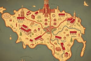
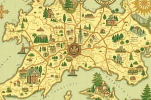
- City maps feature streets and buildings, while country maps include states, cities, lakes, and rivers.
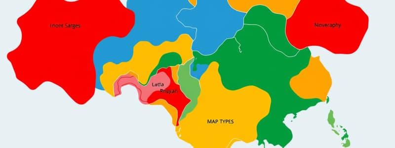
- World maps display continents, countries, oceans, and often use color coding for different nations.
Types of Maps and Their Uses
- Weather maps illustrate conditions like sunshine, rain, or snow distribution across different regions.
- Directions are indicated using four cardinal points: North (toward the North Pole), South (toward the South Pole), East (where the sun rises), and West (where the sun sets).
- Maps may include a compass rose or an arrow indicating north, along with various symbols representing features like bike paths or restrooms.
Map Components
- A scale is essential for understanding real distances on the map, allowing users to estimate how far apart locations are.
- Symbols are small illustrations that provide additional information about features and amenities on the map.
Creating Maps
- To make a personal map, start with graph paper or create your own using a ruler, measuring distances by footstep.
- Every footstep can represent one square on graph paper; map out the room's dimensions and incorporate significant objects with appropriate scaling.
- For an engaging activity, create a treasure map by hiding an object and drawing its location for someone else to find, promoting spatial awareness and navigational skills.
Practical Application
- Practice moving around a mapped area by tracing routes to different landmarks, enhancing understanding of directions and distance.
- Encourage teamwork and creativity by collaborating with a friend to create treasure maps, fostering fun in learning spatial navigation.
Understanding Maps
- Maps visually represent geographical locations, offering an aerial perspective of areas.
- City maps display streets and buildings, while country maps include geographical features like states, lakes, and rivers.
- World maps depict continents, countries, and oceans, often using color coding to differentiate nations.
Types of Maps and Their Uses
- Weather maps convey meteorological conditions such as sun, rain, and snow distribution across various regions.
- Cardinal points (North, South, East, West) provide direction, with North pointing toward the North Pole.
- Maps often feature a compass rose or arrow indicating north, accompanied by symbols that highlight features like bike paths or restrooms.
Map Components
- Scale is crucial for interpreting real-world distances, enabling users to gauge the space between locations accurately.
- Symbols used on maps give essential information about amenities and points of interest in the area.
Creating Maps
- Personal maps can be crafted using graph paper; each square may equate to a footstep to scale distances accurately.
- Mapping a room involves measuring distances and marking significant objects to reflect their proportions correctly.
- Crafting a treasure map by hiding an object and illustrating its location enhances spatial awareness and navigation skills.
Practical Application
- Navigating a mapped area effectively by tracing routes to landmarks develops an understanding of direction and distance.
- Encouraging group activities, like creating treasure maps, promotes teamwork and makes spatial navigation learning enjoyable and engaging.
Studying That Suits You
Use AI to generate personalized quizzes and flashcards to suit your learning preferences.
Description
This quiz explores the fundamentals of maps, their types, and key components. Learn how maps visually represent geographical areas, and understand the significance of scales, symbols, and directions. Test your knowledge on various map types and their uses in everyday life.