Podcast
Questions and Answers
What is the primary purpose of cartography?
What is the primary purpose of cartography?
- To create computer programs
- To construct maps and represent spatial concepts (correct)
- To record historical events
- To analyze weather patterns
The Babylonian World Map, created in 600 BCE, is acknowledged as the earliest known map of the world.
The Babylonian World Map, created in 600 BCE, is acknowledged as the earliest known map of the world.
True (A)
What technology has significantly facilitated modern map-making?
What technology has significantly facilitated modern map-making?
Geographic Information Systems (GIS)
The earliest known maps date back to _____ BCE and primarily depict the night sky.
The earliest known maps date back to _____ BCE and primarily depict the night sky.
Match the following historical maps with their descriptions:
Match the following historical maps with their descriptions:
Who is considered one of the first cartographers from ancient Greece?
Who is considered one of the first cartographers from ancient Greece?
Ancient Greek maps were created solely for decorative purposes.
Ancient Greek maps were created solely for decorative purposes.
What system did Ptolemy use for his maps that is considered a basis for modern cartography?
What system did Ptolemy use for his maps that is considered a basis for modern cartography?
Pei Ju created an early map using a _____ system in the 6th century.
Pei Ju created an early map using a _____ system in the 6th century.
Match the following Greek cartographers with their contributions:
Match the following Greek cartographers with their contributions:
Flashcards are hidden until you start studying
Study Notes
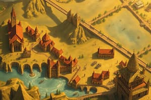
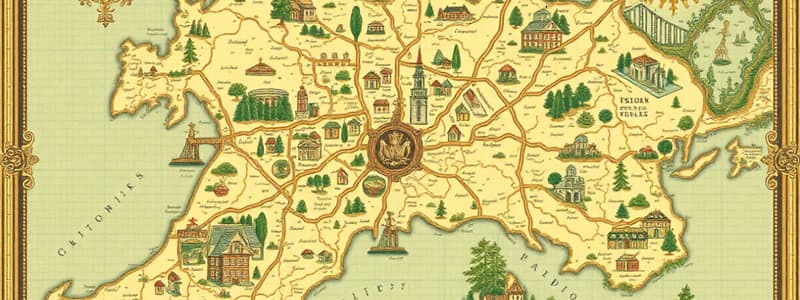
History of Maps and Cartography
- Cartography is the science and art of making maps.
- Early maps evolved from cave paintings and rock carvings to clay tablets.
- The Babylonian World Map, created in 600 BCE, is considered the earliest world map.
- The Greeks created the first paper maps for navigation and depicting the Earth.
- Anaximander was one of the first cartographers who drew a map of the known world.
- Hecataeus, Herodotus, Eratosthenes, and Ptolemy were other prominent Greek mapmakers.
- Ptolemy created maps using a coordinate system with latitude and longitude lines, influencing modern cartography.
- The invention of the Mercator projection in the 1500s revolutionized navigation and cartography.
- The Age of Exploration led to the creation of new maps showing uncharted territories and advancements in cartographic techniques.
Types of Maps
- Reference Maps show only locations without specific information.
- Thematic Maps convey special information about features, such as the 1854 Cholera Map of London.
- Cartogram is a thematic map where distance or area is substituted by a variable.
- Choropleth Maps use shades or colors to represent statistical variables.
- Topographic Maps depict variations in elevation using contour lines.
- Topological Maps simplify maps to retain vital information.
GIS & Remote Sensing
- Geographic Information Systems (GIS) connect maps with databases to analyze and visualize data.
- GIS uses thematic map layers with data for complex mathematical analysis.
- Remote Sensing acquires information using sensors far away, including cameras, radars, and thermometers.
- Satellite images are crucial for monitoring changes in the earth's surface.
Studying That Suits You
Use AI to generate personalized quizzes and flashcards to suit your learning preferences.