Podcast
Questions and Answers
How many time zones are represented by a total angular change of 360 degrees?
How many time zones are represented by a total angular change of 360 degrees?
- 24 (correct)
- 12
- 36
- 10
Which imaginary line divides the Earth into the Northern and Southern Hemispheres?
Which imaginary line divides the Earth into the Northern and Southern Hemispheres?
- Meridian of Greenwich
- Tropic of Cancer
- Antimeridian
- Equator (correct)
What is the latitude of the Tropic of Cancer?
What is the latitude of the Tropic of Cancer?
- 180°
- 0°
- 90°
- 23° 27′ (correct)
Which type of map would be most useful for understanding cultural identities within a country?
Which type of map would be most useful for understanding cultural identities within a country?
Which imaginary circle is denoted at 0° longitude?
Which imaginary circle is denoted at 0° longitude?
What characterizes a topographic map?
What characterizes a topographic map?
What is the primary purpose of a weather map?
What is the primary purpose of a weather map?
How is altitude typically measured?
How is altitude typically measured?
Which statement is true regarding the Arctic Circle?
Which statement is true regarding the Arctic Circle?
What is an example of a numerical scale on a map?
What is an example of a numerical scale on a map?
What is the significance of geographic coordinates?
What is the significance of geographic coordinates?
Which type of map would best help a traveler locate tourist attractions?
Which type of map would best help a traveler locate tourist attractions?
What is the range of longitudes measured from the Greenwich meridian?
What is the range of longitudes measured from the Greenwich meridian?
What is the primary difference between a croquis and a plano?
What is the primary difference between a croquis and a plano?
Which element of a map helps in understanding the proportions between real dimensions and those shown on the map?
Which element of a map helps in understanding the proportions between real dimensions and those shown on the map?
What is the role of coordinates in mapping?
What is the role of coordinates in mapping?
What defines the Greenwich meridian in the context of time zones?
What defines the Greenwich meridian in the context of time zones?
Which of the following statements best describes the function of a Geographic Information System (GIS)?
Which of the following statements best describes the function of a Geographic Information System (GIS)?
What best explains the term 'symbology' on a map?
What best explains the term 'symbology' on a map?
Why were time zones created during the Industrial Revolution?
Why were time zones created during the Industrial Revolution?
What does the title of a map typically indicate?
What does the title of a map typically indicate?
Flashcards are hidden until you start studying
Study Notes
Types of Maps
- Topographic Maps: Represent the Earth's relief with detailed information on a large scale. They incorporate contour lines, hydrography (water features), vegetation, communication routes, and population.
- Meteorological Maps: Showcase current weather conditions at a specific time and location.
- Political Maps: Depict the divisions and boundaries of territories or countries. This can include states, municipalities, capitals, major cities, mountain ranges, and rivers.
- Urban Maps: Show the distribution of features within a city, including infrastructure (roads, bridges), avenues, streets, services, hospitals, schools, banks, etc.
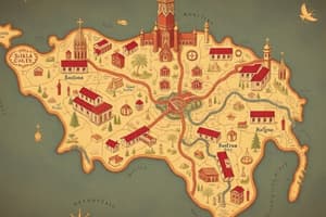
- Tourist Maps: Assist travelers in locating points of interest. They include communication routes, access points, beaches, and other attractions.
Longitude
- Measured in degrees from the Greenwich meridian (0°).
- Ranges from 0° to 180° east or west.
Altitude
- Measured in meters from sea level.
Polar Circles
- Arctic Circle: An imaginary circle located in the northern hemisphere at 66° 33' latitude.
- Antarctic Circle: An imaginary circle located in the southern hemisphere at 66° 33' latitude.
Map Scales
- Objective: Utilize map scales to measure the dimensions of geographical space representations.
Scale
- The mathematical relationship that determines the proportion between the real dimensions of space and the representation on the map.
- It indicates the number of times the ground has been reduced for representation.
- Graphical Scale: A segmented graph used to measure distances on the map.
- Numerical Scale: A fraction that indicates the relationship between map distance and real distance.
Geographical Coordinates
- Objective: Identify geographical coordinates to locate points and areas on a map using cardinal directions (north, south, east, west) and geographical coordinates.
- This system uses a network of parallels (latitude) and meridians (longitude).
- Latitude: Measured in degrees from the equator. Ranges from 0° to 90° north and south.
Representations of Geographical Space
- Sketch: Simple drawing using a large scale to depict major features. Not precise, and scales, measurements, or distances are not accurate.
- Plan: Represents a local space with accurate dimensions. The scale matches real dimensions and does not exceed 111 kilometers. Includes scale, symbols, and orientation.
- Globe: A three-dimensional representation of the Earth. Shows the Earth's shape and coordinates, including the distribution of continents and oceans.
- Map: A flat representation of the Earth's surface using coordinates.
- Satellite Image: A visual representation captured by sensors on artificial satellites.
- Geographic Information System (GIS): A computer system for storing, analyzing, and relating information to identify patterns and create maps.
- Atlas: A collection of maps covering various themes.
Map Elements
-
Objective: Identify the characteristics of elements that make up a map for accurate geographical representation.
-
Map Elements:
- Title: Indicates the topic, place, and time period represented on the map.
- Orientation: Shows the direction of winds, indicating cardinal points. If not shown, a north arrow is at the top of the map.
- Coordinates: A system of imaginary lines on the Earth's surface used to locate points. Uses latitude (north and south) and longitude (east and west).
- Scale: The mathematical relationship indicating the proportion between the real dimensions of space and the representation on the map.
- Symbology: A language used on the map to represent information. Includes lines, points, colors, areas, or icons explained to understand the meaning. Based on the scale and theme of the map.
Time Zones
- Created during the Industrial Revolution due to the increase in production, locomotives, and trade.
- Standardized time around the globe.
- The Greenwich meridian is the starting point of the system.
- Every 15° of longitude change signifies a change in time zone.
- A total of 24 time zones.
Points, Lines, and Circles on the Planet
- North Pole: Imaginary point at 90° North on the Earth's axis.
- South Pole: Imaginary point at 90° South on the Earth's axis.
- Greenwich Meridian: An imaginary semicircle at 0° longitude. It goes from pole to pole and divides the Earth into east and west.
- Equator: An imaginary circle at 0° latitude. It divides the Earth into the Northern and Southern Hemispheres.
- Earth Axis: An imaginary line that goes through the center of the Earth.
- Tropic of Cancer: Imaginary circle in the Northern hemisphere at 23° 27' latitude.
- Tropic of Capricorn: Imaginary circle in the Southern hemisphere at 23° 27' latitude.
- Antimeridian: A semi-circle at 180° longitude. It divides the map in half and goes from pole to pole.
Types of Maps
- Economic Map: Depicts regions or economic activities (agriculture, livestock, mining, industry, routes, or commercial sites).
- Social Map: Shows aspects of social development, including population, education, life expectancy, income per capita, and immigration.
- Demographic Map: Shows information related to the inhabitants of a specific space, including the total number of inhabitants, age, gender, etc.
- Cultural Map: Shows cultural information that shapes a country's identity, including languages spoken, religions practiced, etc.
Studying That Suits You
Use AI to generate personalized quizzes and flashcards to suit your learning preferences.