Podcast
Questions and Answers
What geographical feature is primarily associated with the 'Ring of Fire'?
What geographical feature is primarily associated with the 'Ring of Fire'?
- A high concentration of active volcanoes (correct)
- Numerous large deserts
- Significant glacial formations
- Extensive river systems
Which of the following best describes the purpose of latitude lines?
Which of the following best describes the purpose of latitude lines?
- To measure distances east and west of the prime meridian
- To indicate the different time zones
- To mark the boundaries of political regions
- To measure distances north and south of the equator (correct)
If a location is described as 20° North latitude and 45° West longitude, what does the 20° North latitude indicate?
If a location is described as 20° North latitude and 45° West longitude, what does the 20° North latitude indicate?
- Its distance east of the prime meridian
- Its distance north of the equator (correct)
- Its distance west of the prime meridian
- Its distance south of the equator
Which of these is NOT a tool typically used by geographers?
Which of these is NOT a tool typically used by geographers?
Which type of map is most suitable for showing the distribution of different languages across a continent?
Which type of map is most suitable for showing the distribution of different languages across a continent?
What does the Fujita scale measure?
What does the Fujita scale measure?
If a population pyramid has a wide base and a narrow top, what does this suggest about the population?
If a population pyramid has a wide base and a narrow top, what does this suggest about the population?
A geographer studies the impact of deforestation on local climate patterns. Which aspect of geographical study does this fall under?
A geographer studies the impact of deforestation on local climate patterns. Which aspect of geographical study does this fall under?
Flashcards
Ring of Fire
Ring of Fire
A circular zone around the Pacific Ocean where the majority of active volcanoes are located.
Latitude Lines
Latitude Lines
Imaginary lines that run parallel to the equator, used to locate places north or south. The zero-degree line is the equator, with lines north of it labeled 'north latitude' and lines south labeled 'south latitude'.
Longitude Lines
Longitude Lines
Imaginary lines that circle the Earth over the poles, used to locate places east or west. The prime meridian is the zero-degree line, with lines east of it labeled 'east longitude' and lines west labeled 'west longitude'.
Tools used by geographers
Tools used by geographers
Signup and view all the flashcards
What do geographers study?
What do geographers study?
Signup and view all the flashcards
Physical Map
Physical Map
Signup and view all the flashcards
Political Map
Political Map
Signup and view all the flashcards
Thematic Map
Thematic Map
Signup and view all the flashcards
Study Notes
Ring of Fire
- A zone bordering the Pacific Ocean
- Location of many active volcanoes
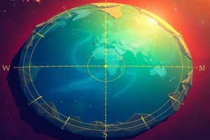
Latitude and Longitude
- Latitude lines: Imaginary lines parallel to the equator
- Used to locate places north or south
- Equator is the 0° latitude line
- Lines north of the equator are north latitude
- Lines south of the equator are south latitude
- Longitude lines: Imaginary lines running over the poles
- Used to complete the grid system
- Mark positions in the east and west hemispheres
Prime Meridian
- The 0° longitude line
Absolute Location
- Every location on Earth has a unique absolute location
- Determined by the intersection of latitude and longitude lines
- Example: Melbourne, Australia is 37° South latitude, 145° East longitude
Map Types
- Physical maps: Show natural features (e.g., mountains, rivers, lakes)
- Political maps: Show countries, states, and boundaries
- Thematic maps: Focus on specific topics (e.g., climate, population)
Tornadoes
- Powerful funnel-shaped columns of spiraling air
- Measured using the Fujita scale
Population Pyramids
- Graphic devices showing population's age and sex distribution
- Useful for understanding population trends in countries
- Wide bases on pyramids indicate large percentages of young people, suggesting rapidly growing populations
Studying That Suits You
Use AI to generate personalized quizzes and flashcards to suit your learning preferences.