Podcast
Questions and Answers
Which of the following is NOT a part of a good map?
Which of the following is NOT a part of a good map?
- Compass rose
- Population density (correct)
- Title
- Legend
Maritime climates are typically characterized by more extreme temperature variations than continental climates.
Maritime climates are typically characterized by more extreme temperature variations than continental climates.
False (B)
What are the two main types of resources based on renewability?
What are the two main types of resources based on renewability?
Renewable and Non-Renewable resources
The _______________ effect describes the economic influence of investments within a community.
The _______________ effect describes the economic influence of investments within a community.
Match the job sectors with their definitions:
Match the job sectors with their definitions:
Which factor is NOT typically associated with population distribution?
Which factor is NOT typically associated with population distribution?
Which type of precipitation occurs when air rises over mountains?
Which type of precipitation occurs when air rises over mountains?
Canada has 10 provinces and 3 territories.
Canada has 10 provinces and 3 territories.
Continental climates have milder temperatures than maritime climates.
Continental climates have milder temperatures than maritime climates.
What is the formula to calculate the doubling time using the Rule of 70?
What is the formula to calculate the doubling time using the Rule of 70?
What is the Rule of 70 used for in population studies?
What is the Rule of 70 used for in population studies?
____ is the classification of soil found in forested areas.
____ is the classification of soil found in forested areas.
Match the following job sectors with their descriptions:
Match the following job sectors with their descriptions:
Which of the following is considered a pull factor for immigration?
Which of the following is considered a pull factor for immigration?
An ecological footprint measures the positive impact of human activities on the environment.
An ecological footprint measures the positive impact of human activities on the environment.
Name two types of alternative energy sources.
Name two types of alternative energy sources.
Which component of a map helps you understand the symbols used?
Which component of a map helps you understand the symbols used?
Canada is the largest country in the world by land area.
Canada is the largest country in the world by land area.
What is the capital city of Canada?
What is the capital city of Canada?
The _____ indicates the cardinal directions on a map.
The _____ indicates the cardinal directions on a map.
Match the following Canadian provinces or territories with their capitals:
Match the following Canadian provinces or territories with their capitals:
Which of the following statements about Canada's population is true?
Which of the following statements about Canada's population is true?
Ocean currents have no impact on the climate of Canada.
Ocean currents have no impact on the climate of Canada.
Name one reason for the increase in healthcare demand in Canada.
Name one reason for the increase in healthcare demand in Canada.
Flashcards
What is a map?
What is a map?
A representation of the Earth's surface on a flat map.
What is a map scale?
What is a map scale?
The ratio of a distance on a map to the corresponding distance on the ground.
What is Canada's size?
What is Canada's size?
The area of land that lies within Canada's borders.
What is population density?
What is population density?
Signup and view all the flashcards
What is physical geography?
What is physical geography?
Signup and view all the flashcards
What are soil layers?
What are soil layers?
Signup and view all the flashcards
What are job sectors?
What are job sectors?
Signup and view all the flashcards
What are renewable resources?
What are renewable resources?
Signup and view all the flashcards
Mapping Scale
Mapping Scale
Signup and view all the flashcards
Compass Rose
Compass Rose
Signup and view all the flashcards
Representative Fraction (RF)
Representative Fraction (RF)
Signup and view all the flashcards
Canada's size
Canada's size
Signup and view all the flashcards
Population Distribution in Canada
Population Distribution in Canada
Signup and view all the flashcards
Canada's Population Density
Canada's Population Density
Signup and view all the flashcards
Canada's Aging Population
Canada's Aging Population
Signup and view all the flashcards
Climate Factors
Climate Factors
Signup and view all the flashcards
What is Climate?
What is Climate?
Signup and view all the flashcards
What is Weather?
What is Weather?
Signup and view all the flashcards
What is Convectional Precipitation?
What is Convectional Precipitation?
Signup and view all the flashcards
What is Orographic Precipitation?
What is Orographic Precipitation?
Signup and view all the flashcards
What is Frontal Precipitation?
What is Frontal Precipitation?
Signup and view all the flashcards
What is Natural Increase?
What is Natural Increase?
Signup and view all the flashcards
What are Push Factors?
What are Push Factors?
Signup and view all the flashcards
What are Pull Factors?
What are Pull Factors?
Signup and view all the flashcards
Study Notes
Map Skills
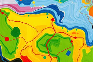
- Map components include title, legend, scale, compass rose, and grid system.
- Mapping scales include representative fraction (RF), linear scale, and verbal scale.
- Calculating distances uses scales and tools.
Canada Geography
- Provinces, territories, neighboring countries, and capital cities should be identifiable on a map.
- Canada's area and population statistics are important.
- Population distribution patterns and reasons for their spread are critical.
- Aging population's impact on society and resources.
Physical Geography
- Canadian landform regions have specific characteristics.
- Climate factors like latitude, ocean currents, wind/pressure systems, and elevation affect weather patterns.
- Weather and climate are differentiated by time scales.
- Precipitation types (relief, convectional, frontal) and climate types (maritime vs. continental).
- Climate graphs aid interpretation.
- Soil layers (topsoil, subsoil) and soil classification in Canada.
- Vegetation regions correspond with soil types.
Population Studies
- Key demographics include birth rate, death rate, immigration rate, and natural increase.
- Doubling time is calculated by dividing 70 by the growth rate.
- Push and pull factors influence population movement.
- Population pyramids illustrate age and gender structure.
- Immigration patterns show trends over time.
Urban and Economic Geography
- Urban land use types and distribution are studied.
- Key job sectors (primary, secondary, tertiary, quaternary) describe economic activities.
- Renewable and non-renewable resources are differentiated.
- Sustainable development focuses on resource usage without compromising future needs.
Energy and Environmental Studies
- Canada's resource extraction methods (open-pit mining, forestry, oil sands) are considered.
- Energy use and alternative energy sources are discussed.
- Ecological footprint measures human impact on the environment.
- The 5 R's (Reduce, Reuse, Recycle, Repair, Refuse) are environmentally crucial.
Global Connections
- Weighing local versus global food systems and trade.
- Important trade agreements include USMCA, TPP, and CETA.
- Multiplier effects highlight economic growth due to investments and job creation.
Studying That Suits You
Use AI to generate personalized quizzes and flashcards to suit your learning preferences.
Related Documents
Description
Test your knowledge on the essential skills of map reading, including components like legends and scales. This quiz also covers Canada’s geography, including provinces, climate factors, and demographics. Brush up on landforms, climate types, and how they shape Canadian society.