What does the map of the Gupta Empire illustrate?

Understand the Problem
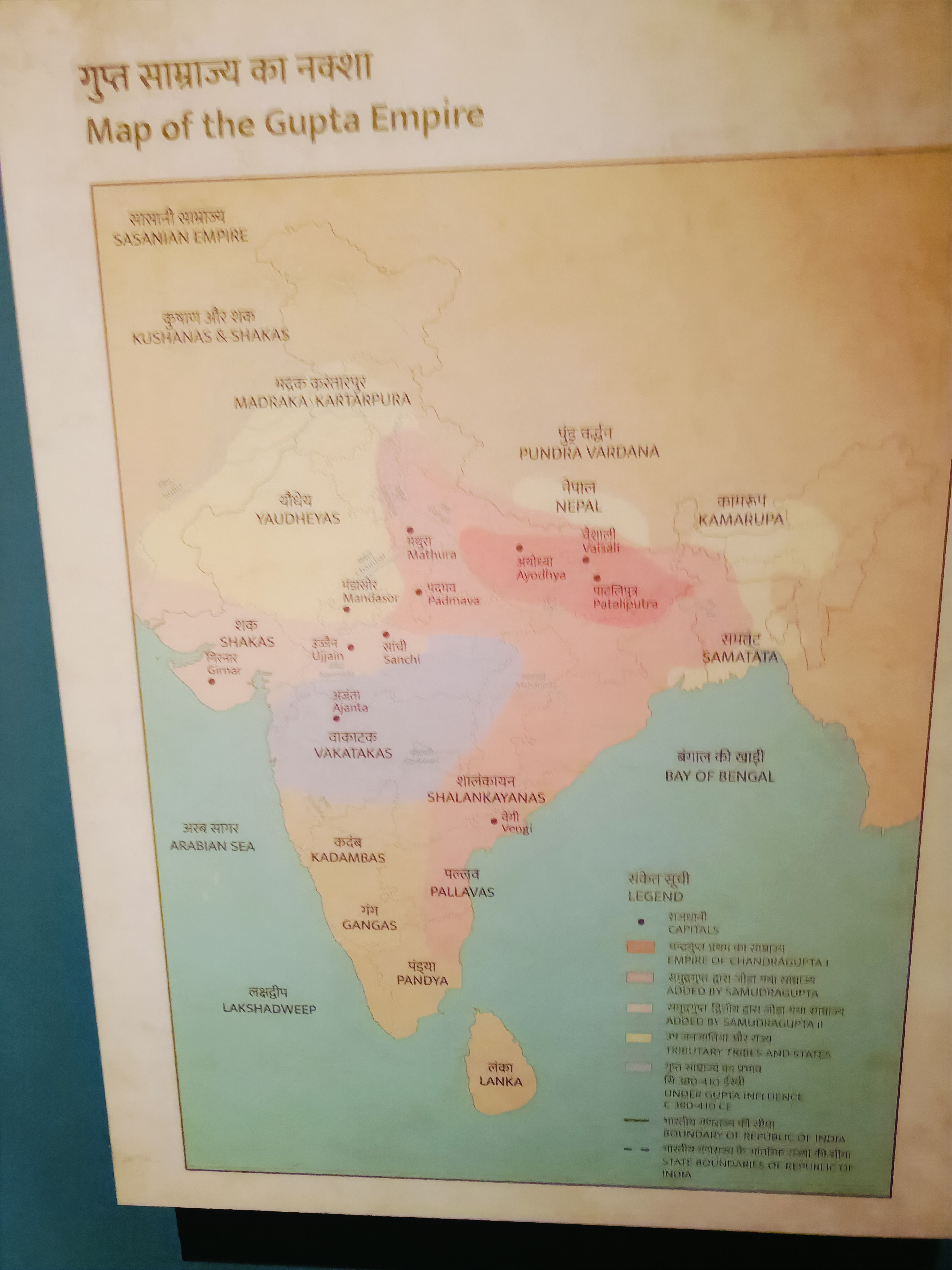
The image shows a map of the Gupta Empire, detailing its territories, capitals, and other regions during its period. The question likely revolves around understanding the historical context of the Gupta Empire based on the provided map.
Answer
Illustrates Gupta Empire's core, conquests, and influence.
The map of the Gupta Empire illustrates the core region of the Gupta dynasty, the extent of its territorial conquests, and the kingdoms under Gupta suzerainty. It highlights key areas of influence during their reign.
Answer for screen readers
The map of the Gupta Empire illustrates the core region of the Gupta dynasty, the extent of its territorial conquests, and the kingdoms under Gupta suzerainty. It highlights key areas of influence during their reign.
More Information
The Gupta Empire, known as the 'Golden Age' of India, was marked by significant achievements in art, science, and political organization.
Tips
Ensure you differentiate between the core regions and areas under suzerainty.
Sources
- Extent of the Gupta Empire, 320-550 CE - World History Encyclopedia - worldhistory.org
- Gupta Empire - Wikipedia - en.wikipedia.org
AI-generated content may contain errors. Please verify critical information