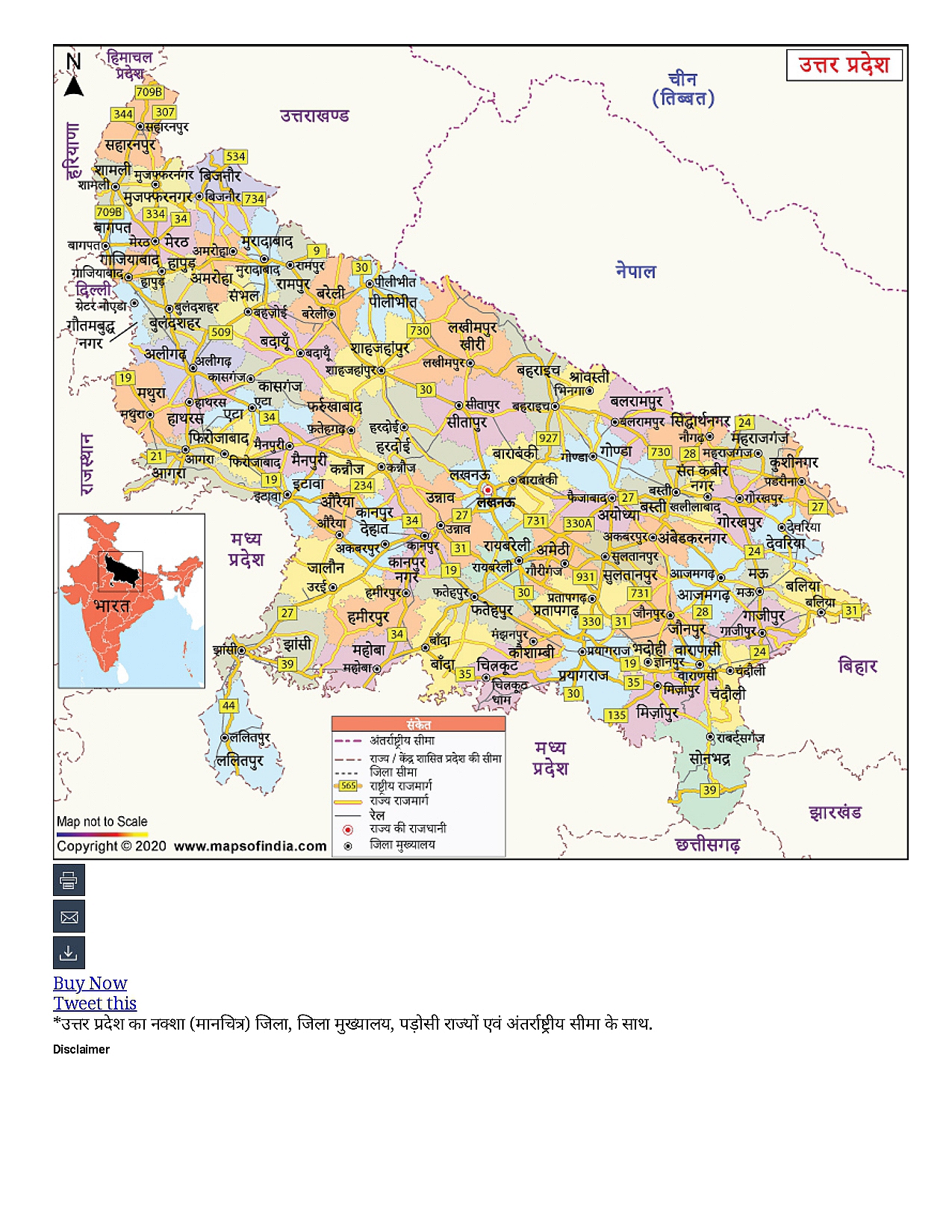
उत्तर प्रदेश का नक्शा

Understand the Problem
इस प्रश्न में एक नक्शा शामिल है, जो उत्तर प्रदेश का है। यह संभावित रूप से उत्तर प्रदेश के किसी विशिष्ट पहलू के बारे में पूछता है, जैसे कि उसकी भौगोलिक जानकारी या प्रशासनिक जिलों का विवरण।
Answer
Map showing Uttar Pradesh's districts and boundaries.
This map shows the districts, state boundaries, neighboring states, and national and international borders of Uttar Pradesh.
Answer for screen readers
This map shows the districts, state boundaries, neighboring states, and national and international borders of Uttar Pradesh.
More Information
Uttar Pradesh has 75 districts and shares borders with several Indian states and Nepal.
Tips
Ensure to differentiate between district boundaries and state/national boundaries.
Sources
- उत्तर प्रदेश का नक्शा | - भारत का मानचित्र (मैप) - hindi.mapsofindia.com
- Uttar Pradesh Map in Hindi - hindi.mapsofworld.com
AI-generated content may contain errors. Please verify critical information