How do GIS programs work?

Understand the Problem
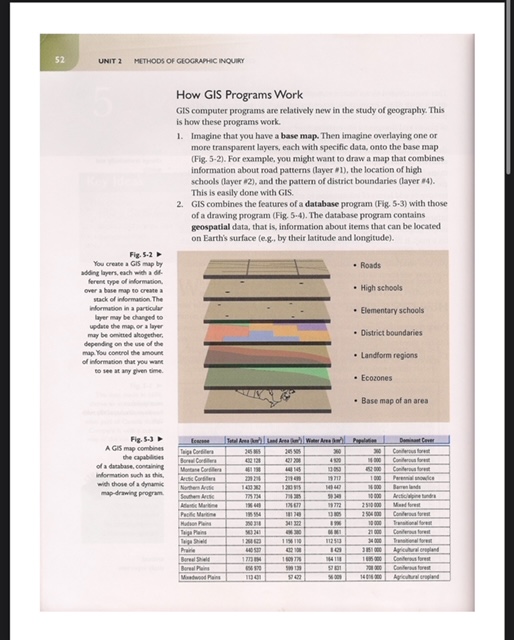
The text discusses how GIS programs operate, specifically the layering of information on a base map and the integration of database features with drawing programs to represent geographic data. It outlines the process of creating a GIS, including the types of data that can be layered on a map.
Answer
GIS integrates a base map with layered data for spatial analysis and visualization.
GIS works by integrating a base map with multiple layers of data, enabling the visualization and analysis of spatial information through a combination of database management and mapping tools.
Answer for screen readers
GIS works by integrating a base map with multiple layers of data, enabling the visualization and analysis of spatial information through a combination of database management and mapping tools.
More Information
GIS technology is pivotal in various fields such as urban planning, environmental science, and transportation by providing a method to analyze and visualize spatial data effectively.
Tips
Common mistakes include not understanding how different data layers interact and not using appropriate data types for specific analyses.
Sources
- What is GIS? - esri.com
- GIS - National Geographic - nationalgeographic.org
- What is GIS? A Guide to Geographic Information Systems - YouTube - youtube.com
AI-generated content may contain errors. Please verify critical information