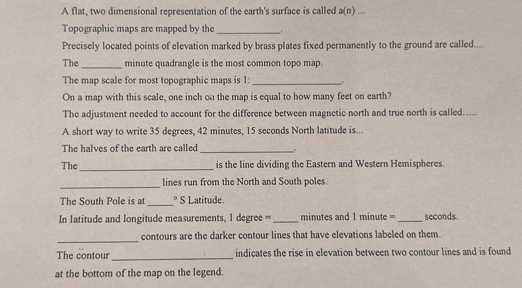
A flat, two dimensional representation of the earth's surface is called a(n) _____. Topographic maps are mapped by the _____. Precisely located points of elevation marked by brass... A flat, two dimensional representation of the earth's surface is called a(n) _____. Topographic maps are mapped by the _____. Precisely located points of elevation marked by brass plates fixed permanently to the ground are called _____. The _____ minute quadrangle is the most common topo map. The map scale for most topographic maps is 1: _____. On a map with this scale, one inch on the map is equal to how many feet on earth? The adjustment needed to account for the difference between magnetic north and true north is called _____. A short way to write 35 degrees, 42 minutes, 15 seconds North latitude is _____. The halves of the earth are called _____. The _____ is the line dividing the Eastern and Western Hemispheres. _____ lines run from the North and South poles. The South Pole is at _____° S Latitude. In latitude and longitude measurements, 1 degree = _____ minutes and 1 minute = _____ seconds. _____ contours are the darker contour lines that have elevations labeled on them. The contour _____ indicates the rise in elevation between two contour lines and is found at the bottom of the map on the legend.

Understand the Problem
The question consists of multiple fill-in-the-blank statements related to topographic maps and geographic concepts. It asks for specific terms or numerical values associated with geography, such as map scale, latitude, and contour lines, indicating that the user needs knowledge in geography.
Answer
map; USGS; benchmarks; 7.5; 24,000; 2,000 feet; declination; 35°42'15" N; hemispheres; Prime Meridian; meridian; 90; 60, 60; index; interval.
The answers are: map; US Geological Survey (USGS); benchmarks; 7.5; 24,000; 2,000 feet; declination; 35°42'15" N; hemispheres; Prime Meridian; meridian; 90; 60, 60; index; interval.
Answer for screen readers
The answers are: map; US Geological Survey (USGS); benchmarks; 7.5; 24,000; 2,000 feet; declination; 35°42'15" N; hemispheres; Prime Meridian; meridian; 90; 60, 60; index; interval.
More Information
Topographic maps are crucial for various applications like hiking, urban planning, and civil engineering due to their detailed elevation data.
Tips
Common mistakes include confusing latitude and longitude terms, and misunderstanding map scales.
Sources
AI-generated content may contain errors. Please verify critical information