Podcast
Questions and Answers
What are the Rocky Mountains known for?
What are the Rocky Mountains known for?
They are known for their high peaks, including Mount Elbert, and their extensive range from northern Canada to the southwestern United States.
How does the East Coast differ in elevation compared to the West Coast?
How does the East Coast differ in elevation compared to the West Coast?
The East Coast features mostly flat terrain with some hills, while the West Coast has abrupt mountains and cliffs like the Sierra Nevada.
Describe the main characteristics of the Appalachian Mountains.
Describe the main characteristics of the Appalachian Mountains.
They are the oldest mountain range, extending from Canada to Alabama, with a generally less rugged terrain compared to the Rockies.
What is significant about the Great Plains in the Central Plains region?
What is significant about the Great Plains in the Central Plains region?
Identify a major river that contributes to commerce in the central United States.
Identify a major river that contributes to commerce in the central United States.
What defines the climate of the Southeastern United States?
What defines the climate of the Southeastern United States?
Explain the role of tectonic plates in shaping U.S. topography.
Explain the role of tectonic plates in shaping U.S. topography.
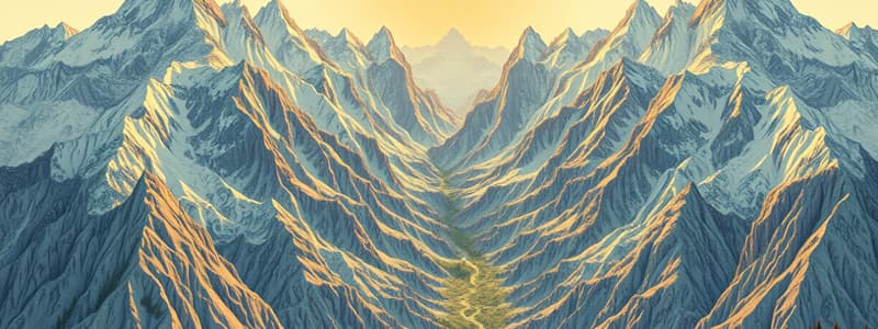
What evidence of geological processes can be found in the Grand Canyon?
What evidence of geological processes can be found in the Grand Canyon?
Flashcards are hidden until you start studying
Study Notes
Relieve y Topografía de Estados Unidos
-
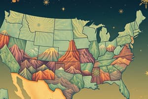
Divisiones Geográficas Principales:
- Montañas Rocosas:
- Se extienden desde el norte de Canadá hasta el suroeste de Estados Unidos.
- Incluyen picos altos como el Monte Elbert (4401 m).
- Appalaches:
- Cadena montañosa más antigua, ubicada en el este.
- Se extienden desde Canadá hasta Alabama.
- Planicie Central:
- Amplias áreas de terreno llano, entre las montañas Rocosas y los Apalaches.
- Incluye las Grandes Llanuras, importantes para la agricultura.
- Costas:
- Costa Este: Relieve mayormente llano con algunas colinas.
- Costa Oeste: Montañas abruptas y acantilados, incluyendo la Sierra Nevada.
- Montañas Rocosas:
-
Ríos Principales:
- Misisipi: Uno de los ríos más largos y caudalosos, crucial para el comercio.
- Missouri: Afluente del Misisipi, clave para el drenaje de la región central.
- Colorado: Famoso por el Gran Cañón, que es un área de gran interés geológico.
-
Desiertos:
- Desierto de Sonora: Ubicado en el suroeste, conocido por su clima árido y biodiversidad.
- Desierto de Mojave: En California, famoso por su paisaje desértico y el Parque Nacional Joshua Tree.
-
Regiones Climáticas:
- Noreste: Clima templado con inviernos fríos y veranos cálidos.
- Sureste: Clima subtropical, con veranos calurosos e inviernos suaves.
- Oeste: Varía desde el clima mediterráneo en California hasta el clima de montaña en las Rocosas.
-
Características Geológicas:
- Cañones: Formaciones como el Gran Cañón destacan por su erosión y estratos geológicos.
- Lagos:
- Lago Superior: El más grande de los Grandes Lagos.
- Lago Tahoe: Conocido por su claridad de agua y profundidad.
-
Factores que Afectan el Relieve:
- Placas Tectónicas: La actividad tectónica ha modelado montañas y valles.
- Erosión: Procesos naturales que han esculpido el paisaje a lo largo de millones de años.
-
Uso del Suelo:
- Agricultura: Predomina en las llanuras centrales y en el Valle de San Joaquín.
- Desarrollo Urbano: Aglomeraciones en áreas costeras y valles de grandes ríos.
Estas características del relieve y la topografía de Estados Unidos contribuyen a su diversidad geográfica y ecológica.
Geographic Divisions
-
Rocky Mountains:
- Stretch from northern Canada to the southwestern U.S.
- Home to high peaks such as Mount Elbert (4,401 m).
-
Appalachians:
- The oldest mountain range in the U.S. located in the east.
- Extend from Canada to Alabama.
-
Central Plains:
- Characterized by vast flat areas between the Rockies and Appalachians.
- Includes the Great Plains, significant for agriculture.
Coastal Regions
-
East Coast:
- Generally flat terrain with some hilly regions.
-
West Coast:
- Features steep mountains and cliffs, including the Sierra Nevada.
Major Rivers
-
Mississippi River:
- One of the longest and most powerful rivers critical for trade.
-
Missouri River:
- A key tributary of the Mississippi, important for central drainage.
-
Colorado River:
- Famous for the Grand Canyon, an area of significant geological interest.
Deserts
-
Sonoran Desert:
- Located in the southwest, known for its arid climate and biodiversity.
-
Mojave Desert:
- Situated in California, renowned for its desert landscapes and Joshua Tree National Park.
Climatic Regions
-
Northeast:
- Features a temperate climate with cold winters and warm summers.
-
Southeast:
- Subtropical climate, characterized by hot summers and mild winters.
-
West:
- Climate varies from Mediterranean in California to mountainous conditions in the Rockies.
Geological Features
-
Canyons:
- Formations like the Grand Canyon exemplify erosion and geological strata.
-
Lakes:
- Lake Superior: Largest of the Great Lakes.
- Lake Tahoe: Known for its clarity and depth.
Factors Influencing Relief
-
Tectonic Plates:
- Tectonic activity has shaped mountains and valleys across the country.
-
Erosion:
- Natural processes have sculpted landscapes over millions of years.
Land Use
-
Agriculture:
- Predominant in the central plains and the San Joaquin Valley.
-
Urban Development:
- Major urban centers are concentrated in coastal areas and large river valleys.
Diversity
- These geological and topographical characteristics contribute to the ecological and geographic diversity of the United States.
Studying That Suits You
Use AI to generate personalized quizzes and flashcards to suit your learning preferences.