Podcast
Questions and Answers
Which of the following factors does NOT affect climate?
Which of the following factors does NOT affect climate?
- Presence of large mountains (correct)
- Distance from the equator
- Distance from a large body of water
- Elevation
Tropical climates are usually cold all year round.
Tropical climates are usually cold all year round.
False (B)
What is the term for the amount of rain or snow that falls in a specific area?
What is the term for the amount of rain or snow that falls in a specific area?
Precipitation
Which river flows through the Midwest Region?
Which river flows through the Midwest Region?
_________ are large areas of mostly flat land often covered with grass.
_________ are large areas of mostly flat land often covered with grass.
Mammoth Cave, the world's largest known cave, is located in Arkansas.
Mammoth Cave, the world's largest known cave, is located in Arkansas.
Match the following climate types with their characteristics:
Match the following climate types with their characteristics:
Name one significant landform found in the Southwest Region.
Name one significant landform found in the Southwest Region.
The ______ Mountains run from the West into the Southwest.
The ______ Mountains run from the West into the Southwest.
Match the regions with their notable features:
Match the regions with their notable features:
Flashcards are hidden until you start studying
Study Notes
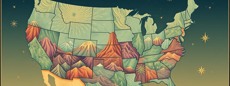
Regions of the United States
Northeast Region
- Features the Appalachian Mountains, characterized by hilly and rocky terrain along the Atlantic coast.
- Westward, there is an expanse of productive farmland.
Southeast Region
- Home to the Atlantic coastal plain.
- Louisiana and Mississippi contain plains leading to the Gulf of Mexico.
- The Mississippi and Red Rivers flow through, facilitating rich farmland in Arkansas and Louisiana.
- Mammoth Cave in Kentucky is the world's longest known cave at 350 miles.
Midwest Region
- Comprised of flat grassy plains and extensive forest areas.
- Notable rolling hills include the Smoky Hills in Kansas.
- Significant waterways include the Mississippi, Ohio, and Missouri Rivers alongside the Great Lakes.
Southwest Region
- Dominated by deserts and canyons, particularly the Grand Canyon, which was formed by the Colorado River.
- Characterized by plateaus and the Rocky Mountains extending from the West.
West Region
-
Known for extreme climates with the highest temperature recorded in Death Valley, California, and the lowest in Alaska.
-
Mt. McKinley in Alaska is the highest landform in the U.S., while Death Valley represents its lowest point.
-
Mt. Everest in Nepal is the world's highest landform; the shore of the Dead Sea in Israel is the lowest.
-
Coastal mountains, white sandy beaches, and fertile green valleys are found in Oregon and California.
-
Heavily forested areas are prevalent, particularly in western Oregon and Washington.
-
The region includes Hawaii and Alaska.
Boundaries
- Defined as lines or natural features dividing areas or states.
- State boundaries represent legal borders with precise measurements, while regional boundaries are based on major landforms.
- Florida’s northern boundary overlaps with Georgia and Alabama; its coastlines are defined by the Atlantic Ocean and Gulf of Mexico.
Landforms
- Mountain: Very high landform with steep sides.
- Plain: Large, mostly flat area often covered with grass.
- Desert: Region with minimal rainfall.
- Canyon: Deep valley with steep rocky walls.
- Plateau: Flat, raised area of land.
Climate
Weather vs. Climate
- Weather refers to atmospheric conditions at a specific time and place; climate is the long-term average of weather conditions.
- Key weather factors include precipitation, temperature, and humidity.
Water in the Air
- Precipitation measures the total rain or snow falling in a specific area.
- Temperature indicates warmth or coldness.
- Humidity represents moisture levels in the air, transforming water vapor into clouds and precipitation.
Climate Influences
- Rainwater runs into rivers, streams, seas, and lakes.
- Climate factors comprise distance from the equator, proximity to large bodies of water, and elevation.
Distance from Equator
- The equator is an imaginary line equidistant from the North and South Poles.
- Warmest climates are found nearest the equator, experiencing consistent warmth year-round.
Distance from Large Bodies of Water
- Coastal areas typically enjoy milder climates; land heats and cools more rapidly than water.
- During summer, cooler ocean air can moderate land temperatures; in winter, warmer ocean air can warm the land.
Elevation
- Elevation refers to how high a location is above sea level; higher elevations generally result in cooler climates.
- Houston and Florida exhibit average temperatures between 40 to 60 degrees Fahrenheit, whereas Indiana experiences 20 to 40 degrees.
Types of Climate
- Tropical Climate: Warm year-round, located near the equator; represented by southern Florida and Hawaii.
- Polar Climate: Found near the poles; includes part of Alaska with extended periods of snow.
- Subarctic Climate: Most of Alaska experiences short summers and long snowy conditions.
- Temperate Climate: Falls between tropical and subarctic climates with moderate temperatures.
Precipitation Averages
- Memphis and Florida experience 40 to 60 inches of annual precipitation, whereas Indiana averages 20 to 40 inches.
Studying That Suits You
Use AI to generate personalized quizzes and flashcards to suit your learning preferences.


