Podcast
Questions and Answers
What do contour lines on a topographical map represent?
What do contour lines on a topographical map represent?
- Places with the same climate and vegetation
- Places with different distances from the sea
- Places with the same latitude and longitude
- Places with the same height above mean sea level (correct)
What is the significance of the pattern and density of contour lines on a topographical map?
What is the significance of the pattern and density of contour lines on a topographical map?
- It helps in identifying specific landforms (correct)
- It helps in determining the climate of the area
- It helps in finding the direction of the sea
- It helps in finding the nearest settlement
What is the purpose of the vertical interval on a topographical map?
What is the purpose of the vertical interval on a topographical map?
- To show the distance between two settlements
- To show the difference in elevation between two successive contour lines (correct)
- To show the direction of water flow
- To show the type of land use
What is the vertical interval of contour lines in the maps of the Survey of India?
What is the vertical interval of contour lines in the maps of the Survey of India?
What is the term used to describe the shape of the land?
What is the term used to describe the shape of the land?
What does the horizontal distance between consecutive contour lines indicate?
What does the horizontal distance between consecutive contour lines indicate?
What type of landform is characterized by a steep slope on one side and a gentle slope on the other?
What type of landform is characterized by a steep slope on one side and a gentle slope on the other?
What is the term for the points on a map with the elevation marked beside them?
What is the term for the points on a map with the elevation marked beside them?
What type of landform is characterized by a long, narrow, continuous area of highland, consisting of a series of mountain peaks or hills?
What type of landform is characterized by a long, narrow, continuous area of highland, consisting of a series of mountain peaks or hills?
What type of landform is characterized by very close together contour lines, and sometimes even merge to form a single line?
What type of landform is characterized by very close together contour lines, and sometimes even merge to form a single line?
Study Notes
Topographical Maps
- Topographical maps are large scale maps that show natural and cultural features of an area in detail.
- They are useful for geographers, planners, hikers, and the defence forces.
- To use a map, one must know how to read and interpret symbols, signs, and contour lines.
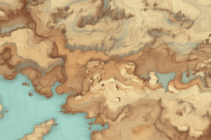
Contour Lines
- Contour lines are lines drawn on maps that join places having the same height above mean sea level.
- Each contour line is numbered and drawn at regular intervals.
- The number of the contour line indicates the height (in metres) of that area above sea level.
- The vertical distance, or the difference in elevation between two successive contour lines, is known as the vertical interval or contour interval.
Characteristics of Contour Lines
- The vertical interval remains constant for any given map.
- In the maps of the Survey of India, the vertical interval is always 20 metres.
- The horizontal distance between consecutive contour lines, called the horizontal equivalent, indicates the slope of the land.
- Closely spaced contour lines indicate steep slopes, while widely spaced lines represent gentle slopes.
- Uniformly spaced lines depict uniform slopes.
- When the lines are very far apart, it means that the land is flat.
Identifying Landforms through Contour Patterns
- Highlands with a steep slope on one side and a gentle slope on the other are called escarpments.
- Escarpments have closely spaced contour lines on the steeper side and widely spaced lines on the gently sloping side.
- Hills or mountains are shown by contour lines arranged in the form of concentric circles.
- Peaks of hills and mountains are indicated with the help of spot heights.
- Plateaus are broad highlands that rise abruptly from the surrounding land and have level, almost flat, tops.
- Plateaus are shown by evenly spaced contour lines surrounding an area with no lines or hardly any lines.
- Ridges are long, narrow, continuous areas of highland, consisting of a series of mountain peaks or hills.
- Ridges have long narrow and elliptical contours with steep slopes on both sides.
- Cliffs are very steep, almost vertical, rock faces and are indicated by contour lines that are very close together and sometimes merge to form a single line.
- Spurs are pieces of hard rock that protrude into river valleys and form an interlocking pattern with the contour lines.
Studying That Suits You
Use AI to generate personalized quizzes and flashcards to suit your learning preferences.
Description
Learn to identify contour patterns, drainage patterns, and signs and symbols used on topographical maps to represent natural and human-made features.