Podcast
Questions and Answers
What is the primary mechanism by which a warm front causes precipitation?
What is the primary mechanism by which a warm front causes precipitation?
- Intense solar heating of the ground, causing localized convection and heavy showers.
- Rapid descent of warm, dry air, leading to adiabatic heating and evaporation.
- Horizontal mixing of warm and cold air masses, creating a saturated environment.
- Forced lifting of warm, moist air over a cooler air mass, resulting in condensation and cloud formation. (correct)
Which scenario would most likely result in orographic rainfall?
Which scenario would most likely result in orographic rainfall?
- A cold front rapidly advancing over a flat, uniform landscape.
- Prevailing winds encountering a mountain range, forcing air to rise. (correct)
- A low-pressure system developing over a large urban area.
- A stationary air mass lingering over a warm body of water.
What distinguishes convective rainfall from frontal rainfall?
What distinguishes convective rainfall from frontal rainfall?
- Convective rainfall is triggered by localized heating and rising of air, whereas frontal rainfall is associated with the meeting of different air masses. (correct)
- Convective rainfall is associated with widespread, prolonged precipitation, while frontal rainfall is localized and intense.
- Convective rainfall is primarily caused by the forced rising of air up a topographic barrier, whereas frontal rainfall results from air mass convergence.
- Convective rainfall results from the lifting of air masses along weather fronts, while frontal rainfall is caused by localized heating of the ground.
Which of the following conditions is least conducive to the formation of rainfall?
Which of the following conditions is least conducive to the formation of rainfall?
How does the slope of a warm front typically compare to the slope of a cold front, and what impact does this have on the type of precipitation produced?
How does the slope of a warm front typically compare to the slope of a cold front, and what impact does this have on the type of precipitation produced?
What critical atmospheric condition primarily facilitates the formation of cumulonimbus clouds, leading to their towering vertical structure?
What critical atmospheric condition primarily facilitates the formation of cumulonimbus clouds, leading to their towering vertical structure?
Which characteristic of the upper troposphere is most responsible for the anvil shape commonly observed in mature cumulonimbus clouds?
Which characteristic of the upper troposphere is most responsible for the anvil shape commonly observed in mature cumulonimbus clouds?
What role does condensation play in the formation and intensification of a cumulonimbus cloud?
What role does condensation play in the formation and intensification of a cumulonimbus cloud?
How might increased concentrations of atmospheric aerosols affect the development of cumulonimbus clouds, assuming other meteorological conditions remain constant?
How might increased concentrations of atmospheric aerosols affect the development of cumulonimbus clouds, assuming other meteorological conditions remain constant?
Which scenario would most likely result in the rapid development of cumulonimbus clouds?
Which scenario would most likely result in the rapid development of cumulonimbus clouds?
What is the primary mechanism by which a microburst, a hazardous weather phenomenon associated with cumulonimbus clouds, is generated?
What is the primary mechanism by which a microburst, a hazardous weather phenomenon associated with cumulonimbus clouds, is generated?
How does the presence of a dry air mass at mid-levels of the troposphere influence the intensity of thunderstorms associated with cumulonimbus clouds?
How does the presence of a dry air mass at mid-levels of the troposphere influence the intensity of thunderstorms associated with cumulonimbus clouds?
Which of the following processes contributes most significantly to charge separation within a cumulonimbus cloud, leading to lightning?
Which of the following processes contributes most significantly to charge separation within a cumulonimbus cloud, leading to lightning?
What is the primary mechanism behind the formation of relief rainfall?
What is the primary mechanism behind the formation of relief rainfall?
Which atmospheric condition is most conducive to the initial uplift of moist air in the formation of relief rainfall?
Which atmospheric condition is most conducive to the initial uplift of moist air in the formation of relief rainfall?
How does the rate of cooling change for an air parcel as it ascends a mountain slope in the context of relief rainfall formation?
How does the rate of cooling change for an air parcel as it ascends a mountain slope in the context of relief rainfall formation?
What is a significant consequence of relief rainfall regarding regional climate patterns around mountainous areas?
What is a significant consequence of relief rainfall regarding regional climate patterns around mountainous areas?
Considering the lifecycle of a thunderstorm within a cumulonimbus cloud, which stage is characterized by both strong updrafts and downdrafts, leading to the most intense precipitation and potentially severe weather?
Considering the lifecycle of a thunderstorm within a cumulonimbus cloud, which stage is characterized by both strong updrafts and downdrafts, leading to the most intense precipitation and potentially severe weather?
In the context of aviation, what is the most significant hazard associated with cumulonimbus clouds?
In the context of aviation, what is the most significant hazard associated with cumulonimbus clouds?
Which of the following processes is most directly responsible for the electrification within a cumulonimbus cloud, leading to lightning?
Which of the following processes is most directly responsible for the electrification within a cumulonimbus cloud, leading to lightning?
Considering climate models and studies, how might increased global temperatures affect the behavior and intensity of cumulonimbus clouds and associated thunderstorms?
Considering climate models and studies, how might increased global temperatures affect the behavior and intensity of cumulonimbus clouds and associated thunderstorms?
Which cloud formation process is most indicative of a warm front?
Which cloud formation process is most indicative of a warm front?
Given similar geographic locations and seasons, which scenario is most likely to result in prolonged and widespread drizzle rather than intense, short-lived rainfall?
Given similar geographic locations and seasons, which scenario is most likely to result in prolonged and widespread drizzle rather than intense, short-lived rainfall?
A weather forecast predicts a 'gradual temperature increase' following a period of steady, light rain. This pattern is most consistent with the approach and passage of which type of weather front?
A weather forecast predicts a 'gradual temperature increase' following a period of steady, light rain. This pattern is most consistent with the approach and passage of which type of weather front?
In mid-latitude regions, warm fronts are often observed to move from southwest to northeast. Which meteorological principle primarily explains this typical direction of movement?
In mid-latitude regions, warm fronts are often observed to move from southwest to northeast. Which meteorological principle primarily explains this typical direction of movement?
While warm fronts are generally associated with less severe weather than cold fronts, under what conditions could a warm front potentially pose a significant weather hazard?
While warm fronts are generally associated with less severe weather than cold fronts, under what conditions could a warm front potentially pose a significant weather hazard?
How does the uneven heating of the Earth's surface primarily contribute to global atmospheric circulation?
How does the uneven heating of the Earth's surface primarily contribute to global atmospheric circulation?
In the context of global atmospheric circulation, what is the defining characteristic of the Hadley cell?
In the context of global atmospheric circulation, what is the defining characteristic of the Hadley cell?
How would a significant increase in the Earth's polar ice affect the global atmospheric circulation?
How would a significant increase in the Earth's polar ice affect the global atmospheric circulation?
What role does the Ferrel cell play in global atmospheric circulation?
What role does the Ferrel cell play in global atmospheric circulation?
Which of the following best describes the relationship between the Hadley cell and subtropical desert formation?
Which of the following best describes the relationship between the Hadley cell and subtropical desert formation?
What would be the most likely effect on global atmospheric circulation if the Earth's rotation significantly slowed down?
What would be the most likely effect on global atmospheric circulation if the Earth's rotation significantly slowed down?
How do changes in sea surface temperatures (SSTs), such as those seen during El Niño events, affect global atmospheric circulation?
How do changes in sea surface temperatures (SSTs), such as those seen during El Niño events, affect global atmospheric circulation?
In a scenario where deforestation occurs on a massive scale near the equator, what is the most likely impact on the Hadley cell?
In a scenario where deforestation occurs on a massive scale near the equator, what is the most likely impact on the Hadley cell?
While the fundamental driver of global atmospheric circulation is uneven solar heating across latitudes, which mechanism most directly initiates the large-scale horizontal pressure differences that set air masses in motion?
While the fundamental driver of global atmospheric circulation is uneven solar heating across latitudes, which mechanism most directly initiates the large-scale horizontal pressure differences that set air masses in motion?
The Ferrel cell, in the three-cell model of global atmospheric circulation, is termed an 'indirect' or 'mixing' cell. What best explains the 'indirect' nature of the Ferrel cell compared to the thermally direct Hadley and Polar cells?
The Ferrel cell, in the three-cell model of global atmospheric circulation, is termed an 'indirect' or 'mixing' cell. What best explains the 'indirect' nature of the Ferrel cell compared to the thermally direct Hadley and Polar cells?
The Intertropical Convergence Zone (ITCZ) is a significant feature of global atmospheric circulation. How does the seasonal migration of the ITCZ most directly impact regional climate patterns, particularly in tropical regions?
The Intertropical Convergence Zone (ITCZ) is a significant feature of global atmospheric circulation. How does the seasonal migration of the ITCZ most directly impact regional climate patterns, particularly in tropical regions?
Considering the influence of global atmospheric circulation on oceanic systems, which of the following statements accurately describes the primary mechanism by which wind patterns associated with circulation cells drive surface ocean currents?
Considering the influence of global atmospheric circulation on oceanic systems, which of the following statements accurately describes the primary mechanism by which wind patterns associated with circulation cells drive surface ocean currents?
While the idealized three-cell model of global atmospheric circulation provides a useful framework, real-world circulation patterns are considerably more complex. Which factor most significantly contributes to deviations from this idealized model in observed atmospheric circulation?
While the idealized three-cell model of global atmospheric circulation provides a useful framework, real-world circulation patterns are considerably more complex. Which factor most significantly contributes to deviations from this idealized model in observed atmospheric circulation?
Flashcards
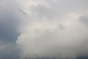
Cumulonimbus Clouds
Cumulonimbus Clouds
Massive, storm-producing clouds, also known as thunderstorm clouds. They cause dramatic weather changes.
Cumulonimbus Appearance
Cumulonimbus Appearance
Cumulonimbus clouds have a dark, flat base close to the ground and can stretch up to 20 km (12 miles) tall.
Anvil Top
Anvil Top
The flat, anvil-like shape at the top of cumulonimbus clouds caused by strong upper-level winds.
Cumulonimbus Texture
Cumulonimbus Texture
Signup and view all the flashcards
Warm Air Rising
Warm Air Rising
Signup and view all the flashcards
Cooling and Condensation
Cooling and Condensation
Signup and view all the flashcards
Key features of Cumulonimbus clouds
Key features of Cumulonimbus clouds
Signup and view all the flashcards
Cloud Formation
Cloud Formation
Signup and view all the flashcards
Warm Front: Gentle Climb
Warm Front: Gentle Climb
Signup and view all the flashcards
Warm Front Clouds
Warm Front Clouds
Signup and view all the flashcards
Warm Front Rain
Warm Front Rain
Signup and view all the flashcards
Cold Front Weather
Cold Front Weather
Signup and view all the flashcards
Warm Front Weather
Warm Front Weather
Signup and view all the flashcards
Relief Rainfall (地形雨)
Relief Rainfall (地形雨)
Signup and view all the flashcards
Source of Moisture (水氣來源)
Source of Moisture (水氣來源)
Signup and view all the flashcards
Windward Side (迎風面)
Windward Side (迎風面)
Signup and view all the flashcards
Leeward Side (背風面)
Leeward Side (背風面)
Signup and view all the flashcards
Cloud Formation (雲的形成)
Cloud Formation (雲的形成)
Signup and view all the flashcards
Orographic Lift (地形抬升)
Orographic Lift (地形抬升)
Signup and view all the flashcards
Condensation and Precipitation (凝結和降水)
Condensation and Precipitation (凝結和降水)
Signup and view all the flashcards
Rain Shadow Effect (雨影效應)
Rain Shadow Effect (雨影效應)
Signup and view all the flashcards
Orographic Rainfall
Orographic Rainfall
Signup and view all the flashcards
Frontal Rainfall
Frontal Rainfall
Signup and view all the flashcards
Convective Rainfall
Convective Rainfall
Signup and view all the flashcards
Warm Front
Warm Front
Signup and view all the flashcards
Cold Front
Cold Front
Signup and view all the flashcards
What is Global Atmospheric Circulation?
What is Global Atmospheric Circulation?
Signup and view all the flashcards
What are Hadley Cells?
What are Hadley Cells?
Signup and view all the flashcards
What are Ferrel Cells?
What are Ferrel Cells?
Signup and view all the flashcards
What are Polar Cells?
What are Polar Cells?
Signup and view all the flashcards
What are Surface Winds?
What are Surface Winds?
Signup and view all the flashcards
Global Atmospheric Circulation
Global Atmospheric Circulation
Signup and view all the flashcards
Uneven Heating
Uneven Heating
Signup and view all the flashcards
Three Circulation Cells
Three Circulation Cells
Signup and view all the flashcards
Hadley Cell
Hadley Cell
Signup and view all the flashcards
Ferrel Cell
Ferrel Cell
Signup and view all the flashcards
Weather Front
Weather Front
Signup and view all the flashcards
Study Notes
Convectional Rainfall
- Convectional rainfall occurs when the sun heats the Earth's surface, causing warm air to rise, cool, and condense into rain.
- It's common in tropical regions and during summer in temperate zones, and can lead to brief thunderstorms.
Formation of Convectional Rainfall
- The sun heats the land or water, leading to evaporation and creating warm, moist air near the surface.
- The warm air expands and rises rapidly, forming convection currents.
- As the air rises, it cools, and water vapor condenses into tiny droplets, forming clouds like cumulonimbus.
- Once the droplets grow too heavy, they fall as rain, often suddenly, accompanied by thunder and lightning.
- This process takes a few hours and peaks in the afternoon when sunlight is strongest.
Location of Convectional Rainfall
- Areas near the equator, experience daily convectional rainfall due to intense, year-round heat.
- Temperate zones like the UK or South East England get convectional rain during hot, sunny spells.
- Localized heating on slopes can trigger convectional showers in mountainous areas.
Effects on Local Weather
- Rapidly rising air creates electrical charges, leading to lightning and thunder.
- Rain is often intense but brief, cooling the ground quickly and stopping further updrafts leading to heavy, short-lived showers.
- Heavy rain can cause sudden flooding in areas with poor drainage or steep terrain.
- Temperatures often drop due to the cooling effect of evaporation and rainfall.
- Tropical regions might experience daily afternoon storms while a summer day in Europe could switch from sunny to stormy in minutes.
Cumulonimbus Clouds
- Cumulonimbus clouds are massive, storm-producing clouds linked to dramatic weather changes.
Appearance of Cumulonimbus Clouds
- They stretch high into the sky (up to 20 km/12 miles tall) and have a dark, flat base close to the ground.
- The top spreads out into a flat, anvil-like shape due to strong winds high up.
- The base is rough and puffy, while the upper icy parts appear wispy or fibrous.
Formation of Cumulonimbus Clouds
- The sun heats the ground, causing warm, moist air to rise like a hot-air balloon.
- As the air rises, it cools, and water vapor turns into tiny droplets or ice crystals, forming a cloud.
- If air keeps rising the cloud grows vertically into a towering cumulonimbus cloud.
- This process often happens in just 30–60 minutes.
Location of Cumulonimbus Clouds
- They are near the equator, where heat and moisture are plentiful (e.g., the Amazon rainforest).
- They occur in temperate zones during hot summers (e.g., Europe, North America).
- Slopes in mountain regions can force warm air upward, triggering storms.
Weather Effects
- Sudden downpours of heavy rain can flood streets or dry riverbeds.
- Charged ice particles collide inside the cloud, creating electrical sparks, resulting in lightning and thunder.
- Strong updrafts carry raindrops upward, freezing them into ice pellets that fall as hail.
- Rotating air within the cloud can rarely create tornadoes or damaging gusts.
- Rain and evaporation quickly lower temperatures once the storm passes.
- A sunny afternoon in Florida can rapidly turn into a lightning-filled storm, then cool off quickly.
- They can disrupt daily life with flash floods, power outages, or travel delays because of their intensity.
- Pilots avoid them due to turbulence and icing.
- Cumulonimbus clouds balance heat and moisture.
Relief Rainfall
- Relief rainfall, also called mountain rainfall, occurs when moist air is forced upward by hills or mountains, leading to cloud formation and precipitation.
- It creates wet areas on one side of mountains and dry zones on the other.
Formation of Relief Rainfall
- Winds carry damp air from oceans or lakes toward land such as from the Atlantic in the UK.
- When this air hits a mountain, it's forced upward and cools down by about 1°C every 100 meters.
- Cooling causes water vapor to condense into clouds, resulting in heavy rain on the windward side of the mountain.
- After losing moisture, the air sinks down the leeward side, warms up, and creates dry areas known as "rain shadows."
Location of Relief Rainfall
- Places like the Andes or the Scottish Highlands get heavy rain on windward slopes in mountainous regions.
- The UK's west coast receives frequent rain, while the east stays drier due to coastal areas with hills.
- Hawaii's mountains cause relief rainfall, creating lush forests on one side and dry zones on the other, in tropical islands.
Effects on Local Weather
- Mountain slopes facing the wind get drenched, such as the UK's Lake District, which sees over 1,600 mm of rain yearly.
- Dry areas form behind mountains; for example, Chile's Atacama Desert is one of Earth's driest places, shielded by the Andes creating Rain Shadows. Rain cools the windward side, while the leeward side stays warm and dry resulting in Temperature Changes. The Alps create sharp contrasts between valleys.
- Wet slopes support farming and forests, while rain shadows may need irrigation for crops; these are Agriculture Patterns.
- Moist Atlantic air causes frequent rain in Wales. Meanwhile, Relief rainfall shapes both weather and landscapes, making some regions green and others arid, with eastern areas like Cambridge remaining much drier.
Cold Frontal Rainfall
- Cold frontal rainfall occurs when there is a collision different of air masses creating distinct weather patterns.
Formation of Cold Frontal Rainfall
- A fast-moving cold air mass slides under a warmer air mass, forcing the warm air upward.
- The warm air rises quickly, forming cumulonimbus clouds.
- This rapid uplift causes heavy rain, thunderstorms, hail, or even tornadoes.
Location of Cold Frontal Rainfall
- Common in temperate regions like North America and Europe.
- Moves quickly, from northwest to southeast in the northern hemisphere.
Effects on Weather
- Cause Sudden downpours of Short, heavy rain showers or thunderstorms.
- Cause Temperature Drop: Cooler air arrives after the front passes .
- Severe Weather involving lightning, hail, and gusty winds .
- Example: A sunny afternoon in Texas turns stormy within minutes, followed by cooler, drier air.
Warm Frontal Rainfall
- Warm Frontal Rainfall occurs when different air masses are collide, creating distinct weather patterns.
Formation of Warm Frontal Rainfall
- A warm air mass slowly rises over a retreating cold air mass.
- Forms stratiform clouds (e.g., nimbostratus) that spread widely
- Light to moderate rain falls ahead of the front, for hours.
Location of Warm Frontal Rainfall
- Common in temperate zones (e.g., UK, Pacific Northwest).
- Moves slowly, often from southwest to northeast.
Effects on Weather
- Prolonged Rain that is drizzly or steady rain over a large area.
- Gradual Warming: Temperatures rise slowly after the front passes .
- Fog or Freezing Rain: In winter, can cause fog or ice if ground temperatures are low
- Example: A gray, drizzly day lasts all afternoon in England. Followed by milder air.
Key Differences Between Cold and Warm Fronts
| Feature | Cold Front | Warm Front |
|---|---|---|
| Speed | Fast-moving | Slow-moving |
| Clouds | Tall cumulonimbus (storms) | Layered stratus/nimbostratus (steady rain) |
| Rain Intensity | Heavy, short bursts | Light to moderate, long-lasting |
| Temperature Change | Sharp cooling after the front | Gradual warming after the front |
- Cold fronts bring dramatic weather shifts but cool the air.
- Warm fronts provide steady rain but can lead to flooding in prolonged cases.
Global Atmospheric Circulation
- Global atmospheric circulation is the large-scale movement of air around the Earth that redistributes heat from the equator to the poles and shaping weather patterns and climates.
Characteristics of Global Atmospheric Circulation
- It is Driven by Uneven Heating, the equator receives more direct sunlight and is warmer while the poles are cooler and that temperature difference drives air movement.
- Three Cells in Each Hemisphere, the circulation is divided into three main cells.
- Hadley Cell is Located between the equator and 30° latitude.
- Ferrel Cell is Found between 30° and 60° latitude.
- Polar Cell Exists between 60° latitude and the poles.
- Pressure Belts are Rising air creates low-pressure zones (rainy areas) while sinking air creates high-pressure zones (dry areas).
- The Coriolis Effect is the Earth's rotation causes winds to curve, influencing their direction.
How It Is Formed
- At the Equator (Hadley Cell):
- The Sun heats and causes warm air to rise
- Rising air and leads to rainfall
- The cooled air spreads towards 30° north and south, and causes deserts like the Sahara
- At Mid-Latitudes (Ferrel Cell):
- Air moves poleward from 30°
- This forms low-pressure zones with unstable weather (e.g., storms in Europe or North America).
- At the Poles (Polar Cell):
- Cold air here leads to high pressure flow.
- This air flows towards 60° latitude, and meets warmer air.
Effects on Local Weather
- Rising warm air results in consistent rainfall creating Rainforests at the Equator .
- Sinking dry air results in arid Deserts at arid 30° Latitude.
- The forming of warm and cold air masses lead to Storms at Mid-Latitudes leading of heavy rainfall.
- Sinking cold in the air crates icy and dry and cold Conditions at Poles.
- The Global atmospheric circulation balances Earth's temperatures and determines the climate.
對流降雨
- 當太陽加熱地球表面,使暖空氣上升、冷卻並凝結成雨時,就會發生對流降雨。
- 它在熱帶地區和溫帶夏季很常見,並可能導致短暫的雷暴。
對流降雨的形成
- 太陽加熱陸地或水,導致蒸發,並在地表附近產生溫暖潮濕的空氣。
- 暖空氣膨脹並迅速上升,形成對流。
- 隨著空氣上升,它會冷卻,水蒸氣會凝結成微小的水滴,形成積雨雲等雲。
- 一旦水滴變得太重,它們就會以降雨的形式落下,通常會突然發生,並伴有雷聲和閃電。
- 這個過程需要幾個小時,並在陽光最強烈的午間達到頂峰。
對流降雨的位置
- 由於強烈的全年高溫,赤道附近的地區每天都會發生對流降雨。
- 英國或東南英格蘭等溫帶地區在炎熱的晴朗天氣中會受到對流降雨的影響。
- 斜坡上的局部加熱會引發山區小陣雨。
對當地天氣的影響
- 迅速上升的空氣會產生電荷,導致閃電和雷聲。
- 降雨通常是強烈但短暫的,迅速冷卻地面並阻止進一步的上升,導致短時間的傾盆大雨。
- 大雨可能導致排水不良或陡峭地形的地區發生突發洪水。
- 由於蒸發和降雨的冷卻效應,溫度通常會下降。
- 熱帶地區可能會在每天下午遇到暴風雨,而歐洲夏季的一天可能會在幾分鐘內從晴朗轉為暴風雨。
積雨雲
- 積雨雲是巨大的、產生風暴的雲,與劇烈的天氣變化有關。
積雨雲的外觀
- 它們高聳入雲(高達 20 公里/12 英里),底部又黑又平,靠近地面。
- 由於高空強風,頂部伸展成扁平的鐵砧形狀。
- 底部粗糙而蓬鬆,而上部的冰冷部分則顯得稀薄或纖維狀。
積雨雲的形成
- 太陽加熱地面,導致溫暖潮濕的空氣像熱氣球一樣上升。
- 隨著空氣上升,它會冷卻,水蒸氣會變成小水滴或冰晶,形成雲。
- 如果空氣持續上升,雲就會垂直生長成高聳的積雨雲。
- 這個過程通常僅需 30-60 分鐘。
積雨雲的位置
- 它們靠近赤道,那裡熱量和濕氣充足(例如亞馬遜雨林)。
- 它們在溫帶的炎熱夏季(例如歐洲、北美)發生。
- 山區的斜坡可以迫使暖空氣向上升,從而引發風暴。
天氣影響
- 突然的傾盆大雨會淹沒街道或乾涸的河床。
- 帶電的冰晶體在雲內碰撞,產生電火花,從而產生閃電和雷聲。
- 強勁的上升氣流將雨滴向上輸送,將其凍結成冰雹。
- 雲內旋轉的空氣很少會產生龍捲風或破壞性陣風。
- 一旦暴風雨過去,降雨和蒸發會迅速降低溫度。
- 佛羅里達州晴朗的下午可能會在幾分鐘內變成充滿閃電的暴風雨,然後迅速降溫。
- 由於它們的強度,它們可能會因突發洪水、停電或旅行延誤而擾亂日常生活。
- 飛行員因湍流和結冰而避開它們。
- 積雨雲平衡熱量和濕氣。
地形雨
- 當潮濕空氣被迫向上穿過山丘或山脈時,就會產生地形雨,導致形成雲和降水。
- 它在山脈的一側產生潮濕的區域,而在另一側產生乾燥的區域。
地形雨的形成
- 風將海洋或湖泊的潮濕空氣帶向陸地,例如來自英國大西洋的空氣。
- 當這種空氣遇到山時,它會被強迫上升並以每 100 米約 1°C 的速度冷卻。
- 冷卻會導致水蒸氣凝結成雲,導致大雨落在山的迎風面。
- 在失去水分後,空氣沉降到背風面,變暖並形成被稱為“雨影”的乾燥區域。
地形雨的位置
- 安第斯山脈或蘇格蘭高地等地會在迎風坡降下大雨的山區。
- 英國的西海岸降雨頻繁,而東部(如英格蘭東部)則因丘陵地帶而保持乾燥。
- 夏威夷的山脈造成地形雨,在一側形成茂密的森林,而在另一側形成乾燥的區域,在熱帶島嶼上。
對當地天氣的影響
- 面向風的山坡被淋濕,例如英國的湖區,每年降雨量超過 1,600 毫米。
- 乾燥的區域在山脈後面形成;例如,智利的阿塔卡馬沙漠是地球上最乾燥的地方之一,受到安第斯山脈的遮蔽,從而形成了雨影。
- 降雨冷卻了迎風面,而背風面保持溫暖乾燥,導致溫度變化。阿爾卑斯山脈造就了山谷之間鮮明的對比。
- 潮濕的斜坡支持農業和森林,而雨影可能需要灌溉作物;這些是農業模式。
- 潮濕的大西洋空氣導致威爾士經常下雨。同時,地形雨塑造了天氣和地貌,使一些地區綠意盎然,另一些地區乾旱貧瘠,劍橋等東部地區仍然乾燥得多。
冷鋒降雨
- 當不同的氣團碰撞形成獨特的天氣模式時,就會發生冷鋒鋒面降雨。
冷鋒降雨的形成
- 快速移動的冷鋒鋒面滑過暖鋒鋒面下方,迫使暖空氣上升。
- 暖空氣迅速上升,形成積雨雲。
- 這種快速上升導致大雨、雷暴、冰雹甚至龍捲風。
冷鋒降雨的位置
- 在北美和歐洲等溫帶地區很常見。
- 在北半球,通常從西北向東南快速移動。
天氣影響
- 導致短時間內爆發傾盆大雨或雷暴。
- 導致氣溫下降:冷空氣在鋒面過後到來。
- 可能出現閃電、冰雹和大風等惡劣天氣。
- 範例:德克薩斯州晴朗的下午在幾分鐘內變成暴風雨,隨後空氣變得涼爽乾燥。
暖鋒降雨
- 當不同的氣團碰撞形成獨特的天氣模式時,就會發生暖鋒鋒面降雨。
暖鋒降雨的形成
- 暖鋒鋒面緩慢地越過退卻的冷鋒鋒面。
- 形成廣泛擴散的層狀雲(例如雨層雲)。
- 在鋒面前方降下小到中雨,持續數小時。
暖鋒降雨的位置
- 在溫帶地區很常見(例如英國、太平洋西北地區)。
- 通常從西南向東北緩慢移動。
天氣影響
- 長時間降雨:大範圍內的小雨或穩定的降雨。
- 逐漸升溫:在鋒面過後,氣溫緩慢上升。
- 霧或凍雨:在冬天,如果地面溫度較低可能會導致霧或結冰的雨 範例:在英國,灰濛濛、細雨綿綿的一天持續整個下午。隨後天氣變得溫和。
冷鋒和暖鋒的主要差異
| 特徵 | 冷鋒 | 暖鋒 |
|---|---|---|
| 速度 | 快速移動 | 緩慢移動 |
| 雲 | 高積雨雲(風暴) | 層狀/雨層雲(穩定降雨) |
| 降雨強度 | 強烈、短暫的爆發 | 小到中等、持續降雨 |
| 溫度變化 | 鋒面後面的氣溫急劇下降 | 鋒面後面的氣溫逐漸升高 |
- 冷鋒帶來劇烈的天氣變化,但會冷卻空氣。
- 暖鋒帶來穩定的降雨,但可能導致長時間的洪災。
全球大氣環流
- 全球大氣環流是地球周圍的大規模空氣運動,它將熱量從赤道重新分配到兩極,並塑造天氣模式和氣候。
####全球大氣環流的特徵
- 它是由不均勻的加熱驅動的,赤道接收的陽光更多,並且更溫暖,而兩極更冷,並且溫度差異驅動著空氣流動。
- 每個半球有三個環流,環流分為三個主要環流。
- 哈德利環流位於赤道和緯度 30° 之間。
- 費雷爾環流位於緯度 30° 和 60° 之間。
- 極地環流存在於緯度 60° 和兩極之間。
- 氣壓帶是上升氣流形成低氣壓區(多雨地區),而下沉氣流形成高氣壓區(乾燥地區)。
- 地球自轉產生的科里奧利效應導致風向彎曲,影響了風的方向。
它的形成方式
- 在赤道(哈德利環流):
- 太陽加熱並導致暖空氣上升
- 上升的空氣並導致降雨
- 冷卻的空氣向北和向南擴散到 30°,並導致撒哈拉等沙漠
- 在中緯度(費雷爾環流):
- 空氣從 30° 向極地方向移動
- 這形成了不穩定天氣的低氣壓帶(例如,歐洲或北美的風暴)。
- 在兩極(極地環流):
- 此處的冷空氣導致氣流高壓。
- 這種空氣流向緯度 60°,並遇到溫暖的空氣。
對當地天氣的影響
- 上升的暖空氣導致持續降雨,從而在赤道形成熱帶雨林。
- 下沉的乾空氣導致乾旱的 30° 緯度地區形成沙漠。
- 暖空氣和冷鋒鋒面的形成導致中緯度的風暴發生,從而造成大雨。
- 空氣中下沉冷在桿創建冰冷和干燥和冷條件。
- 全球大氣環流平衡地球的溫度並決定氣候。
Studying That Suits You
Use AI to generate personalized quizzes and flashcards to suit your learning preferences.
Related Documents
Description
Explore the mechanisms behind different types of rainfall, including warm front precipitation and orographic rainfall. Understand the conditions necessary for cumulonimbus cloud formation, the role of condensation, and the impact of atmospheric aerosols.