Podcast
Questions and Answers
What is the primary factor that initiates convectional rainfall?
What is the primary factor that initiates convectional rainfall?
- The heating of the Earth's surface. (correct)
- The collision of warm and cold air masses.
- The movement of air over large bodies of water.
- The cooling of the upper atmosphere.
Which type of cloud is most commonly associated with convectional rainfall?
Which type of cloud is most commonly associated with convectional rainfall?
- Altostratus clouds
- Stratus clouds
- Cumulonimbus clouds (correct)
- Cirrus clouds
In what type of location is convectional rainfall most likely to occur on a daily basis?
In what type of location is convectional rainfall most likely to occur on a daily basis?
- Tropical regions (correct)
- Polar regions
- Temperate forests
- Desert ecosystems
Which of the following is least likely to be an effect of convectional rainfall?
Which of the following is least likely to be an effect of convectional rainfall?
What distinguishes cumulonimbus clouds from other cloud types?
What distinguishes cumulonimbus clouds from other cloud types?
How high can cumulonimbus clouds extend into the atmosphere?
How high can cumulonimbus clouds extend into the atmosphere?
Which of the following best describes the base of a cumulonimbus cloud?
Which of the following best describes the base of a cumulonimbus cloud?
What is the primary mechanism for the initial formation of a cumulonimbus cloud?
What is the primary mechanism for the initial formation of a cumulonimbus cloud?
What process causes water vapor to transform into liquid droplets or ice crystals inside a cumulonimbus cloud?
What process causes water vapor to transform into liquid droplets or ice crystals inside a cumulonimbus cloud?
The 'anvil top' of a cumulonimbus cloud is formed due to what atmospheric condition?
The 'anvil top' of a cumulonimbus cloud is formed due to what atmospheric condition?
What type of weather is LEAST likely to be associated with cumulonimbus clouds?
What type of weather is LEAST likely to be associated with cumulonimbus clouds?
What is relief rainfall primarily caused by?
What is relief rainfall primarily caused by?
What is a direct result of relief rainfall?
What is a direct result of relief rainfall?
What initially carries the damp air needed for relief rainfall?
What initially carries the damp air needed for relief rainfall?
Which of the following conditions is LEAST likely to contribute to the formation of relief rainfall?
Which of the following conditions is LEAST likely to contribute to the formation of relief rainfall?
How does the altitude of a mountain range affect the amount of rainfall in a relief rainfall scenario?
How does the altitude of a mountain range affect the amount of rainfall in a relief rainfall scenario?
What is the primary process by which clouds form in the context of relief rainfall?
What is the primary process by which clouds form in the context of relief rainfall?
In a region experiencing relief rainfall, which side of a mountain range would typically be characterized by a rain shadow?
In a region experiencing relief rainfall, which side of a mountain range would typically be characterized by a rain shadow?
Consider a scenario where a coastal mountain range causes relief rainfall. If the prevailing winds shift direction and now blow parallel to the mountain range instead of perpendicular, what is the MOST likely effect on rainfall patterns?
Consider a scenario where a coastal mountain range causes relief rainfall. If the prevailing winds shift direction and now blow parallel to the mountain range instead of perpendicular, what is the MOST likely effect on rainfall patterns?
What type of cloud usually forms during cold frontal rainfall?
What type of cloud usually forms during cold frontal rainfall?
Which of the following best describes how a cold front forms?
Which of the following best describes how a cold front forms?
Where are cold fronts most commonly observed?
Where are cold fronts most commonly observed?
Which weather phenomenon is least likely to be associated with a cold front?
Which weather phenomenon is least likely to be associated with a cold front?
How does the speed of a cold front typically compare to that of a warm front?
How does the speed of a cold front typically compare to that of a warm front?
Predict the most immediate change in weather after a cold front passes through an area.
Predict the most immediate change in weather after a cold front passes through an area.
Imagine a city experiencing a prolonged heatwave. A cold front approaches. Which of the following presents the most accurate prediction of immediate impact when the cold front arrives?
Imagine a city experiencing a prolonged heatwave. A cold front approaches. Which of the following presents the most accurate prediction of immediate impact when the cold front arrives?
A meteorologist observes an approaching cold front in an area with unusually high atmospheric stability. How might this impact the typical weather patterns associated with the front?
A meteorologist observes an approaching cold front in an area with unusually high atmospheric stability. How might this impact the typical weather patterns associated with the front?
What is the fundamental source of energy that drives global atmospheric circulation?
What is the fundamental source of energy that drives global atmospheric circulation?
Which of the following best describes the direction of air movement in the Hadley cell?
Which of the following best describes the direction of air movement in the Hadley cell?
The Coriolis effect, caused by Earth's rotation, has the greatest impact on which aspect of global atmospheric circulation?
The Coriolis effect, caused by Earth's rotation, has the greatest impact on which aspect of global atmospheric circulation?
Which of the following is the most accurate description of the relationship between global atmospheric circulation and global heat distribution?
Which of the following is the most accurate description of the relationship between global atmospheric circulation and global heat distribution?
Which type of rainfall is caused by air being forced to rise over mountains?
Which type of rainfall is caused by air being forced to rise over mountains?
In a warm front, what happens to the warm air mass as it meets a cold air mass?
In a warm front, what happens to the warm air mass as it meets a cold air mass?
Compared to warm fronts, rainfall from cold fronts is typically...
Compared to warm fronts, rainfall from cold fronts is typically...
Flashcards
Convectional Rainfall
Convectional Rainfall
Rain that happens when the sun heats the ground, making warm air rise and turn into rain.
Heating the Ground
Heating the Ground
The sun warms the ground, making water turn into vapor.
Rising Air
Rising Air
Warm air goes up quickly, creating air currents.
Cooling and Condensation
Cooling and Condensation
Signup and view all the flashcards
Rainfall
Rainfall
Signup and view all the flashcards
What is relief rainfall?
What is relief rainfall?
Signup and view all the flashcards
What kind of air is involved in relief rainfall?
What kind of air is involved in relief rainfall?
Signup and view all the flashcards
What happens when warm, moist air meets a mountain?
What happens when warm, moist air meets a mountain?
Signup and view all the flashcards
What happens to rainfall amounts on different sides of the mountain?
What happens to rainfall amounts on different sides of the mountain?
Signup and view all the flashcards
Cumulonimbus Clouds
Cumulonimbus Clouds
Signup and view all the flashcards
Height of Cumulonimbus Clouds
Height of Cumulonimbus Clouds
Signup and view all the flashcards
Anvil Top
Anvil Top
Signup and view all the flashcards
Cumulonimbus Texture
Cumulonimbus Texture
Signup and view all the flashcards
Rising Warm Air
Rising Warm Air
Signup and view all the flashcards
Cloud Base Characteristics
Cloud Base Characteristics
Signup and view all the flashcards
Cumulonimbus Formation
Cumulonimbus Formation
Signup and view all the flashcards
Cold Frontal Rainfall
Cold Frontal Rainfall
Signup and view all the flashcards
Collision of Air Masses (Cold Front)
Collision of Air Masses (Cold Front)
Signup and view all the flashcards
Rapid Rising Air (Cold Front)
Rapid Rising Air (Cold Front)
Signup and view all the flashcards
Intense Weather (Cold Front)
Intense Weather (Cold Front)
Signup and view all the flashcards
Sudden Downpours (Cold Front)
Sudden Downpours (Cold Front)
Signup and view all the flashcards
Temperature Drop (Cold Front)
Temperature Drop (Cold Front)
Signup and view all the flashcards
Severe Weather Potential (Cold Front)
Severe Weather Potential (Cold Front)
Signup and view all the flashcards
Air mass collision
Air mass collision
Signup and view all the flashcards
Orographic Rainfall
Orographic Rainfall
Signup and view all the flashcards
Warm Front
Warm Front
Signup and view all the flashcards
Cold Front
Cold Front
Signup and view all the flashcards
Frontal Rainfall
Frontal Rainfall
Signup and view all the flashcards
Cooling Air and Rainfall
Cooling Air and Rainfall
Signup and view all the flashcards
What is global atmospheric circulation?
What is global atmospheric circulation?
Signup and view all the flashcards
Hadley Cell
Hadley Cell
Signup and view all the flashcards
Ferrel Cell
Ferrel Cell
Signup and view all the flashcards
Polar Cell
Polar Cell
Signup and view all the flashcards
Pressure Belts
Pressure Belts
Signup and view all the flashcards
Study Notes
Convectional Rainfall
- This type of rainfall happens when the sun heats the Earth's surface.
- The warm air rises, cools, and turns into rain.
- It often occurs in tropical areas and during summer in temperate areas.
- It can lead to brief, intense thunderstorms.
How Convectional Rainfall Forms
- The sun heats the land or water, causing water to turn into vapor. The process creates warm, moist air near the surface.
- The warm air that's created rises quickly, forming convection currents.
- As the air rises, it cools. Water vapor turns into tiny droplets and forms clouds, like cumulonimbus clouds.
- When the water droplets grow too heavy, they fall as rain, often with thunder and lightning.
Where It Happens
- It happens daily near the equator, like in the Amazon Rainforest, because of year-round heat.
- It can occur in temperate zones, like the UK or South East England, during hot, sunny weather.
- In mountainous areas, localized heating on slopes triggers showers.
Effects on Local Weather
- Rapidly rising air can create electrical charges, leading to lightning and thunder.
- Rain is often intense but brief, cooling the ground and stopping updrafts.
- Heavy rain can cause sudden flooding in areas with poor drainage or steep terrain.
- Temperatures often drop after the rain.
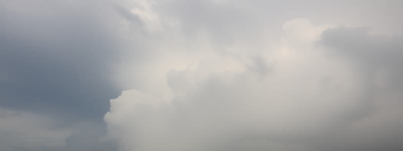
Cumulonimbus Clouds
- This type of cloud are large, storm-producing clouds also called "thunderstorm clouds."
- They look towering and are linked to dramatic weather changes.
What Cumulonimbus Clouds Look Like
- They are tall and dark, stretching high into the sky (up to 20 km/12 miles tall) with a dark, flat base close to the ground.
- Their top spreads out into a flat, anvil shape because of strong winds.
- The base of the cloud is rough and puffy, while the upper icy parts look wispy or fibrous.
How They Form
- The sun heats the ground, causing warm, moist air to rise like a hot-air balloon.
- As the air rises, it cools, and water vapor turns into tiny droplets or ice crystals, forming a cloud.
- The cloud grows vertically into a towering cumulonimbus if the air keeps rising (due to heat, mountains, or colliding weather systems).
Where They Form
- They are found near the equator, where the sun heats the land causing heat and moisture.
- These form in temperate zones during hot summers such as Europe and North America
- These form in mountain regions where slopes can force warm air upward, triggering storms.
Weather Effects
- It can cause sudden downpours, leading to flooded streets or dry riverbeds.
- It consists of charged ice particles that collide, creating electrical sparks, causing lightning and thunder.
- Strong air currents can carry raindrops upward, freezing them into ice pellets.
- Rotating air within the cloud can sometimes create tornadoes or damaging gusts.
- Rain and evaporation lower temperatures quickly once the storm passes.
Relief Rainfall
- This rainfall happens when moist air is pushed upward by hills or mountains, leading to clouds and rain.
- It creates wet areas on one side of mountains and dry zones on the other.
How Relief Rainfall Forms
- Winds carry damp air from oceans or lakes toward land and When this air hits a mountain, it's forced upward.
- As the air climbs, it cools, causing water vapor to condense into clouds.
- This produces heavy rain on the windward side (side facing the wind) of the mountain.
- After losing moisture, the air sinks down the leeward side (opposite side), warms up, and creates dry areas called rain shadows.
Where It Occurs
- It occurs in mountainous regions, such as the Andes or the Scottish Highlands, which get heavy rain on windward slopes.
- Coastal areas with hills, where the west coast receives frequent rain, while the east stays drier.
- In tropical islands such as Hawaii, mountains cause this rainfall, creating lush forests on one side and dry zones on the other.
Effects on Local Weather
- Mountain slopes facing the wind get drenched with heavy rain, such as the UK's Lake District.
- Dry areas form behind mountains, such as Chile's Atacama Desert. This desert, is shielded by the Andes,
- Rain cools the windward side, while the leeward side stays warm and dry, such as in the Alps.
- Wet slopes support farming and forests, while rain shadows may need irrigation for crops
Cold Frontal Rainfall
- This happens when a fast-moving cold air mass slides under a warmer air mass, forcing the warm air upward.
- The warm air rises quickly, forming tall cumulonimbus clouds.
- It causes heavy rain, thunderstorms, hail, or even tornadoes.
- It's common in temperate regions and moves quickly, often from northwest to southeast in the northern hemisphere.
- It consists of short, heavy rain showers or thunderstorms, along with cooler air.
Warm Frontal Rainfall
- It happens when a warm air mass slowly rises over a retreating cold air mass.
- It forms layered clouds (like nimbostratus) and brings light to moderate rain that lasts for hours.
- It's common in temperate zones and moves slowly, often from southwest to northeast.
- This rainfall is drizzly or steady rain over a large area with gradual warming.
Key Differences Between Frontal Rainfalls
| Feature | Cold Front | Warm Front |
|---|---|---|
| Speed | Fast-moving | Slow-moving |
| Clouds | Tall cumulonimbus (storms) | Layered stratus/nimbostratus (steady rain) |
| Rain Intensity | Heavy, short bursts | Light to moderate, long-lasting |
| Temperature Change | Sharp cooling after the front | Gradual warming after the front |
Global Atmospheric Circulation
- Global atmospheric air circulation is the large-scale movement of air around Earth, redistributing heat from the equator to the poles.
- It is driven by uneven heating and divided into 3 cells in each hemisphere: Hadley, Ferrel, and Polar.
How Global Atmospheric Circulation is Formed
- At the Equator (Hadley Cell), the sun heats the surface causing warm air to rise, cooling, leading to rainfall, and cooled air spreads towards 30° north and south.
- At mid-latitudes (Ferrel Cell), air moves poleward from 30° and meets cold air, forming unstable weather.
- At the poles (Polar Cell), cold air sinks creating high pressure, flowing towards 60° latitude.
Effects on Local Weather
- Rising warm air at the equator causes rainforests, while sinking dry air at 30° latitude creates deserts.
- The meeting of air masses at mid-latitudes leads to storms. Sinking cold air at the poles creates icy climates.
- It balances Earth's temperatures, determines ecosystems, and influences wind patterns.
Studying That Suits You
Use AI to generate personalized quizzes and flashcards to suit your learning preferences.