Podcast
Questions and Answers
Which of the following best describes the relationship between the Earth's compositional and mechanical layers?
Which of the following best describes the relationship between the Earth's compositional and mechanical layers?
- Compositional layers are primarily concerned with the flow of energy, and mechanical layers focus on the material properties.
- Compositional layers are defined by their physical state of matter, while mechanical layers are defined by their chemical makeup.
- Compositional layers describe what the layers are made of and state of matter, while mechanical layers describe the activities that occur within them. (correct)
- Compositional layers relate to the density of different materials, while mechanical layers relate to the relative pressure exerted on them.
Which of these is the best example of a divergent plate boundary?
Which of these is the best example of a divergent plate boundary?
- The West Coast of North America
- The Mid-Atlantic Ridge (correct)
- The San Andreas Fault
- The Himalayan Region
What is the primary force behind the movement of tectonic plates, according to the theory?
What is the primary force behind the movement of tectonic plates, according to the theory?
- Friction combined with gravitational pressure.
- Radioactive decay alone
- Convection currents in the mantle and gravitational pressure in combination. (correct)
- Gravitational pressure alone
Which of the following represents a key distinction between observations and interpretations in the context of Wegener's theory of continental drift?
Which of the following represents a key distinction between observations and interpretations in the context of Wegener's theory of continental drift?
What distinguishes a 'natural system' from a 'human system' in a geographical context?
What distinguishes a 'natural system' from a 'human system' in a geographical context?
Which geological process is primarily responsible for the formation of oceanic trenches?
Which geological process is primarily responsible for the formation of oceanic trenches?
In the rock cycle, which process directly transforms sediment into sedimentary rock?
In the rock cycle, which process directly transforms sediment into sedimentary rock?
Which of the following does NOT accurately describe a main difference between weather and climate?
Which of the following does NOT accurately describe a main difference between weather and climate?
Which of the following best represents the correct order of the major geologic eras from the most ancient to the most recent?
Which of the following best represents the correct order of the major geologic eras from the most ancient to the most recent?
Which of the following is an example of an igneous intrusive rock?
Which of the following is an example of an igneous intrusive rock?
Which term describes the process where water vapor changes directly to ice?
Which term describes the process where water vapor changes directly to ice?
Which of the following is the primary reason for the difference between maritime and continental climates?
Which of the following is the primary reason for the difference between maritime and continental climates?
Which of the following metamorphic rocks is formed from sedimentary rock?
Which of the following metamorphic rocks is formed from sedimentary rock?
Which of the following best describes the relationship between the Earth's spheres?
Which of the following best describes the relationship between the Earth's spheres?
Which of the following was NOT a key observation used by Alfred Wegener to support his continental drift hypothesis?
Which of the following was NOT a key observation used by Alfred Wegener to support his continental drift hypothesis?
What was a primary reason why Wegener's continental drift hypothesis was not initially accepted?
What was a primary reason why Wegener's continental drift hypothesis was not initially accepted?
Plate tectonics explains the Earth's surface processes through:
Plate tectonics explains the Earth's surface processes through:
Why do geologists use geologic eras to organize Earth’s history?
Why do geologists use geologic eras to organize Earth’s history?
In the rock cycle, which process transforms sedimentary rock into metamorphic rock:
In the rock cycle, which process transforms sedimentary rock into metamorphic rock:
How does the water cycle interact with the rock cycle?
How does the water cycle interact with the rock cycle?
What climate factor primarily influences total annual precipitation in a location?
What climate factor primarily influences total annual precipitation in a location?
Flashcards
Natural vs. Human Systems
Natural vs. Human Systems
A natural system is a system that is driven by nature, while a human system is driven by human activity.
Biotic vs. Abiotic Parts & Synergy
Biotic vs. Abiotic Parts & Synergy
Biotic parts of a system are living organisms, while abiotic parts are non-living components. Synergy refers to the interaction and cooperation between these parts.
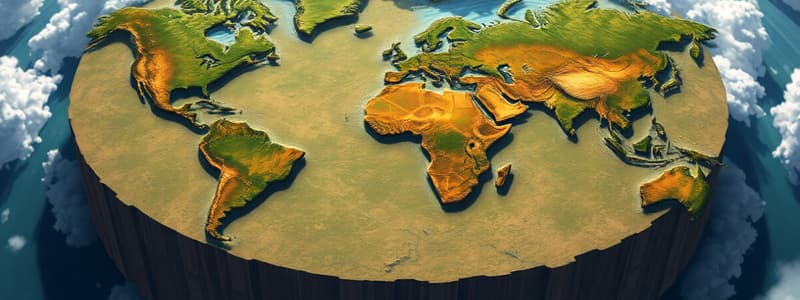
Earth's Spheres
Earth's Spheres
The atmosphere is the layer of gases surrounding the Earth, the hydrosphere includes all water on Earth, the lithosphere is the Earth's solid outer layer, and the biosphere encompasses all living things.
Hypothesis, Theory, and Scientific Method
Hypothesis, Theory, and Scientific Method
Signup and view all the flashcards
Tectonic Plates
Tectonic Plates
Signup and view all the flashcards
Lithification
Lithification
Signup and view all the flashcards
Cooling
Cooling
Signup and view all the flashcards
Erosion
Erosion
Signup and view all the flashcards
Weathering
Weathering
Signup and view all the flashcards
Transportation
Transportation
Signup and view all the flashcards
Deposition
Deposition
Signup and view all the flashcards
Metamorphism
Metamorphism
Signup and view all the flashcards
Liquification/Melting
Liquification/Melting
Signup and view all the flashcards
What is the range?
What is the range?
Signup and view all the flashcards
What is total annual precipitation?
What is total annual precipitation?
Signup and view all the flashcards
What is maximum seasonal precipitation?
What is maximum seasonal precipitation?
Signup and view all the flashcards
What is the growing season?
What is the growing season?
Signup and view all the flashcards
Why did Wegner's theory of continental drift fail?
Why did Wegner's theory of continental drift fail?
Signup and view all the flashcards
What is Plate Tectonics?
What is Plate Tectonics?
Signup and view all the flashcards
Why did Plate Tectonics succeed where Continental Drift failed?
Why did Plate Tectonics succeed where Continental Drift failed?
Signup and view all the flashcards
What is the difference between a good theory and a BETTER theory?
What is the difference between a good theory and a BETTER theory?
Signup and view all the flashcards
Study Notes
Physical Geography - Grade 9
-
-
- Key Concepts: It is crucial to differentiate between natural and human systems, as both play significant roles in shaping the environment and influencing human activities. Natural systems encompass a wide range of processes and features that occur in the absence of any human intervention. These processes include not only weather patterns, such as precipitation and temperature changes, but also geological formations like mountains, valleys, and soil development, as well as ecosystems that support diverse forms of life. Ecosystems, in particular, consist of both biotic components, including plants, animals, and microorganisms, and abiotic components, such as sunlight, soil, water, and air, all of which interact to maintain a balance crucial for survival. In contrast, human systems entail the various societal impacts on the environment, reflecting the ways in which human action alters landscapes through urbanization, which leads to the development of cities and infrastructure; agriculture, which modifies land for food production; and industry, which can result in pollution and resource depletion. The effects of these human systems are far-reaching and can lead to challenges such as habitat destruction and climate change. Understanding the biotic (living) and abiotic (non-living) components within Earth's systems is vital for students as it equips them to evaluate the interactions between these elements that contribute to balanced ecosystems. The interconnectedness of these components underscores the importance of maintaining a sustainable relationship between humans and the environment, emphasizing that changes in one area—such as deforestation or urban sprawl—can have profound and sometimes unexpected effects on other areas, such as local wildlife populations and climate patterns. By studying these relationships, students can develop a deeper appreciation for ecosystem services, such as air and water purification, and pollination, highlighting the need for stewardship of natural resources.
- Continental Drift Theory (Wegener): The Continental Drift Theory, proposed by the early 20th-century geologist Alfred Wegener, offers the fascinating notion that continents were once part of a singular supercontinent called Pangaea, which existed roughly 335 million years ago. This notion fundamentally changed how scientists view the dynamic nature of Earth’s surfaces and its history. Over millions of years, this massive landmass fragmented, and the individual continents drifted to their current positions due to tectonic activity. The movement of these tectonic plates continues today, influencing not only the shape of our continents but also the occurrence of earthquakes, volcanic eruptions, and mountain-building processes. To fully appreciate this theory, it is essential to differentiate among observations (what can be directly observed or measured), interpretations (the conclusions drawn from these observations based on evidence), and scientific methods (the systematic approaches employed to test hypotheses and validate scientific ideas). Wegener's four main observations that supported his theory include the remarkable fit of the continents, particularly the jigsaw-like alignment of South America and Africa, which suggests they were once joined; the distribution of identical fossils across continents that are now separated by vast oceans, indicating the land was once continuous; geological similarities found in rock formations on different continents, especially in related mountain ranges that suggest a common origin; and paleoclimatic evidence, such as coal deposits or glacial deposits, that indicates warm climates existed in regions currently characterized by cold temperatures due to their current locations. By delving into these observations, students can better understand the foundational concepts behind continental drift and the increasing acceptance of this theory within the scientific community, which paved the way for advancements in the field of plate tectonics.
- Plate Tectonics Theory (Wilson): Building upon Wegener's initial ideas, the Plate Tectonics Theory, articulated by geologist John Tuzo Wilson and others, provides a comprehensive explanation of the Earth's structure and geological activity. This theory describes the Earth's lithosphere—its rigid outer layer—composed of a series of large slabs known as tectonic plates. These plates float upon the semi-fluid asthenosphere beneath them, allowing for significant movement and interaction at their boundaries, leading to various geological phenomena. The Earth's structure is composed of four distinct layers: the inner core (solid), outer core (liquid), mantle (semi-solid), and crust (solid). Each layer plays a distinct role in the geodynamics of the planet, with the mantle being responsible for convection currents that drive plate movement. Additionally, the Earth is categorized into three mechanical layers based on physical properties: the lithosphere (the mechanically rigid outer layer), the asthenosphere (a semi-fluid layer beneath the lithosphere), and the mesosphere (the lower mantle area). The interactions between tectonic plates can be classified into four main types of boundaries: divergent boundaries, where plates separate and new crust is formed (such as at the Mid-Atlantic Ridge); convergent boundaries, where plates collide leading to the creation of mountain ranges (an example being the Himalayas, formed through the collision of the Indian and Eurasian plates); subduction zones, where one plate descends beneath another (such as those found in the Pacific Ring of Fire, which is notorious for its volcanic activity); and transform boundaries, where plates slide horizontally past one another (like the San Andreas Fault in California, which can lead to significant earthquakes). The forces driving plate tectonics are complex and multifaceted, including gravitational forces, the heat generated by radioactive decay, the convection currents circulating within the mantle, and the friction generated during plate interactions. All of these factors contribute to the dynamic processes that continuously reshape our planet over geologic timescales, resulting in the geological diversity we observe today.
- Geologic Time: Understanding geologic time is essential for grasping the vast and intricate history of our planet, which is typically divided into four major eras: the Precambrian, the Paleozoic, the Mesozoic, and the Cenozoic. The Precambrian is the longest era, spanning around 4.5 billion years and encompasses the formation of the Earth itself, along with the emergence of some of the oldest and simplest life forms in the form of bacteria and single-celled organisms. This era laid the groundwork for more complex forms of life that would follow. The Paleozoic era is characterized by the appearance of a diverse range of marine life, insects, and early land plants, alongside significant evolutionary events such as the dramatic Cambrian explosion (approximately 541 million years ago), where a multitude of life forms rapidly evolved and diversified. The Mesozoic era, often referred to as the age of reptiles, is dominated by the reign of dinosaurs, as well as the emergence of early mammals and birds within its timeframe. This era is notable for the breakup of Pangaea, which led to the diversification of species. Lastly, the Cenozoic era is portrayed as the age of mammals, highlighting the rise of mammalian species and the expansion of flowering plants, eventually leading to the complex ecosystems and modern world we experience today. The Cenozoic is characterized by the development of significant climatic changes and the evolution of mammals and birds. Each of these geologic eras is intimately linked to major geological and biological transformations, showcasing the timeline of evolution alongside significant climatic shifts, as well as geological events such as mass extinctions, continental drift, and volcanic eruptions that have shaped landscapes in Canada and around the globe. These events illustrate the importance of geological time in understanding the evolution of life and the Earth's environments.
- Rock Cycle: The rock cycle is a continuous and intricate natural process that describes the transformation of rocks through various states and processes over time. It begins with the formation of magma beneath the Earth's surface, where extreme heat and pressure exist within the mantle. As this magma cools and solidifies, it forms igneous rocks, which are the first stage in the rock cycle, showcasing the impact of thermal energy on rock formation. Once these igneous rocks are exposed to the forces of nature, such as weathering and erosion, they break down into smaller fragments known as sediments. This ongoing process transforms the landscape and contributes to soil formation. Over time, when these sediments accumulate, they undergo lithification, a process that compresses and cements them to form sedimentary rocks, characterized by their stratified appearance. Additionally, existing rocks can be subjected to intense heat and pressure, leading to their transformation into metamorphic rocks, which exhibit distinct textures and mineral compositions due to these geological forces. Key processes in the rock cycle include cooling (where magma becomes solid), erosion (the weathering and transportation of rock materials), weathering (the breaking down of rocks into smaller particles), transportation (movement of sediments by wind, water, or ice), deposition (the settling of sediments in a new location), compaction (the densifying of sediments under pressure), and metamorphism (the alteration of rocks due to heat and pressure). Furthermore, the cycle can involve processes such as liquefaction or melting, which highlight the dynamic and ever-changing nature of Earth's materials. Examples of different rock types include granite (an igneous rock formed from cooled magma, characterized by its coarse grain), obsidian (a naturally occurring volcanic glass characterized by its smooth, glassy texture, and rapid cooling process), silt (a fine-grained sedimentary material that often forms from the erosion of rocks), sandstone (a sedimentary rock formed from compacted grains of sand, often found in layered deposits), limestone (derived primarily from calcium carbonate, often from fossilized marine organisms, and important in both geological and economic contexts), shale (a soft, fine-grained sedimentary rock that can contain fossilized remains), and gneiss (a metamorphic rock known for its distinct banding and foliation patterns due to high-grade metamorphism). Each of these rock types plays a crucial role in the ongoing cycle of rock formation, erosion, and reconstruction, underscoring the complex interactions inherent to Earth’s geology and its impact on our environment.
Climate
- Climate Factors: A variety of factors influence the climate of a region, which can be conveniently encapsulated by the acronym L.O.W.E.R.N: Latitude, Ocean currents, Wind patterns, Elevation, Relief, and Nearness to water. Each of these factors significantly affects temperature and precipitation patterns on a global scale, highlighting the multifaceted nature of climate systems. Latitude, for instance, directly impacts the angle and intensity of sunlight received at different locations on Earth, which in turn influences local temperatures and seasonal variations. Ocean currents, such as the Gulf Stream, can moderate coastal climates by transporting warm or cold water across vast distances, leading to milder temperatures in some regions while intensifying weather patterns in others, demonstrating the interconnections within climate systems. Wind patterns, including major global wind systems like the trade winds and westerlies, also play critical roles in transporting moisture and determining precipitation levels across various geographic areas, contributing to the overall climate of a specific region. Moreover, the processes of condensation (the transition from vapor back to liquid), sublimation (the transition from solid to gas), precipitation (the falling of moisture in forms such as rain, snow, or sleet), and evaporation (the transition from liquid to gas) are pivotal in the water cycle, which shapes local climates significantly. This cycle is integral to distributing water across the planet, which affects ecosystems and human activities alike. A notable distinction is made between Maritime climates, characterized by moderate temperatures and high humidity levels due to their proximity to oceans, which can result in consistent precipitation patterns, and Continental climates, which typically experience more significant temperature extremes and lower humidity levels owing to their distance from large bodies of water, leading to more varied weather conditions. Moreover, students should familiarize themselves with various climate graphs that visually represent average annual temperatures, temperature ranges, total annual precipitation, maximum seasonal precipitation, and the length of the growing season. These graphs are essential tools for enhancing their comprehension of regional climate characteristics and variations, helping to develop a nuanced understanding of how local climates function within the broader context of global climate patterns.
- Water Cycle: The water cycle, also known as the hydrological cycle, serves as a critical framework that describes the continuous movement of water across the Earth in its various states: liquid, solid, and gas. Important processes involved in the water cycle include evaporation (the transition of water from a liquid state to vapor, influenced by temperature and solar radiation), condensation (the transformation of water vapor back to liquid form, often resulting in cloud formation), precipitation (the falling of moisture in different forms such as rain, snow, or hail), and infiltration (the absorption of water into the soil and underlying rocks, which replenishes groundwater supplies). Furthermore, it is crucial to recognize how the water cycle interacts with the rock cycle; for example, precipitation contributes to the weathering of rocks, which is an important step in the formation of sediments that feed into the rock cycle. The interplay between these cycles illustrates the interconnectedness of Earth’s systems and how they influence each other. By interpreting climate graphs and analyzing various climatic data, students can develop a deeper understanding of the different climate types present across diverse regions of Canada. These variations are influenced by the L.O.W.E.R.N factors, illustrating how geographic and environmental elements come together to create distinct climatic conditions. Understanding these intricate interactions not only enhances comprehension of ecosystems, such as how various species adapt to their environments, but also sheds light on the ongoing changes impacting weather and climate patterns, preparing students to appreciate the challenges posed by climate change and environmental degradation facing our planet today. For instance, shifts in temperature and precipitation patterns can exacerbate issues such as droughts, flooding, and changes in biodiversity, highlighting the importance of environmental science education for future generations.
-
Studying That Suits You
Use AI to generate personalized quizzes and flashcards to suit your learning preferences.


