Podcast
Questions and Answers
Which major river systems contributed to the formation of the Northern Plain?
Which major river systems contributed to the formation of the Northern Plain?
- Beas, Satluj, and Yamuna
- Teesta, Dihang, and Kali
- Jhelum, Chenab, and Ravi
- Indus, Ganga, and Brahmaputra (correct)
What type of soil predominantly composes the Northern Plain?
What type of soil predominantly composes the Northern Plain?
- Alluvial soil (correct)
- Laterite soil
- Sandy soil
- Clay soil
The term 'doab' refers to the land between which two features?
The term 'doab' refers to the land between which two features?
- Two mountain ranges
- Two plains
- Two valleys
- Two rivers (correct)
Which section of the Northern Plain extends between Ghaggar and Teesta rivers?
Which section of the Northern Plain extends between Ghaggar and Teesta rivers?
Which river system's tributaries are primarily associated with the Punjab Plains?
Which river system's tributaries are primarily associated with the Punjab Plains?
What is the approximate area covered by the Northern Plain?
What is the approximate area covered by the Northern Plain?
The Brahmaputra Plain is primarily located in which area?
The Brahmaputra Plain is primarily located in which area?
What type of climate contributes to the productivity of the Northern Plain?
What type of climate contributes to the productivity of the Northern Plain?
What is the outer-most range of the Himalayas called?
What is the outer-most range of the Himalayas called?
Which of the following ranges is part of the Purvachal region?
Which of the following ranges is part of the Purvachal region?
What characterizes the Duns found between the Lesser Himalaya and the Shiwaliks?
What characterizes the Duns found between the Lesser Himalaya and the Shiwaliks?
Which region of the Himalayas is traditionally known as Punjab Himalaya?
Which region of the Himalayas is traditionally known as Punjab Himalaya?
What geological composition primarily makes up the hills in the Purvachal region?
What geological composition primarily makes up the hills in the Purvachal region?
Which Duns is NOT mentioned as a well-known Dun?
Which Duns is NOT mentioned as a well-known Dun?
Which part of the Himalayas lies between the Satluj and Kali rivers?
Which part of the Himalayas lies between the Satluj and Kali rivers?
What marks the eastern-most boundary of the Himalayas?
What marks the eastern-most boundary of the Himalayas?
What is the term used for the narrow belt where rivers deposit pebbles while descending from the mountains?
What is the term used for the narrow belt where rivers deposit pebbles while descending from the mountains?
Which characteristic defines the terai region of the northern plains?
Which characteristic defines the terai region of the northern plains?
What type of soil is found in the bhangar region of the northern plains?
What type of soil is found in the bhangar region of the northern plains?
What is the largest inhabited riverine island in the world located in the Brahmaputra River?
What is the largest inhabited riverine island in the world located in the Brahmaputra River?
How do the rivers in their lower course affect the formation of island features?
How do the rivers in their lower course affect the formation of island features?
What major geographical feature characterizes the northern plains of India?
What major geographical feature characterizes the northern plains of India?
Which of the following statements is true regarding the northern plains?
Which of the following statements is true regarding the northern plains?
Which activity has occurred extensively in the terai region over time?
Which activity has occurred extensively in the terai region over time?
What is the average elevation range of the Western Ghats?
What is the average elevation range of the Western Ghats?
Which peak is the highest in the Eastern Ghats?
Which peak is the highest in the Eastern Ghats?
In which direction does the flow of rivers in this region generally occur?
In which direction does the flow of rivers in this region generally occur?
What geographical feature do the Western Ghats cause by rising moist winds?
What geographical feature do the Western Ghats cause by rising moist winds?
Which range has a higher average elevation, the Western Ghats or the Eastern Ghats?
Which range has a higher average elevation, the Western Ghats or the Eastern Ghats?
Which of the following rivers is NOT mentioned as draining this region?
Which of the following rivers is NOT mentioned as draining this region?
Which area is locally known as Bundelkhand?
Which area is locally known as Bundelkhand?
What is a characteristic feature of the Eastern Ghats?
What is a characteristic feature of the Eastern Ghats?
Which river is NOT mentioned as forming a delta along the Bay of Bengal?
Which river is NOT mentioned as forming a delta along the Bay of Bengal?
What is the largest saltwater lake in India?
What is the largest saltwater lake in India?
Which of the following features is NOT found in the coastal plains along the Bay of Bengal?
Which of the following features is NOT found in the coastal plains along the Bay of Bengal?
Which two islands form the broad categories of the island groups in the Bay of Bengal?
Which two islands form the broad categories of the island groups in the Bay of Bengal?
What feature characterizes the northern part of the coastal plains along the Bay of Bengal?
What feature characterizes the northern part of the coastal plains along the Bay of Bengal?
What is the strategic significance of the Andaman and Nicobar islands?
What is the strategic significance of the Andaman and Nicobar islands?
What type of natural formation covers larger areas in the desert regions of India?
What type of natural formation covers larger areas in the desert regions of India?
What geographical feature separates the Andaman Islands from the Nicobar Islands?
What geographical feature separates the Andaman Islands from the Nicobar Islands?
Study Notes
Glaciers and Passes in the Great Himalayas
- Major glaciers and passes are located in the Great Himalayas, a vital geographical feature.
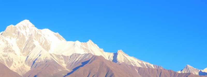
- The Himalayas are the outermost range known as the Shiwaliks, extending over 10-50 km in width, with altitudes between 900 to 1100 metres.
Regional Divisions of the Himalayas
- Himalayas are divided longitudinally and regionally from west to east, demarcated by river valleys.
- Punjab Himalaya includes areas between the Indus and Satluj rivers; therefore, known regionally as Kashmir and Himachal Himalayas.
- The Kumaon Himalayas lie between the Satluj and Kali rivers.
- Nepal Himalayas are demarcated by the Kali and Teesta rivers, while the Assam Himalayas extend between the Teesta and Dihang rivers.
- Eastern Himalayas known as Purvachal consist of hills like Patkai, Naga, Manipur, and Mizo hills, predominantly made of sedimentary rocks.
The Northern Plain
- Formed by the alluvial deposits from the Indus, Ganga, and Brahmaputra rivers, with fertile soil covering a vast area.
- Divided into three sections: Punjab Plains, Ganga Plains, and Brahmaputra Plains.
- Punjab Plains include regions formed by the Indus and its tributaries, while Ganga Plains extend from the Ghaggar to Teesta rivers across multiple northern states.
Physiographic Features of the Northern Plains
- Characterized by the ‘doab’ regions, which are created by river confluence, like Punjab meaning 'five rivers'.
- The northern plains display diverse relief features, including bhabar, terai, and floodplains.
- Bhabar is a narrow belt of river deposits where streams disappear, leading to the wet, marshy terai region ideal for agriculture.
The Central Highlands and Ghats
- Central Highlands wider in the west, shrink toward the east, with regions known as Bundelkhand and Baghelkhand.
- The Western Ghats have an elevation range of 900 to 1600 metres, causing orographic rain, while the Eastern Ghats are lower, averaging around 600 metres.
- Significant peaks include Anai Mudi (2,695 metres) and Doda Betta (2,637 metres) in the Western Ghats, with Mahendragiri (1,501 metres) in the Eastern Ghats.
Coastal Plains
- The coastal plains along the Bay of Bengal are named Northern Circar in the north and Coromandel Coast in the south.
- Major rivers like Mahanadi, Godavari, Krishna, and Kaveri form extensive deltas.
- Chilika Lake is notable as the largest saltwater lake in India, located in Odisha.
Islands of India
- India has two significant island groups: Andaman Islands (north) and Nicobar Islands (south).
- These islands are believed to be elevated portions of submarine mountains, essential for strategic purposes.
Studying That Suits You
Use AI to generate personalized quizzes and flashcards to suit your learning preferences.
Description
Explore the fascinating physical features of India, focusing on the Great Himalayas. Test your knowledge about the names of glaciers, mountain passes, and the highest peaks located in different states of India. Understand the geographical significance of the Shiwaliks and their characteristics.


