Podcast
Questions and Answers
In which grid cells should the parking lot be drawn?
In which grid cells should the parking lot be drawn?
- A2 and B2
- D1 and D2
- A1 and B1 (correct)
- C1 and C2
What is the correct location for the pool based on the provided instructions?
What is the correct location for the pool based on the provided instructions?
- A3
- D2 (correct)
- C2
- B3
Which two cells correspond to the location of the restaurant?
Which two cells correspond to the location of the restaurant?
- C1 and D1
- A2 and B2 (correct)
- B2 and C2
- A1 and B1
If the Dock Office is located just west of the Fuel Dock, where is the Dock Office positioned?
If the Dock Office is located just west of the Fuel Dock, where is the Dock Office positioned?
Which cell represents the location of the Snack Bar?
Which cell represents the location of the Snack Bar?
What direction would you take walking from the high school to the middle school?
What direction would you take walking from the high school to the middle school?
How would you describe the location of the coffee shop in relation to the middle school?
How would you describe the location of the coffee shop in relation to the middle school?
What shape should the path from B Dock to the Snack Bar take?
What shape should the path from B Dock to the Snack Bar take?
What are the cardinal directions that should be labeled on a compass rose?
What are the cardinal directions that should be labeled on a compass rose?
How are the lines of latitude identified on a map?
How are the lines of latitude identified on a map?
Which city is located at coordinates 10°N latitude and 67°W longitude?
Which city is located at coordinates 10°N latitude and 67°W longitude?
Which line of longitude is located at the western border of Guyana?
Which line of longitude is located at the western border of Guyana?
Which of the following cities is nearest to the equator based on the provided coordinates?
Which of the following cities is nearest to the equator based on the provided coordinates?
In which cell is Egypt’s capital, Cairo, located on the grid map?
In which cell is Egypt’s capital, Cairo, located on the grid map?
Which option correctly identifies the intermediate directions on a compass rose?
Which option correctly identifies the intermediate directions on a compass rose?
Bur Safajah and Luxor are located in which grid cell?
Bur Safajah and Luxor are located in which grid cell?
Which province is bordered by British Columbia?
Which province is bordered by British Columbia?
Which statement about the relative positions of Canadian provinces is incorrect?
Which statement about the relative positions of Canadian provinces is incorrect?
Which of the following statements is true regarding Russia's size compared to Mongolia?
Which of the following statements is true regarding Russia's size compared to Mongolia?
Based on population density maps, which region is expected to have a temperate climate?
Based on population density maps, which region is expected to have a temperate climate?
Which region in Europe is likely to have the coldest climate?
Which region in Europe is likely to have the coldest climate?
Which city is known for high elevation?
Which city is known for high elevation?
What feature would you expect Ayers Rock to have based on its description?
What feature would you expect Ayers Rock to have based on its description?
Which city was a leading exporter of iron during the Industrial Revolution?
Which city was a leading exporter of iron during the Industrial Revolution?
Which of these cities had a copper mining location near water?
Which of these cities had a copper mining location near water?
What was probably the leading export for Great Britain in 1750?
What was probably the leading export for Great Britain in 1750?
What type of map would depict physical features like mountains and rivers?
What type of map would depict physical features like mountains and rivers?
Based on the geographical context, what would you anticipate about the Great Australian Bight?
Based on the geographical context, what would you anticipate about the Great Australian Bight?
Which city would most likely have significant textile manufacturing in 1750?
Which city would most likely have significant textile manufacturing in 1750?
What is the position of the pond relative to the library and the elementary school?
What is the position of the pond relative to the library and the elementary school?
Which street can be found to the south of the Coffee Shop?
Which street can be found to the south of the Coffee Shop?
What type of map is being depicted in the content about Australia?
What type of map is being depicted in the content about Australia?
How far is Cuidad Juarez from Torreón according to the options provided?
How far is Cuidad Juarez from Torreón according to the options provided?
Which city is located approximately 200 miles west of Querétaro?
Which city is located approximately 200 miles west of Querétaro?
Approximately how far is Acapulco from Altamira?
Approximately how far is Acapulco from Altamira?
What does the symbol on the map represent when it indicates a body of water?
What does the symbol on the map represent when it indicates a body of water?
Which city is approximately 200 miles from Morelia?
Which city is approximately 200 miles from Morelia?
Flashcards are hidden until you start studying
Study Notes
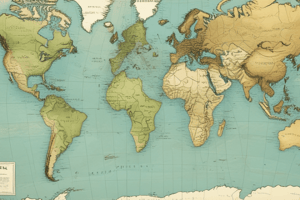
Map Skills Overview
- Compass rose indicates cardinal (North, East, South, West) and intermediate directions (NE, NW, SE, SW).
- Equator and Prime Meridian are fundamental lines for global mapping.
- Maps categorized as physical (geographical features) or political (borders, cities).
Latitude and Longitude
- Latitude lines run horizontally; longitude lines run vertically.
- Cities can be located using their coordinates.
- Latitude and longitude cross at specific geographic locations.
- Knowledge of key cities at given coordinates is essential.
Grid Maps
- Identifies locations using a grid system (e.g., A1, B2).
- Important to understand how to represent locations like cities based on grid cells.
- Create indexes for quick reference of key locations.
The Marina Map
- Map keys define symbols for docks, parking, and amenities.
- Understanding spatial relationship of features like the Dock Office and restaurant is key.
- Drawing paths can illustrate movement between locations in a given area.
City Map Analysis
- Understanding directional movement between landmarks (e.g., high school to middle school).
- Recognizing relative locations (e.g., coffee shop's direction from the middle school).
- Emphasis on visual skills and route mapping in urban planning.
Designing Your Own City Map
- Encourages creativity while learning mapping fundamentals.
- Suggested features include schools, libraries, and water bodies.
Map of Mexico
- Knowledge of distances between cities is important (e.g., Acapulco to Altamira).
- Identifying geographical landmarks like bodies of water and cities is fundamental.
- Familiarity with political divisions helps in locating major cities.
Map of Australia
- Understanding types of maps (political vs. physical) enhances geographical literacy.
- Identifying geographic features such as elevation and bodies of water is vital.
Industrial Revolution in Great Britain
- Key cities like Ironbridge and Swansea were significant for industrial activities.
- Understanding the exports of each region provides insight into historical economics.
- Different types of maps reflect different historical focuses.
True or False Activity
- Analyzes comprehension of map details and relationships between regions.
- Distinguishes facts regarding geographic locations and their relative positions.
Population Density Map of Russia
- Identifies population distribution and predicts climate based on density.
- Essential to compare spatial data between large regions, e.g., Russia vs. Mongolia.
Climate Map of Europe
- Recognizes regions based on climate, which affects population density.
- Comparative analysis of climate zones aids in understanding geography's impact on human settlement.
Studying That Suits You
Use AI to generate personalized quizzes and flashcards to suit your learning preferences.