Podcast
Questions and Answers
What is the imaginary line that divides the Earth into Northern and Southern Hemispheres?
What is the imaginary line that divides the Earth into Northern and Southern Hemispheres?
- Prime Meridian
- Equator (correct)
- 180th Meridian
- International Date Line
Which continent is located in all four hemispheres?
Which continent is located in all four hemispheres?
- Europe
- Asia
- Africa (correct)
- North America
What is the longitude of the Prime Meridian?
What is the longitude of the Prime Meridian?
- 180°
- 90°
- 270°
- 0° (correct)
What is the purpose of the international date line?
What is the purpose of the international date line?
What is the latitude of the equator?
What is the latitude of the equator?
What is the purpose of a compass rose on a map?
What is the purpose of a compass rose on a map?
What is the significance of the scale of a map?
What is the significance of the scale of a map?
What are the points called where the axis of the Earth passes through?
What are the points called where the axis of the Earth passes through?
What is the purpose of indicating the north at the top of a map?
What is the purpose of indicating the north at the top of a map?
What determines the amount of detail shown on a map?
What determines the amount of detail shown on a map?
Which imaginary line divides the globe into the Northern and Southern Hemispheres?
Which imaginary line divides the globe into the Northern and Southern Hemispheres?
Which of the following continents is NOT located in at least two hemispheres at once?
Which of the following continents is NOT located in at least two hemispheres at once?
What is the term for the point on a river where it meets a larger body of water?
What is the term for the point on a river where it meets a larger body of water?
What is the term for a narrow strip of land that connects two larger landmasses?
What is the term for a narrow strip of land that connects two larger landmasses?
What is the purpose of a map's key or legend?
What is the purpose of a map's key or legend?
What is the feature that divides the globe into Eastern and Western Hemispheres?
What is the feature that divides the globe into Eastern and Western Hemispheres?
Which of the following is NOT a characteristic of a peninsula?
Which of the following is NOT a characteristic of a peninsula?
What is the purpose of a harbor?
What is the purpose of a harbor?
What is the definition of an island?
What is the definition of an island?
What is the coast also called?
What is the coast also called?
What is the significance of the equator on a map?
What is the significance of the equator on a map?
How do you measure straight-line distances on a map?
How do you measure straight-line distances on a map?
What is the purpose of a map scale?
What is the purpose of a map scale?
Which continents exist solely in the Northern Hemisphere?
Which continents exist solely in the Northern Hemisphere?
What is the ratio of map distance to real-world distance according to the map scale?
What is the ratio of map distance to real-world distance according to the map scale?
Flashcards are hidden until you start studying
Study Notes
Maps and Map Skills
- Maps have keys or legends to explain their symbols, representing human and physical characteristics of places.
- Most maps are oriented with the North Pole at the top, unless otherwise indicated.
- Students should be able to measure distance on a map and use an atlas.
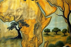
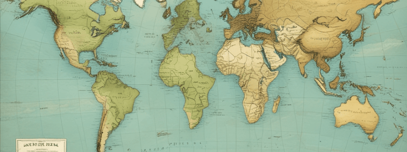
Continents and Oceans
- There are seven continents and four oceans, including the North and South Poles, and major rivers on each continent.
- All continents are located in at least two hemispheres at once (Northern or Southern, and Eastern or Western).
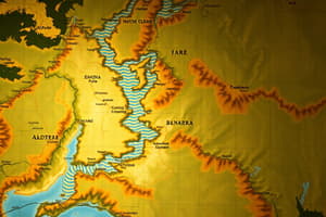
Rivers
- Every continent except Antarctica has several great rivers, which have played important roles throughout human history.
- Rivers provide many important benefits and resources, but they also have great destructive power.
Hemispheres
- The equator is an imaginary line around the center of the world, dividing the globe into the Northern and Southern Hemispheres.
- The world can also be looked at as having a Western Hemisphere and an Eastern Hemisphere.
- Any continent occupies portions of at least two hemispheres.
Geographical Terms and Features
- A peninsula is a piece of land sticking out into a body of water, almost surrounded by water.
- A harbor is a part of a body of water, providing a safe place for ships to anchor.
- A bay is a small area of an ocean or a lake that creates an opening in the land.
- An island is land completely surrounded by water, smaller than a continent.
- The coast is the land that runs along an ocean, bay, or gulf, also called the coastline or the shore.
Scale and Measurement
- Scale is the ratio between the representation and the thing it represents on a map.
- A large-scale map will show less area but more detail than a small-scale map.
- Students can use a ruler to measure distances on a map, and multiply by the scale to get the straight-line distance.
Directions and Compass Rose
- The cardinal directions are north, south, east, and west, with intermediate directions being northeast, southeast, southwest, and northwest.
- A compass rose indicates the directions on a map.
- Most maps and globes are oriented with the north at the top, unless otherwise indicated.
Studying That Suits You
Use AI to generate personalized quizzes and flashcards to suit your learning preferences.