Podcast
Questions and Answers
What are the three main branches of geography?
What are the three main branches of geography?
- Physical, Biological, and Chemical
- Human, Environmental, and Cultural
- Physical, Political, and Thematic
- Physical, Human, and Environmental (correct)
Canada is divided into five provinces and two territories.
Canada is divided into five provinces and two territories.
False (B)
What is the term for the difference between immigration and emigration rates?
What is the term for the difference between immigration and emigration rates?
net migration rate
A ________________ is a directional indicator on maps.
A ________________ is a directional indicator on maps.
Match the following types of immigrants with their characteristics:
Match the following types of immigrants with their characteristics:
What are the three main types of rocks?
What are the three main types of rocks?
Latitude is a factor that does not affect climate.
Latitude is a factor that does not affect climate.
What is the process of rock formation and transformation called?
What is the process of rock formation and transformation called?
The Earth is composed of three layers: the ______________, mantle, and core.
The Earth is composed of three layers: the ______________, mantle, and core.
Match the following climate regions with their characteristics:
Match the following climate regions with their characteristics:
Flashcards are hidden until you start studying
Study Notes
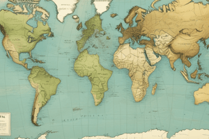
Unit 1 - Introduction to Geography
- Canada is divided into time zones, essential for understanding spatial patterns
- Three main branches of geography: physical, human, and environmental
- Essential mapping elements: scales, projections, and types of maps
- Map scales can be converted to real-world distances using mathematical calculations
- Canada consists of 10 provinces and 3 territories, each with their own capital cities
- Map projections: methods of representing the Earth's surface on a flat map, e.g. Mercator and Gall-Peters
- Three main types of maps: physical, political, and thematic
- Major lines of longitude: Prime Meridian and other longitudinal lines
- Major lines of latitude: Equator, Tropic of Cancer, Tropic of Capricorn, Arctic Circle, and Antarctic Circle
- Canada is surrounded by lakes, rivers, and oceans
- Compass rose: a directional indicator on maps
- Seven continents, each with unique features and characteristics
Unit 2 - Changing Populations & Livable Cities
- Three main types of immigrants: economic, family, and refugees
- Immigration point system: assesses criteria for immigration to Canada
- Historical waves of immigration have shaped Canada's population
- Urban and rural areas have distinct characteristics and interactions
- Total growth: total population change over time
- Net migration rate: difference between immigration and emigration rates
- Birth and death rates influenced by fertility rates, life expectancy, and other factors
- Traditional notion of neighborhoods has evolved over time
- Natural increase rate: rate of population growth due to births and deaths
- Immigrants, emigrants, and refugees have distinct definitions and characteristics
- Push, pull, and intervening factors influence migration patterns
- Population density: population per unit area
- Population distribution: geographical spread of population
- The Baby Boom: a post-World War II demographic phenomenon
Unit 3 - Physical Geography
- Canada divided into three main landform regions: Canadian Shield, mountains, and plains
- Earth composed of three layers: crust, mantle, and core
- Canada has two main climate regions: continental and maritime
- Rock cycle: process of rock formation and transformation
- Continental drift: movement of continents over geological time
- Plate tectonics: theory of Earth's crustal plates
- Three main types of rocks: igneous, sedimentary, and metamorphic
- Factors affecting climate: latitude, ocean currents, wind, air masses, elevation, relief, and nearness to water (LOWERN)
- Geologic eras: geological time periods
- Continental and maritime climates have distinct characteristics
Unit 4 - Industry & Natural Resources
- Canada's largest trading partners: countries with which Canada trades the most
- Imports and exports: goods and services brought into and sent out of Canada
- Transnational corporations (TNCs): significant impact on the economy
- Fisheries: an important aspect of Canada's economy, require management
- Trade: exchange of goods and services between countries
- Globalization: increasing interconnectedness of economies and societies
- Sweat shops: labor conditions in manufacturing that raise concerns
- Fossil fuels: coal, oil, and natural gas
- Three main types of industry: primary (extractive), secondary (manufacturing), and tertiary (services)
- Natural resources: renewable or non-renewable
- Child labor: a global issue that raises concerns about exploitation
Studying That Suits You
Use AI to generate personalized quizzes and flashcards to suit your learning preferences.