Podcast
Questions and Answers
What is the primary role of latitude and longitude in geography?
What is the primary role of latitude and longitude in geography?
- Describing a location on Earth. (correct)
- Establishing climate zones.
- Determining the Earth's axial tilt.
- Defining the Earth's elliptical orbit.
Why are lines of latitude also referred to as parallels?
Why are lines of latitude also referred to as parallels?
- They never meet and are equidistant from each other. (correct)
- They vary in degrees from 0° to 180°.
- They are used to determine time zones.
- They converge at the poles.
How many total latitudes are there, including the equator?
How many total latitudes are there, including the equator?
- 179
- 90
- 181 (correct)
- 180
Given the formula: Distance = (π × R/180) × Δθ, what does Δθ represent?
Given the formula: Distance = (π × R/180) × Δθ, what does Δθ represent?
Why does the distance between degrees of longitude vary, whereas the distance between degrees of latitude remains nearly constant?
Why does the distance between degrees of longitude vary, whereas the distance between degrees of latitude remains nearly constant?
What is the significance of the Earth's axial tilt (obliquity)?
What is the significance of the Earth's axial tilt (obliquity)?
The word 'tropic' comes from the Greek term 'tropos.' What does this term signify in the context of the Tropics of Cancer and Capricorn?
The word 'tropic' comes from the Greek term 'tropos.' What does this term signify in the context of the Tropics of Cancer and Capricorn?
What is the primary characteristic of the June solstice (Summer Solstice) in the Northern Hemisphere?
What is the primary characteristic of the June solstice (Summer Solstice) in the Northern Hemisphere?
During the Winter Solstice, which area experiences 24 hours of daylight?
During the Winter Solstice, which area experiences 24 hours of daylight?
Why is the Earth's orbit described as elliptical?
Why is the Earth's orbit described as elliptical?
At which point in Earth's orbit does Earth receive more solar energy; however, seasons are not caused by this?
At which point in Earth's orbit does Earth receive more solar energy; however, seasons are not caused by this?
During an equinox, what is the position of the sun relative to the Earth?
During an equinox, what is the position of the sun relative to the Earth?
What defines the Prime Meridian?
What defines the Prime Meridian?
If it is Monday in Japan and you travel westward to the United States, what day is it in the United States?
If it is Monday in Japan and you travel westward to the United States, what day is it in the United States?
What is the approximate distance of one degree of longitude at the equator?
What is the approximate distance of one degree of longitude at the equator?
What purpose does the International Date Line (IDL) serve?
What purpose does the International Date Line (IDL) serve?
What is the longitude of the International Date Line (IDL)?
What is the longitude of the International Date Line (IDL)?
If you travel eastward from the United States to Japan and it is Monday in the United States, what day does it become in Japan?
If you travel eastward from the United States to Japan and it is Monday in the United States, what day does it become in Japan?
What are lines of longitude also called?
What are lines of longitude also called?
Given the coordinates of Faisalabad Clock Tower as Latitude: 31° 25′ 07.22"N and Longitude: 73° 04′ 44.90″E, which of the following is the decimal conversion of the latitude?
Given the coordinates of Faisalabad Clock Tower as Latitude: 31° 25′ 07.22"N and Longitude: 73° 04′ 44.90″E, which of the following is the decimal conversion of the latitude?
Flashcards
Geographical Coordinate System
Geographical Coordinate System
A system using latitude and longitude to describe locations on Earth.
Latitude
Latitude
Imaginary horizontal lines extending East to West, measuring the angular distance North or South of the Equator.
Equator
Equator
Line with zero-degree latitude that divides the Earth into the Northern and Southern Hemispheres.
Longitude
Longitude
Signup and view all the flashcards
Prime Meridian
Prime Meridian
Signup and view all the flashcards
International Date Line (IDL)
International Date Line (IDL)
Signup and view all the flashcards
Axial Tilt (Obliquity)
Axial Tilt (Obliquity)
Signup and view all the flashcards
Tropic of Cancer/Capricorn
Tropic of Cancer/Capricorn
Signup and view all the flashcards
Earth's orbit
Earth's orbit
Signup and view all the flashcards
Aphelion
Aphelion
Signup and view all the flashcards
Perihelion
Perihelion
Signup and view all the flashcards
Summer Solstice
Summer Solstice
Signup and view all the flashcards
Winter Solstice
Winter Solstice
Signup and view all the flashcards
Equinox
Equinox
Signup and view all the flashcards
Study Notes
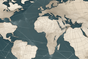
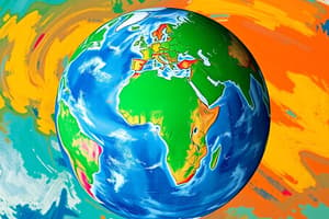
- Latitude and Longitude form a geographical coordinate system describing locations on Earth.
Latitudes
- Latitudes are imaginary horizontal lines extending east to west on the globe.
- Latitudes range from 0° at the Equator to 90° North (North Pole) and 90° South (South Pole).
- Latitudes are also known as Parallels because they never meet and are equidistant.
- Parallels get shorter towards the poles; the Equator is the longest, and a great circle.
Equator
- The Equator is the line with zero degrees latitude.
- The Equator (0° latitude) divides Earth into the Northern and Southern Hemispheres.
- Latitudes play a significant role in determining climate zones.
- There are a total of 181 latitudes, including the Equator.
- 90 latitudes are in the Northern Hemisphere (from 1°N to 90°N).
- 90 latitudes are in the Southern Hemisphere (from 1°S to 90°S).
- 1 latitude accounts for the Equator (0°).
- The total number of latitudes calculation: 90 + 90 + 1 = 181.
- The distance between consecutive latitudes (1° apart) is approximately 111 km (69 miles).
Distance Calculation
- Distance = (π × R/180) × Δθ
- R = 6371 km (Earth's average radius)
- Π = 3.1416
- Δθ = Difference in latitude (in degrees)
- 1° of latitude is approximately 3.1416 × 6371 / 180 ≈ 111 km
- The distance remains nearly constant as latitude lines are parallel.
- Longitude distances vary because meridians converge at the poles.
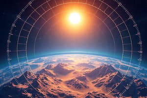
- The axial tilt of Earth (obliquity) is the angle between Earth's rotational axis and its orbital plane around the Sun.
- The Axial Tilt of the Earth is 23.5°.
Tropic Lines
- The Tropic of Cancer and Tropic of Capricorn are lines of latitude marking the northernmost and southernmost circles where the Sun can be directly overhead at the solstice.
- The Tropic of Cancer is at 23° 26′ 10.5” (23.43624 N).
- The Tropic of Capricorn is at 23° 26'10.5" (23.43624 S).
- The word "tropic" originates from the Greek term "tropos," meaning "turn" or "change."
- The term refers to the sun's perceived change in direction as it reaches these latitudes.
- The Tropic of Cancer marks the northernmost latitude where the sun is directly overhead, occurring at the June solstice (Summer solstice).
- The Tropic of Capricorn marks the southernmost latitude where the sun is directly overhead, occurring at the December solstice (Winter solstice).
Earth's Orbit
- Earth's orbit around the Sun is elliptical, causing variations in the Earth-Sun distance throughout the year.
- The terms come from ancient Greek: "helios" means "Sun," "apo" means "far," and "peri" means "close."
- Aphelion (farthest from the Sun = 152.1 million km) occurs around July 3rd-4th.
- Earth is at its farthest point from the Sun (~152 million km).
- The Sun appears slightly smaller in the sky.
- Perihelion (closest to the Sun = 147.1 million km) occurs around January 3rd.
- Earth is at its closest point to the Sun (~147 million km).
- The Sun appears slightly larger in the sky.
- Earth receives more solar energy during perihelion, but this does not cause summer; seasons are determined by Earth's axial tilt (23.5°), not distance.
- Seasons are NOT caused by Earth's distance from the Sun.
- Seasons are controlled by Earth's axial tilt (23.5°).
Solstices
- Summer Solstice (June Solstice): The Sun is overhead at the Tropic of Cancer (23.5°N).
- The Northern Hemisphere experiences the longest day and shortest night.
- The Northern Hemisphere gets the maximum daylight hours.
- The Arctic Circle (66.5°N) experiences 24 hours of daylight.
- Occurs around June 21st each year.
- During the Summer Solistice, the Southern Hemisphere experiences the shortest day and longest night. The Antarctic Circle (66.5°S) experiences 24 hours of darkness (Polar Night).
- Winter Solstice (December Solstice): The Sun is overhead at the Tropic of Capricorn (23.5°S).
- The Southern Hemisphere experiences the longest day and shortest night.
- The Southern Hemisphere experiences maximum daylight hours.
- The Antarctic Circle (66.5°N) experiences 24 hours of daylight.
- Occurs around December 21st each year.
- During the Winter Solistice, the Northern Hemisphere experiences the shortest day and longest night. The Arctic Circle (66.5°S) experiences 24 hours of darkness (Polar Night).
Equinox
- The Sun is directly overhead at the Equator during an equinox.
- Day and night are nearly equal in length all over the Earth during equinoxes.
- Equinoxes occur twice a year.
- Spring equinox occurs on March 20th - 21st.
- Fall equinox occurs on September 22nd-23rd.
Longitude
- Longitudes (Meridians) are imaginary vertical lines (semicircles) extending from the North Pole to the South Pole on the globe.
- The Prime Meridian is the line with zero degrees longitude.
- Longitudes range from 0° at Greenwich, London, to 360° at the midway point of the Pacific Ocean.
- The 180° longitude line / meridian is called the International Date Line (IDL) and is directly opposite the 0° meridian.
- Meridians are instrumental in determining time zones and local time.
- There are 360 meridians.
- The distance between meridians is not equal.
- At the Equator: 1° = 111 km
- At 30°N and 30°S: 1° = 96.5 km
- The distance decreases until it reaches zero at the poles.
International Date Line
- The International Date Line was established in 1884 and passes through the Mid-Pacific Ocean, roughly following the 180° line.
- Traveling East to West (e.g., Japan to the United States) results in Gaining a day and adding a day
- If it is Monday in Japan, traveling westward to the United States results in it becoming Sunday.
- Traveling West to East (e.g., United States to Japan) results losing a day
- If it is Monday in the United States, traveling eastward to Japan results in it becoming Tuesday.
- Earth's actual rotation time is 23 hours, 56 minutes, and 4 seconds, not exactly 24 hours.
Coordinate System
- Coordinate systems are commonly described in two units: Degree Minute Seconds (DMS).
- Coordinates of Faisalabad Clock Tower:
- Latitude: 31° 25′ 07.22"N
- Longitude: 73° 04′ 44.90″E
- Converting Degree Minute Seconds (DMS) to Decimals for Latitude:
- 31° 25′ 07.22"N
- 31 + 25/60 + 7.22/3600
- 31 + 0.4166 + 0.00200 = 31.418
- Converting Degree Minute Seconds (DMS) to Decimals for Longitude:
- 73° 04′ 44.90″E
- 73 + 04/60 + 44.90/3600
- 73 + 0.0666 + 0.01247 = 73.079
- Convert Decimals to Degree Minute Seconds (DMS):
- 31.4187
- 31.4187 x 60 = 31 25.122
- 31 25.122 x 60 = 31 25 7.32
- 31° 25′ 7.22"
- Coordinates:
- Latitude: 24° N - 37° N
- Longitude: 61° E - 77° E
- Total Area: 881,913 sq km
- Altitude:
- Highest point: K-2 (8611m)
- Deepest point: Dasu patan (6500m)
- Lowest point: Sea level 0 (feet)
Studying That Suits You
Use AI to generate personalized quizzes and flashcards to suit your learning preferences.