Podcast
Questions and Answers
From where are longitudes measured?
From where are longitudes measured?
The Prime Meridian (Greenwich, England)
What is the basis for the latitude system?
What is the basis for the latitude system?
The Earth's equator
What are the benefits of using latitudes and longitudes?
What are the benefits of using latitudes and longitudes?
Precision, Simplicity, Universal Application
What is the maximum value of latitudes?
What is the maximum value of latitudes?
What is the maximum value of longitudes?
What is the maximum value of longitudes?
What are some uses of latitudes and longitudes in geography?
What are some uses of latitudes and longitudes in geography?
How can latitudes and longitudes be manipulated mathematically?
How can latitudes and longitudes be manipulated mathematically?
What does the distribution and patterns of latitudes and longitudes help geographers correlate?
What does the distribution and patterns of latitudes and longitudes help geographers correlate?
In what way can latitudes and longitudes provide valuable insights into historic research?
In what way can latitudes and longitudes provide valuable insights into historic research?
What is the conclusion about the importance of latitudes and longitudes in geography?
What is the conclusion about the importance of latitudes and longitudes in geography?
Study Notes
Title: The Geographic Grid: Understanding Latitudes and Longitudes in Geography
Geography, the scientific study of Earth's features and their relationships, is a fascinating and diverse field. As an essential aspect of geography, we explore latitudes and longitudes — a simple yet powerful system for precisely pinpointing locations across the globe.
Latitudes and Longitudes: A Brief Overview
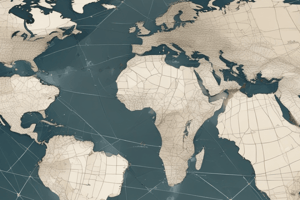
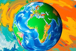
Latitudes and longitudes (also called coordinates) are a Cartesian coordinate system that discretizes the Earth's surface into a grid of lines. The Earth's equator, an imaginary line around the planet, acts as the basis for the latitude system. Latitudes are measured from 0° at the equator to 90° at the North and South poles.
Longitudes, on the other hand, are the lines that run from the North Pole to the South Pole, crossing the Earth's surface at each meridian. Longitudes are measured from 0° at the Prime Meridian (Greenwich, England) to 180° East and 180° West.
Benefits of Latitudes and Longitudes
The latitude and longitude system offers numerous benefits:
- Precision: Coordinates allow for pinpoint accuracy when specifying a geographic location, down to a fraction of a degree.
- Simplicity: Using latitudes and longitudes, you can easily distinguish locations on the Earth's surface, even if they are thousands of miles apart.
- Universal Application: This coordinate system is used globally, regardless of the country or region.
- Ease of Calculation: Latitudes and longitudes can be added, subtracted, multiplied, and divided using simple mathematical operations.
Using Latitudes and Longitudes in Geography
Geographers use latitudes and longitudes to:
- Mapmaking: By assigning coordinates to specific locations on the Earth's surface, geographers can create accurate and detailed maps.
- Measure Distance and Area: Latitudes and longitudes can be used to calculate distances and areas between locations, providing valuable insight into different geographic phenomena.
- Environmental Research: By studying the distribution and patterns of latitudes and longitudes, geographers can correlate climate, weather, and ecological factors to better understand the world.
- Historic Research: Latitudes and longitudes can be used to plot the paths of historical voyages, providing valuable insights into the exploration and colonization of the Earth.
Conclusion
Latitudes and longitudes are a powerful tool for geographers, allowing them to precisely pinpoint locations on the Earth's surface, measure distances and areas, and analyze environmental and historic phenomena. The simplicity and universal nature of this coordinate system make it a vital component of the discipline of geography. As we continue to explore our planet, latitudes and longitudes will remain a critical element of geographic research and understanding.
Studying That Suits You
Use AI to generate personalized quizzes and flashcards to suit your learning preferences.
Description
Explore the Cartesian coordinate system of latitudes and longitudes, essential for pinpointing global locations with precision. Discover the benefits of this universal system and its applications in mapmaking, environmental research, and historic analysis.