Podcast
Questions and Answers
What is the latitude of the Tropic of Cancer?
What is the latitude of the Tropic of Cancer?
- 66.5° north
- 23.5° south
- 23.5° north (correct)
- 0°
Which of the following statements is true regarding lines of latitude?
Which of the following statements is true regarding lines of latitude?
- They measure east-west position.
- They are all the same length.
- They intersect at the poles. (correct)
- They can exceed 90° in latitude.
What defines the east-west position of a point on Earth's surface?
What defines the east-west position of a point on Earth's surface?
- Horizon
- Latitude
- Equator
- Longitude (correct)
At what degree does the Prime Meridian run?
At what degree does the Prime Meridian run?
How many main lines of latitude exist when excluding the North and South Poles?
How many main lines of latitude exist when excluding the North and South Poles?
What separates the world into day and night?
What separates the world into day and night?
Which of the following describes all points on a meridian?
Which of the following describes all points on a meridian?
In a spatial reference system, what does the datum represent?
In a spatial reference system, what does the datum represent?
What does latitude indicate about a point on Earth?
What does latitude indicate about a point on Earth?
What is the longest parallel that divides the Earth into two equal hemispheres?
What is the longest parallel that divides the Earth into two equal hemispheres?
Which statement is true regarding lines of longitude?
Which statement is true regarding lines of longitude?
What is the role of the reference parallel in a latitude measurement?
What is the role of the reference parallel in a latitude measurement?
How many degrees of latitude exist on Earth?
How many degrees of latitude exist on Earth?
At what angle is the geographical north-south axis tilted from the Earth's orbital plane?
At what angle is the geographical north-south axis tilted from the Earth's orbital plane?
What is the primary function of a graticule?
What is the primary function of a graticule?
Which of the following is not true about lines of latitude?
Which of the following is not true about lines of latitude?
What characteristic is essential for a spatial reference system to be considered effective?
What characteristic is essential for a spatial reference system to be considered effective?
What is the primary issue associated with geographic coordinate systems?
What is the primary issue associated with geographic coordinate systems?
Which of the following best describes rectangular coordinate systems?
Which of the following best describes rectangular coordinate systems?
What is the structure of an Ordnance Survey map reference in Great Britain?
What is the structure of an Ordnance Survey map reference in Great Britain?
The WGS 84 spatial reference system is primarily used in which of the following applications?
The WGS 84 spatial reference system is primarily used in which of the following applications?
What is one of the limitations of applying rectangular coordinate systems?
What is one of the limitations of applying rectangular coordinate systems?
Which statement about the British National Grid system is correct?
Which statement about the British National Grid system is correct?
What is a limitation of using postcodes for geographical analysis?
What is a limitation of using postcodes for geographical analysis?
What defines the geographic coordinate system's lines of latitude and longitude?
What defines the geographic coordinate system's lines of latitude and longitude?
Which of the following statements about spatial referencing is true?
Which of the following statements about spatial referencing is true?
In which scenario would using a non-coordinate system like postcodes be most appropriate?
In which scenario would using a non-coordinate system like postcodes be most appropriate?
When using geographic coordinate systems, what is the angular reference for Kuala Lumpur?
When using geographic coordinate systems, what is the angular reference for Kuala Lumpur?
What is one benefit of using the Cartesian coordinate system for spatial data?
What is one benefit of using the Cartesian coordinate system for spatial data?
How are postcode units structured in the UK?
How are postcode units structured in the UK?
Which of the following statements about the British National Grid is incorrect?
Which of the following statements about the British National Grid is incorrect?
What does the hierarchical structure of postcodes enable?
What does the hierarchical structure of postcodes enable?
Flashcards
Geographic Coordinate System
Geographic Coordinate System
A system that uses two angles, latitude and longitude, to pinpoint a location on Earth's surface.
Latitude
Latitude
A measure of a point's north-south position, relative to the Equator, ranging from 0° (equator) to 90° (North or South Pole).
Longitude
Longitude
A measure of a point's east-west position, relative to the Prime Meridian, ranging from 0° to 180° (East or West).
Equator
Equator
Signup and view all the flashcards
Prime Meridian
Prime Meridian
Signup and view all the flashcards
Graticule
Graticule
Signup and view all the flashcards
Axial Tilt
Axial Tilt
Signup and view all the flashcards
Parallel vs. Converging Lines
Parallel vs. Converging Lines
Signup and view all the flashcards
Rectangular Coordinate System
Rectangular Coordinate System
Signup and view all the flashcards
Non-Coordinate System
Non-Coordinate System
Signup and view all the flashcards
What is the Equator?
What is the Equator?
Signup and view all the flashcards
What is the Prime Meridian?
What is the Prime Meridian?
Signup and view all the flashcards
Map Projection
Map Projection
Signup and view all the flashcards
Issues of Geographic Spatial Referencing
Issues of Geographic Spatial Referencing
Signup and view all the flashcards
What are lines of latitude?
What are lines of latitude?
Signup and view all the flashcards
What are lines of longitude?
What are lines of longitude?
Signup and view all the flashcards
How does longitude relate to time?
How does longitude relate to time?
Signup and view all the flashcards
What is a graticule?
What is a graticule?
Signup and view all the flashcards
What is a spatial reference system?
What is a spatial reference system?
Signup and view all the flashcards
What is the Earth's axial tilt?
What is the Earth's axial tilt?
Signup and view all the flashcards
What is the British National Grid?
What is the British National Grid?
Signup and view all the flashcards
What is a 6-figure grid reference?
What is a 6-figure grid reference?
Signup and view all the flashcards
How does the British National Grid use a Cartesian system?
How does the British National Grid use a Cartesian system?
Signup and view all the flashcards
What are postcodes?
What are postcodes?
Signup and view all the flashcards
How are postcodes hierarchical?
How are postcodes hierarchical?
Signup and view all the flashcards
Why are postcodes limited in spatial analysis?
Why are postcodes limited in spatial analysis?
Signup and view all the flashcards
Why do non-coordinate systems need conversion?
Why do non-coordinate systems need conversion?
Signup and view all the flashcards
How are different spatial referencing systems used?
How are different spatial referencing systems used?
Signup and view all the flashcards
Study Notes
Coordinate Systems
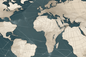
- Latitude and longitude form a geographic coordinate system used to locate a point on Earth.
- Latitude measures the north-south position, ranging from 0° at the equator to 90° at the poles (North or South).
- Longitude measures the east-west position, ranging from 0° at the Prime Meridian (Greenwich) to 180° East and West.
- Lines of latitude are parallel to each other and horizontal.
- Lines of longitude (meridians) are vertical and meet at the poles.
- Latitude and longitude values form the coordinates for any point on Earth.
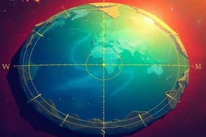
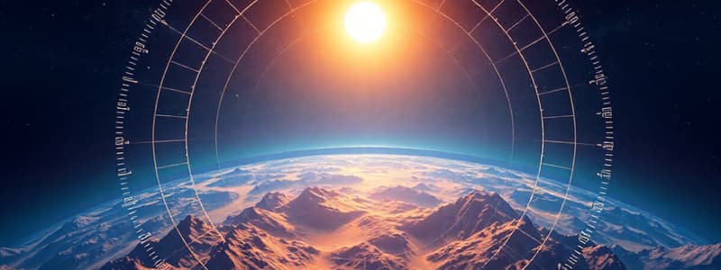
- A graticule is a model formed by the crossing network of latitude and longitude lines.
Geographic Coordinate Systems
- Earth is modeled as a sphere for geographic coordinate systems.
- Spherical coordinates use latitude and longitude to define locations.
- Latitude and longitude are angles measured from the center of the Earth, with the equator as the reference line for latitude (0°).
- The Prime Meridian (passing through Greenwich) is the reference for measuring longitude (0°).
Issues with Geographic Systems
- Geographic systems assume the Earth is a perfect sphere, which is not entirely accurate; this affects precision, especially near the poles.
- Lines of latitude and longitude are less dense at the poles and more dense at the equator.
- Lines of latitude and longitude are distorted on maps, especially at larger scales, which can affect calculations.
Rectangular Coordinate Systems
- Rectangular systems use perpendicular axes (x,y, and z).
- Used to represent locations on a map or surface in a grid format.
- Commonly used in smaller regions (e.g., national grids) instead of global coverage.
- The grid coordinates of the points are used to calculate distances.
Non-Coordinate Systems (e.g. Postcodes)
- Postcodes are hierarchical location identifiers, and not directly coordinate-based.
- Postcodes provide a descriptive code referencing a geographic area.
- Postcodes are useful for identifying locations in restricted areas, but may not be suitable for all analysis types.
- Converting postcodes to spatial coordinates may be necessary for further analysis.
Studying That Suits You
Use AI to generate personalized quizzes and flashcards to suit your learning preferences.