Podcast
Questions and Answers
What are the four major types of landforms?
What are the four major types of landforms?
- Basins, valleys, mountains, hills
- Mountains, hills, plateaus, plains (correct)
- Rivers, lakes, buttes, canyons
- Canyons, basins, plateaus, hills
What is the largest mountain range in the United States?
What is the largest mountain range in the United States?
- Rocky Mountains (correct)
- Sierra Nevada Mountains
- Himalayan Mountains
- Appalachian Mountains
How are most landforms on Earth formed?
How are most landforms on Earth formed?
- Over millions of years (correct)
- Through human activity
- Over a short period of time
- Through volcanic eruptions only
What is the purpose of national parks and wilderness preserves?
What is the purpose of national parks and wilderness preserves?
What type of events can create new landforms?
What type of events can create new landforms?
What connects the Lawrence River in Canada to the Hudson River in the United States?
What connects the Lawrence River in Canada to the Hudson River in the United States?
What mountain range is located in the state of California?
What mountain range is located in the state of California?
What is the name of the region indicated by the tan coloration in the state of California?
What is the name of the region indicated by the tan coloration in the state of California?
What is the name of the body of water into which the Mississippi River flows?
What is the name of the body of water into which the Mississippi River flows?
What is the name of the valley located to the east of the Mississippi River?
What is the name of the valley located to the east of the Mississippi River?
What is the highest peak of the Rocky Mountains?
What is the highest peak of the Rocky Mountains?
What is the name of the valley that is known for being the hottest place on Earth?
What is the name of the valley that is known for being the hottest place on Earth?
What is the primary force that shaped the Grand Canyon?
What is the primary force that shaped the Grand Canyon?
What is the name of the river that is the longest in the United States?
What is the name of the river that is the longest in the United States?
What is the largest of the Great Lakes by surface area?
What is the largest of the Great Lakes by surface area?
Flashcards are hidden until you start studying
Study Notes
Landforms
- A landform is a naturally occurring feature on the surface of the Earth.
- The four major types of landforms are mountains, hills, plateaus, and plains.
- Rivers, lakes, buttes, canyons, basins, and valleys are also considered landforms.
Formation of Landforms
- Landforms are created by natural processes such as tectonic plate movement, weathering, and erosion.
- Most landforms on Earth were formed over millions of years, although cataclysmic events such as volcanic eruptions can also create new landforms.
Major Landforms in the United States
- The United States contains all types of landforms.
- The Grand Canyon, Rocky Mountains, Mississippi River, and Great Lakes are among the most famous landforms within the U.S.
Mountains, Valleys, and Canyons of the U.S.
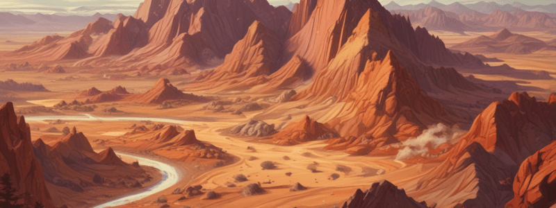
- The United States is home to several mountain ranges, including the Rocky Mountains, Appalachian Mountains, and Sierra Nevada Mountains.
- The Rocky Mountains are the largest range in the United States, stretching across the western United States from New Mexico to Canada.
- The Appalachian Mountains are located on the eastern side of the country and are among the oldest on Earth, with formation beginning 1.1 billion years ago.
- The Sierra Nevada Mountains are located along the eastern side of California and are the youngest of the three major United States ranges, with uplift beginning 4 million years ago.
Valleys
- Death Valley is the hottest place on Earth, located in southern California, and can regularly reach summer temperatures of over 120 degrees.
- The Great Appalachian Valley is a region that encompasses land from Canada to Alabama.
- The Tennessee Valley is located on the western side of the Appalachian Mountains, and the Shenandoah Valley is located to the east of the range.
Canyons
- The Grand Canyon is the most famous canyon in the United States, located in Arizona, and is 227 miles long and 18 miles wide.
- The second largest canyon in the United States is Palo Duro Canyon, located in the Panhandle region of Texas.
Rivers and Lakes of the U.S.
- Rivers are bodies of freshwater that flow downhill from a source known as the headwaters.
- The Mississippi River is the most famous river in the United States, stretching 2,350 miles from its headwaters to its final destination at the Gulf of Mexico.
- The Great Lakes are a major source of freshwater, stretching over 750 miles across the border of the United States and Canada.
- The Great Lakes were formed by melting glaciers around 14,000 years ago.
U.S. Landforms Map
- The topographical map of the United States provides an overview of the location of major landforms in the United States.
- The map shows the Sierra Nevada Mountains, Death Valley, the Grand Canyon, the Rocky Mountains, the Mississippi River, and the Great Lakes.
North American Landforms Map
- The map shows the major landforms of the North American continent, including the extension of the Rocky Mountains into the Sierra Madre Mountains of Mexico and the Canadian Rockies in Canada.
- The map also shows the clear boundary created by the Great Lakes between the United States and Canada.
- The map also clearly shows the glaciers located on the island of Greenland.
Studying That Suits You
Use AI to generate personalized quizzes and flashcards to suit your learning preferences.


