Podcast
Questions and Answers
What was the geological history of India prior to 50 million years ago?
What was the geological history of India prior to 50 million years ago?
- India was part of an ancient landmass called Gondwanaland. (correct)
- India was connected to North America.
- India did not exist as a landmass.
- India was an island separate from Gondwanaland.
Which line divides India into two almost equal parts?
Which line divides India into two almost equal parts?
- Prime Meridian
- Equator
- Tropic of Cancer (correct)
- Tropic of Capricorn
How long is India's north-south and east-west stretch approximately?
How long is India's north-south and east-west stretch approximately?
- 1,500 kilometers in both directions.
- 2,000 kilometers combined.
- 3,000 kilometers in both directions. (correct)
- 3,000 kilometers in the north-south direction only.
Which location is the southernmost tip of India?
Which location is the southernmost tip of India?
What effect does India's longitudinal stretch have on time?
What effect does India's longitudinal stretch have on time?
How does latitude affect temperature in India?
How does latitude affect temperature in India?
What climatic zone does the southern half of India primarily fall into?
What climatic zone does the southern half of India primarily fall into?
What is a key difference in day and night duration between Kanyakumari and Kashmir?
What is a key difference in day and night duration between Kanyakumari and Kashmir?
What is the geographical shape of the Peninsular Plateau?
What is the geographical shape of the Peninsular Plateau?
Which two groups is the Peninsular Plateau divided into?
Which two groups is the Peninsular Plateau divided into?
Which river bounds the Central Highlands to the south?
Which river bounds the Central Highlands to the south?
Which coastal plain extends from Kutch in Gujarat to Kanyakumari in Tamil Nadu?
Which coastal plain extends from Kutch in Gujarat to Kanyakumari in Tamil Nadu?
Which of the following rivers does not form a delta on the western coast?
Which of the following rivers does not form a delta on the western coast?
Which major island group is located in the Arabian Sea?
Which major island group is located in the Arabian Sea?
Which group of islands contains 204 islands and includes the Barren Volcano?
Which group of islands contains 204 islands and includes the Barren Volcano?
What type of islands are the Lakshadweep Islands primarily formed by?
What type of islands are the Lakshadweep Islands primarily formed by?
Which coastal plain is known for having well-developed deltas formed by numerous rivers?
Which coastal plain is known for having well-developed deltas formed by numerous rivers?
The Ten Degree Channel separates which two islands?
The Ten Degree Channel separates which two islands?
What is the primary role of the Himalayas concerning India's climate?
What is the primary role of the Himalayas concerning India's climate?
What natural resources are predominantly found in the Northern Plains?
What natural resources are predominantly found in the Northern Plains?
Which geographical feature is the highest mountain range in the world?
Which geographical feature is the highest mountain range in the world?
Which of the following states is not located in north-eastern India?
Which of the following states is not located in north-eastern India?
Which rivers are responsible for forming the Ganga-Brahmaputra plain?
Which rivers are responsible for forming the Ganga-Brahmaputra plain?
What is the capital of the union territory of Jammu and Kashmir?
What is the capital of the union territory of Jammu and Kashmir?
Which plateau is known for the Deccan Trap Region, suitable for cotton and sugarcane cultivation?
Which plateau is known for the Deccan Trap Region, suitable for cotton and sugarcane cultivation?
Which region of India is known for its flat plains formed by rivers?
Which region of India is known for its flat plains formed by rivers?
What defines the Great Indian Desert's climate?
What defines the Great Indian Desert's climate?
What is the maximum altitude of the peaks in the Himalayas mentioned?
What is the maximum altitude of the peaks in the Himalayas mentioned?
Which mountain range is considered the outermost range of the Himalayas?
Which mountain range is considered the outermost range of the Himalayas?
Which of the following states has Amaravati as its capital?
Which of the following states has Amaravati as its capital?
Which mountain range lies parallel to the western coast of the Indian peninsula?
Which mountain range lies parallel to the western coast of the Indian peninsula?
What is a key characteristic of the Eastern Ghats?
What is a key characteristic of the Eastern Ghats?
What is the average height range of the Greater Himalayas?
What is the average height range of the Greater Himalayas?
Which major passes can be found across the Himalayas?
Which major passes can be found across the Himalayas?
Which river is NOT mentioned as flowing through the northern plains?
Which river is NOT mentioned as flowing through the northern plains?
Which zone includes states like Goa and Karnataka?
Which zone includes states like Goa and Karnataka?
What type of land is referred to as 'doabs' in the context of Punjab?
What type of land is referred to as 'doabs' in the context of Punjab?
What is the importance of the Northern Plains as agricultural land?
What is the importance of the Northern Plains as agricultural land?
Which city is the capital of the union territory Andaman and Nicobar Islands?
Which city is the capital of the union territory Andaman and Nicobar Islands?
What is the highest peak in the Western Ghats?
What is the highest peak in the Western Ghats?
What type of mountain formation is described by the Himalayas?
What type of mountain formation is described by the Himalayas?
Which of these states is located in the southern region of India?
Which of these states is located in the southern region of India?
Which plateau lies between the Malwa Plateau and the Deccan Plateau?
Which plateau lies between the Malwa Plateau and the Deccan Plateau?
What is the geographical feature of the Ganges River plains?
What is the geographical feature of the Ganges River plains?
What is the significance of the Brahmaputra River in relation to the Ganga?
What is the significance of the Brahmaputra River in relation to the Ganga?
Flashcards
India's latitudinal extent
India's latitudinal extent
India's north-south measurement, approximately 3,000 kilometers, creating differences in climate and day length.
Standard Meridian of India
Standard Meridian of India
Longitude 82°30′ East, used to determine India's standard time.
Tropic of Cancer
Tropic of Cancer
An imaginary line (23.5° North latitude) that divides India almost equally.
India's Shape
India's Shape
Signup and view all the flashcards
Time Difference (India)
Time Difference (India)
Signup and view all the flashcards
Climate Zones(India)
Climate Zones(India)
Signup and view all the flashcards
Indira Point
Indira Point
Signup and view all the flashcards
Latitudinal impact on climate
Latitudinal impact on climate
Signup and view all the flashcards
Peninsular Plateau
Peninsular Plateau
Signup and view all the flashcards
Central Highlands
Central Highlands
Signup and view all the flashcards
Deccan Plateau
Deccan Plateau
Signup and view all the flashcards
Western Coastal Plain
Western Coastal Plain
Signup and view all the flashcards
Eastern Coastal Plain
Eastern Coastal Plain
Signup and view all the flashcards
Delta
Delta
Signup and view all the flashcards
Andaman and Nicobar Islands
Andaman and Nicobar Islands
Signup and view all the flashcards
Lakshadweep Islands
Lakshadweep Islands
Signup and view all the flashcards
Minicoy
Minicoy
Signup and view all the flashcards
Nicobar Pigeon
Nicobar Pigeon
Signup and view all the flashcards
Himalayas: Meaning
Himalayas: Meaning
Signup and view all the flashcards
Himalayas: Location
Himalayas: Location
Signup and view all the flashcards
Himalayas: Extension
Himalayas: Extension
Signup and view all the flashcards
Himalayas: Formation
Himalayas: Formation
Signup and view all the flashcards
Himalayan Ranges
Himalayan Ranges
Signup and view all the flashcards
Greater Himalayas
Greater Himalayas
Signup and view all the flashcards
Greater Himalayas: Peaks
Greater Himalayas: Peaks
Signup and view all the flashcards
Lesser Himalayas
Lesser Himalayas
Signup and view all the flashcards
Lesser Himalayas: Ranges
Lesser Himalayas: Ranges
Signup and view all the flashcards
Lesser Himalayas: Hill Stations
Lesser Himalayas: Hill Stations
Signup and view all the flashcards
Outer Himalayas
Outer Himalayas
Signup and view all the flashcards
Sivaliks: Characteristics
Sivaliks: Characteristics
Signup and view all the flashcards
Terai Region
Terai Region
Signup and view all the flashcards
Purvanchal Range
Purvanchal Range
Signup and view all the flashcards
Himalayas
Himalayas
Signup and view all the flashcards
Northern Plains
Northern Plains
Signup and view all the flashcards
What are the key features of the Northern Plains?
What are the key features of the Northern Plains?
Signup and view all the flashcards
Indo-Gangetic Plain
Indo-Gangetic Plain
Signup and view all the flashcards
Brahmaputra Plain
Brahmaputra Plain
Signup and view all the flashcards
Western Ghats
Western Ghats
Signup and view all the flashcards
Eastern Ghats
Eastern Ghats
Signup and view all the flashcards
Nilgiri Hills
Nilgiri Hills
Signup and view all the flashcards
Great Indian Desert
Great Indian Desert
Signup and view all the flashcards
Doab
Doab
Signup and view all the flashcards
Malwa Plateau
Malwa Plateau
Signup and view all the flashcards
Chhota Nagpur Plateau
Chhota Nagpur Plateau
Signup and view all the flashcards
What is the importance of the Himalayas to India?
What is the importance of the Himalayas to India?
Signup and view all the flashcards
Study Notes
India's Physiography
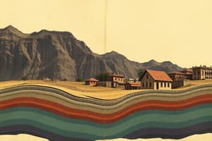
- India has a complex geological history, evolving from Gondwanaland to its current position. Around 50 million years ago, the Indian subcontinent collided with the Tibetan landmass, forming the Himalayas.
- India is the seventh largest country globally.
- Its geographic span lies entirely within the Northern and Eastern Hemispheres.
- Latitudinal extent: 8°4'N to 37°6′N; longitudinal extent: 68°7'E to 97°25'E. The southernmost point is Indira Point.
- The Tropic of Cancer (23°30'N) roughly bisects the country.
- The east-west and north-south dimensions are approximately 3,000 kilometers each, leading to a two-hour time difference between the east and west.
- Standard Meridian of India is 82°30' East, passing through Prayagraj.
- The latitudinal spread causes variations in temperature and day length. The southern part (peninsular India) is tropical and warm, while the northern part has a more diverse climate, including cold winters.
Boundaries of India
- Northern and North-eastern borders: Himalayan mountain range.
- North-western borders: Afghanistan and Pakistan.
- North-eastern neighbours: China, Bhutan, and Nepal.
- Eastern border: Bangladesh.
- Far east border: Myanmar.
- South-western border: separated from Sri Lanka by the Palk Strait and Gulf of Mannar, Maldives are also a neighboring island nation..
Political Divisions
- India is divided into 28 states and 8 union territories.
- States and union territories are categorized into various zones based on location (e.g., North-western, Northern, Western, Central, Eastern, North-eastern, Southern).
- A table lists states, union territories, and their respective capital cities.
Physiographic Divisions
- India's diverse physical features are grouped into six major divisions.
- Northern Mountains (Himalayas): The highest mountain range globally, including the Greater Himalayas (high peaks like Mt. Everest), Lesser Himalayas (hill stations), and Siwaliks (outermost range). The Purvanchal range is the eastern section of the Himalayas. The Karakoram range extends along the border of India, Pakistan, China..
- Northern Plains: Formed by alluvial deposits from Himalayan rivers, particularly the Ganga and Brahmaputra rivers. A major agricultural region (the granaries of India). The Western Plain is formed by the Indus and its tributaries.
- Peninsular Plateau: A broad, ancient plateau, divided into the Central Highlands and Deccan Plateau.
- Great Indian Desert/Thar Desert: Characterized by very low rainfall (less than 150 mm annually) and a dry climate; located to the north-west of the Aravalli Hills.
- Coastal Plains: Two plains run along the coasts – the Western Coastal Plain (narrow in the middle, wider at the north and south) and the Eastern Coastal Plain (broader than its western counterpart).
- Islands: Two major island groups – the Andaman and Nicobar Islands (within the Bay of Bengal) and the Lakshadweep Islands (in the Arabian Sea).
Studying That Suits You
Use AI to generate personalized quizzes and flashcards to suit your learning preferences.
Description
Explore the fascinating geological history and geographic features of India. This quiz covers the formation of the Himalayas, the country's dimensions, its position in the hemispheres, and the impact of latitude on climate. Test your knowledge on India's boundaries and significant meridians!