Podcast
Questions and Answers
What kind of terrain exists in hilly regions?
What kind of terrain exists in hilly regions?
Rugged Terrain
Which of the following is NOT a major physical feature of the earth?
Which of the following is NOT a major physical feature of the earth?
- Deserts
- Plateaus
- Plains
- Volcanoes (correct)
- Islands
- Mountains
Which of these rocks is used to make talcum powder?
Which of these rocks is used to make talcum powder?
- Soapstone (correct)
- Marble
- Limestone
- Granite
India's landmass was formed during a single geological period.
India's landmass was formed during a single geological period.
What are three geological processes that shape the relief of the Earth?
What are three geological processes that shape the relief of the Earth?
What is the name of the theory that explains the formation of physical features based on the movement of the Earth's crust?
What is the name of the theory that explains the formation of physical features based on the movement of the Earth's crust?
The movement of the plates results in ______ within the plates and the continental rocks above, leading to folding, faulting, and volcanic activity.
The movement of the plates results in ______ within the plates and the continental rocks above, leading to folding, faulting, and volcanic activity.
Match the following types of plate boundaries with their descriptions:
Match the following types of plate boundaries with their descriptions:
The movement of tectonic plates has influenced the position and size of continents over millions of years.
The movement of tectonic plates has influenced the position and size of continents over millions of years.
Where are most volcanoes and earthquakes located?
Where are most volcanoes and earthquakes located?
What is the name of the ancient supercontinent that included India, Australia, South Africa, South America, and Antarctica?
What is the name of the ancient supercontinent that included India, Australia, South Africa, South America, and Antarctica?
The Himalayan uplift is a result of the collision of the Indo-Australian plate with the Eurasian plate.
The Himalayan uplift is a result of the collision of the Indo-Australian plate with the Eurasian plate.
How were the northern plains of India formed?
How were the northern plains of India formed?
The peninsular plateau is considered one of the most stable landmasses on Earth.
The peninsular plateau is considered one of the most stable landmasses on Earth.
Which of the following is NOT a recent landform in India?
Which of the following is NOT a recent landform in India?
What is the name of the highest mountain range in the world, and where does it stretch?
What is the name of the highest mountain range in the world, and where does it stretch?
The Himalayas are geologically young and structurally fold mountains.
The Himalayas are geologically young and structurally fold mountains.
What is the name of the northernmost range of the Himalayas that contains the highest peaks, and what is its average height?
What is the name of the northernmost range of the Himalayas that contains the highest peaks, and what is its average height?
What is the name of the longitudinal valley lying between the Lesser Himalayas and the Shiwaliks?
What is the name of the longitudinal valley lying between the Lesser Himalayas and the Shiwaliks?
What is the name of the most rugged mountain system south of the Himadri, and what is its average altitude?
What is the name of the most rugged mountain system south of the Himadri, and what is its average altitude?
What is the name of the outermost range of the Himalayas, and what is its altitude range?
What is the name of the outermost range of the Himalayas, and what is its altitude range?
How is the peninsular plateau composed?
How is the peninsular plateau composed?
What two broad divisions make up the peninsular plateau?
What two broad divisions make up the peninsular plateau?
What is the name of the sandy and rocky desert that merges with the western extension of the Central Highlands?
What is the name of the sandy and rocky desert that merges with the western extension of the Central Highlands?
What is the direction of the flow of the rivers that drain the Central Highlands?
What is the direction of the flow of the rivers that drain the Central Highlands?
What are the names of the three hills that mark the eastern edge of the Deccan Plateau?
What are the names of the three hills that mark the eastern edge of the Deccan Plateau?
The Western Ghats are lower in elevation than the Eastern Ghats.
The Western Ghats are lower in elevation than the Eastern Ghats.
What is the name of the black soil region in the Deccan Plateau, and how did it form?
What is the name of the black soil region in the Deccan Plateau, and how did it form?
What is the name of the desert that lies toward the western margins of the Aravali Hills, and what is its characteristic climate?
What is the name of the desert that lies toward the western margins of the Aravali Hills, and what is its characteristic climate?
The Indian Desert is a flat plain with no variations in its relief.
The Indian Desert is a flat plain with no variations in its relief.
What is the name of the only major river in the Indian desert?
What is the name of the only major river in the Indian desert?
What is the name of the coastal strip that runs along the Arabian Sea, and into which three sections is it divided?
What is the name of the coastal strip that runs along the Arabian Sea, and into which three sections is it divided?
The coastal plains along the Bay of Bengal are wider and flatter than those along the Arabian Sea.
The coastal plains along the Bay of Bengal are wider and flatter than those along the Arabian Sea.
What is the name of the largest salt-water lake in India, and where is it located?
What is the name of the largest salt-water lake in India, and where is it located?
What are the two island groups of India?
What are the two island groups of India?
What is the name of the administrative headquarters of Lakshadweep, and what is its significance in terms of biodiversity?
What is the name of the administrative headquarters of Lakshadweep, and what is its significance in terms of biodiversity?
What are coral polyps?
What are coral polyps?
What are the three types of coral reefs?
What are the three types of coral reefs?
What is the name of the elongated chain of islands located in the Bay of Bengal, extending from north to south?
What is the name of the elongated chain of islands located in the Bay of Bengal, extending from north to south?
The Andaman and Nicobar Islands are believed to be elevated portions of submarine mountains?
The Andaman and Nicobar Islands are believed to be elevated portions of submarine mountains?
What is the name of India's only active volcano?
What is the name of India's only active volcano?
The Himalayas are the primary source of water and forest wealth for India.
The Himalayas are the primary source of water and forest wealth for India.
What is the significance of the northern plains in relation to India's agricultural production?
What is the significance of the northern plains in relation to India's agricultural production?
What is the significance of the peninsular plateau in relation to India's industrial development?
What is the significance of the peninsular plateau in relation to India's industrial development?
What are the two major activities associated with the coastal region and island groups of India?
What are the two major activities associated with the coastal region and island groups of India?
Flashcards
Shiwaliks
Shiwaliks
The outermost range of the Himalayas, extending over 10-50km with an altitude between 900 and 1100m. These ranges are made up of unconsolidated sediments deposited by the rivers from the main Himalayan ranges.
Peninsular Plateau
Peninsular Plateau
The oldest landmass in India, formed by the ancient supercontinent Gondwana Land. It consists of igneous and metamorphic rocks and features broad, shallow valleys and rounded hills.
Gondwana Land
Gondwana Land
The southern part of the ancient supercontinent Pangea, which included what is now India, Australia, South Africa, South America, and Antarctica. It was a single landmass until it was split by continental drift.
Plate Tectonics
Plate Tectonics
Signup and view all the flashcards
Weathering
Weathering
Signup and view all the flashcards
Erosion
Erosion
Signup and view all the flashcards
Deposition
Deposition
Signup and view all the flashcards
Himadri
Himadri
Signup and view all the flashcards
Himachal
Himachal
Signup and view all the flashcards
Majuli
Majuli
Signup and view all the flashcards
Bhabar
Bhabar
Signup and view all the flashcards
Terai
Terai
Signup and view all the flashcards
Bhangar
Bhangar
Signup and view all the flashcards
Khadar
Khadar
Signup and view all the flashcards
Central Highlands
Central Highlands
Signup and view all the flashcards
Chilika Lake
Chilika Lake
Signup and view all the flashcards
Deccan Plateau
Deccan Plateau
Signup and view all the flashcards
Western and Eastern Ghats
Western and Eastern Ghats
Signup and view all the flashcards
Andaman and Nicobar Islands
Andaman and Nicobar Islands
Signup and view all the flashcards
Lakshadweep Islands
Lakshadweep Islands
Signup and view all the flashcards
Deccan Trap
Deccan Trap
Signup and view all the flashcards
Indian Desert
Indian Desert
Signup and view all the flashcards
Western Coastal Plains
Western Coastal Plains
Signup and view all the flashcards
Eastern Coastal Plains
Eastern Coastal Plains
Signup and view all the flashcards
Peninsula
Peninsula
Signup and view all the flashcards
Purvachal
Purvachal
Signup and view all the flashcards
Kannad Plain
Kannad Plain
Signup and view all the flashcards
Mahendragiri
Mahendragiri
Signup and view all the flashcards
Study Notes
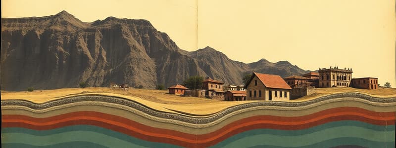
Physical Features of India
- India has diverse landforms, including plains, mountains, plateaus, deserts, and islands
- These features result from processes like plate tectonics, weathering, erosion, and deposition.
- Rocks vary in hardness and type (marble, soapstone) reflecting different geological compositions
- Plate movement (convergent, divergent, transform) leads to folding, faulting, and volcanic activity.
- The Himalayas formed from the collision between the Indian and Eurasian plates.
- The Himalayas are structurally young, highly elevated mountains, and varied in altitude.
- The northern plains formed from the alluvial deposits of rivers (Indus, Ganga, Brahmaputra).
Major Physiographic Divisions
- Himalayan Mountains: A young mountain system stretching from Indus to Brahmaputra
- Northern Plains: Formed by the sediment deposition of rivers, flat land, fertile soil and thickly populated.
- Peninsular Plateau: Anciet rock formations, high plateaus and gently sloping hills
- Indian Desert: Undulating sandy plains, low rainfall, arid climate due to dryness
- Coastal Plains: Narrow strips, western (Konkan, Kannad, Malabar) and eastern (Coromandel, Northern Circars) coast
- Islands: Andaman & Nicobar, and Lakshadweep, composed of coral islands and volcanic rocks
Studying That Suits You
Use AI to generate personalized quizzes and flashcards to suit your learning preferences.


