Podcast
Questions and Answers
The Tropic of Cancer does not pass through which of the following states?
The Tropic of Cancer does not pass through which of the following states?
- Odisha (correct)
- Chhattisgarh
- Tripura
- Rajasthan
The easternmost longitude of India is:
The easternmost longitude of India is:
- 68° 7' E
- 82° 32' E
- 97° 25' E (correct)
- 77° 6' E
Uttarakhand, Uttar Pradesh, Bihar, West Bengal and Sikkim have common frontiers with which country?
Uttarakhand, Uttar Pradesh, Bihar, West Bengal and Sikkim have common frontiers with which country?
- Nepal (correct)
- China
- Bhutan
- Myanmar
If you intend to visit Kavarati during your summer vacations, which one of the following Union Territories of India you will be going to?
If you intend to visit Kavarati during your summer vacations, which one of the following Union Territories of India you will be going to?
My friend hails from a country which does not share land boundary with India. Identify the country.
My friend hails from a country which does not share land boundary with India. Identify the country.
Name the group of islands lying in the Arabian Sea.
Name the group of islands lying in the Arabian Sea.
Name the countries which are larger than India.
Name the countries which are larger than India.
Which island group of India lies to its south-east?
Which island group of India lies to its south-east?
Which island countries are our southern neighbours?
Which island countries are our southern neighbours?
The sun rises two hours earlier in Arunachal Pradesh as compared to Gujarat in the west but the watches show the same time. How does this happen?
The sun rises two hours earlier in Arunachal Pradesh as compared to Gujarat in the west but the watches show the same time. How does this happen?
The central location of India at the head of the Indian Ocean is considered of great significance. Why?
The central location of India at the head of the Indian Ocean is considered of great significance. Why?
Which of the following Union Territories lies along the western coast of India?
Which of the following Union Territories lies along the western coast of India?
Find the area-wise smallest and largest state in India.
Find the area-wise smallest and largest state in India.
Find the states that do not have an international boundary or lie on the coast by land.
Find the states that do not have an international boundary or lie on the coast by land.
Classify the states into four groups, each having common frontiers with:
Classify the states into four groups, each having common frontiers with:
Flashcards
Tropic of Cancer
Tropic of Cancer
A line of latitude that passes through parts of India, dividing it into almost equal halves.
Indira Point
Indira Point
The southernmost point of India, which was submerged during the 2004 tsunami.
Landmass of India
Landmass of India
The total land area of India, covering 2.4% of the world's landmass.
Standard Meridian of India
Standard Meridian of India
Signup and view all the flashcards
Time Lag
Time Lag
Signup and view all the flashcards
Duration of Day
Duration of Day
Signup and view all the flashcards
Duration of Night
Duration of Night
Signup and view all the flashcards
Coastline of India
Coastline of India
Signup and view all the flashcards
Young Fold Mountains
Young Fold Mountains
Signup and view all the flashcards
Deccan Peninsula
Deccan Peninsula
Signup and view all the flashcards
Trans Indian Ocean Route
Trans Indian Ocean Route
Signup and view all the flashcards
Arabian Sea
Arabian Sea
Signup and view all the flashcards
Bay of Bengal
Bay of Bengal
Signup and view all the flashcards
Suez Canal
Suez Canal
Signup and view all the flashcards
International Highway of Trade and Commerce
International Highway of Trade and Commerce
Signup and view all the flashcards
Upanishads
Upanishads
Signup and view all the flashcards
Ramayana
Ramayana
Signup and view all the flashcards
Panchtantra
Panchtantra
Signup and view all the flashcards
Decimal System
Decimal System
Signup and view all the flashcards
Muslin and Spices
Muslin and Spices
Signup and view all the flashcards
Influence of Greek Sculpture and Architecture
Influence of Greek Sculpture and Architecture
Signup and view all the flashcards
Architectural Styles of Dome and Minarets
Architectural Styles of Dome and Minarets
Signup and view all the flashcards
States of India
States of India
Signup and view all the flashcards
Union Territories of India
Union Territories of India
Signup and view all the flashcards
Neighbours of India
Neighbours of India
Signup and view all the flashcards
Indian Subcontinent
Indian Subcontinent
Signup and view all the flashcards
Continents
Continents
Signup and view all the flashcards
India
India
Signup and view all the flashcards
Land Boundary
Land Boundary
Signup and view all the flashcards
Deccan Peninsula
Deccan Peninsula
Signup and view all the flashcards
Direct Rule
Direct Rule
Signup and view all the flashcards
Local Autonomy
Local Autonomy
Signup and view all the flashcards
Suez Canal
Suez Canal
Signup and view all the flashcards
Exchange of Ideas
Exchange of Ideas
Signup and view all the flashcards
Study Notes
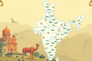
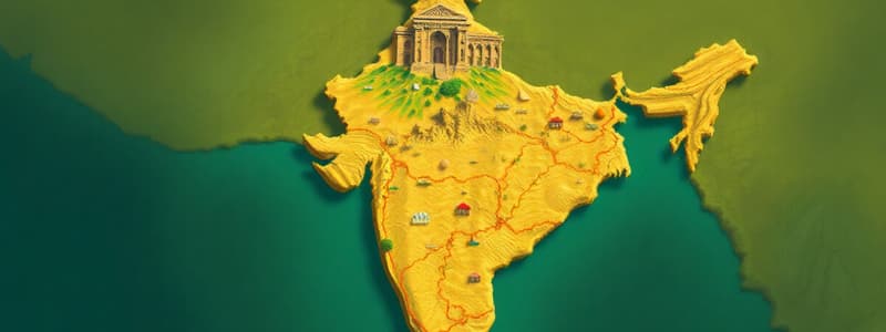
India - Size and Location
- India is one of the oldest civilizations, experiencing significant socioeconomic progress in recent decades.
- It's situated entirely in the Northern Hemisphere.
- India spans latitudes 8°4'N to 37°6'N and longitudes 68°7'E to 97°25'E.
- The Tropic of Cancer (23° 30'N) roughly divides the country into two parts.
- The Andaman and Nicobar Islands and the Lakshadweep Islands are located to the southeast and southwest of the mainland, respectively.
- India's land area is approximately 3.28 million square kilometers, representing about 2.4% of the world's total geographical area.
- Indira Point, India's southernmost point, was submerged in the 2004 tsunami.
India and the World
- India's central location between East and West Asia and its extension into the Indian Ocean provide significant strategic advantages.
- It's a crossroads for trade routes between East and West Asia, Africa, and Europe.
- The Suez Canal's opening significantly reduced India's travel time to Europe by about 7,000 km.
India's Size and Shape
- India has an estimated land boundary of 15,200 km.
- The total coastline (including islands) extends approximately 7,516.6 km.
- The country's shape narrows near the 22° N latitude, with its western and eastern coasts facing the Arabian Sea and the Bay of Bengal respectively.
- India stretches from the west-to-east is greatly variable compared with the north-to-south extent.
- The time difference across India (from Gujarat to Arunachal Pradesh) is two hours, owing to its East-West length.
India's Neighbors and Relations
- India shares land borders with Pakistan and Afghanistan (NW), China, Nepal, and Bhutan (N), and Myanmar and Bangladesh (E).
- India has important relationships with neighboring countries, often due to trade, cultural exchange, and shared history.
India's Geographical Features
- The country has a varied landscape determined by proximity to land and water features.
- India's mountains and passes have been important for human migration.
Studying That Suits You
Use AI to generate personalized quizzes and flashcards to suit your learning preferences.