Podcast
Questions and Answers
What is the southernmost point of India that got submerged during the tsunami in 2004?
What is the southernmost point of India that got submerged during the tsunami in 2004?
- Nikobar Islands
- Indira Point (correct)
- Andaman Islands
- Lakshadweep Islands
India lies entirely in the Southern Hemisphere.
India lies entirely in the Southern Hemisphere.
False (B)
What is the area of India in square kilometers?
What is the area of India in square kilometers?
3.28 million
The Tropic of Cancer is located at _____ degrees north.
The Tropic of Cancer is located at _____ degrees north.
Match the following locations with their respective bodies of water:
Match the following locations with their respective bodies of water:
What is the primary theme of the map represented in Figure 1.1?
What is the primary theme of the map represented in Figure 1.1?
The Atlantic Ocean is located between North America and Europe.
The Atlantic Ocean is located between North America and Europe.
Name one ocean that borders South America.
Name one ocean that borders South America.
The geographical area represented in the map accounts for about ____ percent of the total geographical area of the world.
The geographical area represented in the map accounts for about ____ percent of the total geographical area of the world.
Match the following continents with their associated oceans:
Match the following continents with their associated oceans:
Which of the following oceans is present in the southern hemisphere?
Which of the following oceans is present in the southern hemisphere?
75°S latitude extends into the tropics.
75°S latitude extends into the tropics.
What is the significance of 0° longitude on the map?
What is the significance of 0° longitude on the map?
What is the total length of India's coastline, including all territories?
What is the total length of India's coastline, including all territories?
India is located entirely north of the equator.
India is located entirely north of the equator.
What latitude is the Standard Meridian of India located at?
What latitude is the Standard Meridian of India located at?
The Deccan Peninsula helps India to maintain close contact with __________.
The Deccan Peninsula helps India to maintain close contact with __________.
Why is the coastline of India significant?
Why is the coastline of India significant?
The Indian landmass serves as a __________ location between East and West Asia.
The Indian landmass serves as a __________ location between East and West Asia.
Match the regions of India with their respective descriptions:
Match the regions of India with their respective descriptions:
India's distance from Europe increased after the opening of the Suez Canal.
India's distance from Europe increased after the opening of the Suez Canal.
Which continents have been major trade routes for India throughout history?
Which continents have been major trade routes for India throughout history?
India has maritime contacts that are older than its land routes with the world.
India has maritime contacts that are older than its land routes with the world.
Name one significant cultural contribution from India that influenced other countries.
Name one significant cultural contribution from India that influenced other countries.
India shares its land boundaries with __________ and __________ in the northwest.
India shares its land boundaries with __________ and __________ in the northwest.
Match the following countries with their respective locations in relation to India:
Match the following countries with their respective locations in relation to India:
Which of the following items was an important trade commodity taken from India to other countries?
Which of the following items was an important trade commodity taken from India to other countries?
The exchange of goods from India contributed to the spread of __________ and the decimal system.
The exchange of goods from India contributed to the spread of __________ and the decimal system.
Oceans have facilitated interaction for India with other countries over time.
Oceans have facilitated interaction for India with other countries over time.
Which two types of states existed in India before 1947?
Which two types of states existed in India before 1947?
Sri Lanka is separated from India by a wide expanse of ocean.
Sri Lanka is separated from India by a wide expanse of ocean.
Name the two island countries that are India's southern neighbors.
Name the two island countries that are India's southern neighbors.
India has _____ states and Eight Union Territories.
India has _____ states and Eight Union Territories.
Match the following geographical features with their characteristics:
Match the following geographical features with their characteristics:
What is the purpose of School Bhuvan?
What is the purpose of School Bhuvan?
The architectural styles of dome and minarets in India originate from Chinese influence.
The architectural styles of dome and minarets in India originate from Chinese influence.
Where can students explore various maps of India related to the secondary stage?
Where can students explore various maps of India related to the secondary stage?
Which of the following states does NOT lie on the Tropic of Cancer?
Which of the following states does NOT lie on the Tropic of Cancer?
The easternmost longitude of India is 82° 32' E.
The easternmost longitude of India is 82° 32' E.
Name the group of islands lying in the Arabian Sea.
Name the group of islands lying in the Arabian Sea.
Kavarati is situated in the Union Territory of _____
Kavarati is situated in the Union Territory of _____
Which country does NOT share a land boundary with India?
Which country does NOT share a land boundary with India?
Match the following Indian states with the countries they share a border with:
Match the following Indian states with the countries they share a border with:
What is the significance of India's central location at the head of the Indian Ocean?
What is the significance of India's central location at the head of the Indian Ocean?
The sun rises four hours earlier in Arunachal Pradesh than in Gujarat.
The sun rises four hours earlier in Arunachal Pradesh than in Gujarat.
Flashcards
Tropic of Cancer in India
Tropic of Cancer in India
The Tropic of Cancer, at 23.5 degrees North latitude, divides India into almost equal halves.
India's Latitudinal and Longitudinal Extent
India's Latitudinal and Longitudinal Extent
India's mainland extends from 8°4'N to 37°6'N latitude and 68°7'E to 97°25'E longitude.
Island Groups in India
Island Groups in India
The Andaman and Nicobar Islands are in the Bay of Bengal, and the Lakshadweep Islands are in the Arabian Sea.
Area of India
Area of India
Signup and view all the flashcards
Indira Point
Indira Point
Signup and view all the flashcards
Geographical Area
Geographical Area
Signup and view all the flashcards
Geographical Area of a Country
Geographical Area of a Country
Signup and view all the flashcards
Percentage of Geographical Area
Percentage of Geographical Area
Signup and view all the flashcards
180° Meridian
180° Meridian
Signup and view all the flashcards
Geographical Location
Geographical Location
Signup and view all the flashcards
Latitude Lines
Latitude Lines
Signup and view all the flashcards
Longitude Lines
Longitude Lines
Signup and view all the flashcards
Continent
Continent
Signup and view all the flashcards
India's Trade and Commerce
India's Trade and Commerce
Signup and view all the flashcards
Upanishads, Ramayana, Panchtantra
Upanishads, Ramayana, Panchtantra
Signup and view all the flashcards
Land Routes of India
Land Routes of India
Signup and view all the flashcards
Mountain Passes in India
Mountain Passes in India
Signup and view all the flashcards
Maritime Contacts of India
Maritime Contacts of India
Signup and view all the flashcards
Constraints of Maritime Interaction
Constraints of Maritime Interaction
Signup and view all the flashcards
India's International Boundaries
India's International Boundaries
Signup and view all the flashcards
States by International Boundaries
States by International Boundaries
Signup and view all the flashcards
India's Size and Boundaries
India's Size and Boundaries
Signup and view all the flashcards
India's Geographical Location
India's Geographical Location
Signup and view all the flashcards
The Deccan Peninsula's Significance
The Deccan Peninsula's Significance
Signup and view all the flashcards
India's Coastal Importance
India's Coastal Importance
Signup and view all the flashcards
India's East-West Extent
India's East-West Extent
Signup and view all the flashcards
The Suez Canal's Impact on India
The Suez Canal's Impact on India
Signup and view all the flashcards
Latitude and Day/Night Duration
Latitude and Day/Night Duration
Signup and view all the flashcards
Standard Meridian of India
Standard Meridian of India
Signup and view all the flashcards
What separates India and Sri Lanka?
What separates India and Sri Lanka?
Signup and view all the flashcards
Name two island countries near India.
Name two island countries near India.
Signup and view all the flashcards
What are the building blocks of India?
What are the building blocks of India?
Signup and view all the flashcards
What were the provinces in British India?
What were the provinces in British India?
Signup and view all the flashcards
What were the Princely States in British India?
What were the Princely States in British India?
Signup and view all the flashcards
What are the Union Territories of India?
What are the Union Territories of India?
Signup and view all the flashcards
Where is India located on the globe?
Where is India located on the globe?
Signup and view all the flashcards
Why is India's geographical location important?
Why is India's geographical location important?
Signup and view all the flashcards
Which states does the Tropic of Cancer pass through in India?
Which states does the Tropic of Cancer pass through in India?
Signup and view all the flashcards
What is the easternmost longitude of India?
What is the easternmost longitude of India?
Signup and view all the flashcards
Which countries share borders with the states of Uttarakhand, Uttar Pradesh, Bihar, West Bengal, and Sikkim?
Which countries share borders with the states of Uttarakhand, Uttar Pradesh, Bihar, West Bengal, and Sikkim?
Signup and view all the flashcards
Which Union Territory of India contains the island Kavarati?
Which Union Territory of India contains the island Kavarati?
Signup and view all the flashcards
Which country does not share a land boundary with India?
Which country does not share a land boundary with India?
Signup and view all the flashcards
What group of islands lies in the Arabian Sea?
What group of islands lies in the Arabian Sea?
Signup and view all the flashcards
Which island group lies to the south-east of India?
Which island group lies to the south-east of India?
Signup and view all the flashcards
Which island countries are India's southern neighbours?
Which island countries are India's southern neighbours?
Signup and view all the flashcards
Study Notes
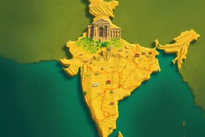
India - Size and Location
- India is a ancient civilization with significant socio-economic progress
- Located entirely in the Northern Hemisphere
- Extends from 8°4'N to 37°6'N latitude and 68°7'E to 97°25'E longitude
- The Tropic of Cancer (23°30'N) divides the country roughly in half
- Has Andaman and Nicobar Islands and Lakshadweep Islands
- The southernmost point (Indira Point) was submerged by a tsunami
- Total land area is approximately 3.28 million square kilometers (2.4% of the world's geographical area)
- The country has a coastline of about 7,516.6km
India's Position in the World
- India is the seventh largest country globally, with a land boundary of roughly 15,200km.
- The country is bordered by young fold mountains in the northwest, north and northeast.
- The south stretches towards the Indian Ocean, creating the Arabian Sea on the west and the Bay of Bengal on the east
- The distance between Gujarat and Arunachal Pradesh has a time difference of two hours due to the different longitudes.
- Standard Meridian of India (82°30'E) is used as the standard time for the entire country.
- Latitudinal extent affects the length of days and nights differently across the country (more pronounced in the north)
- India occupies a key position in international trade routes, linking East and West Asia.
India's Neighbours and Geographic Significance
- India shares land boundaries with Pakistan, Afghanistan, China, Nepal, Bhutan, Myanmar, and Bangladesh
- India has a prominent coastline on the Indian Ocean, a strategic location for trade routes
- The opening of the Suez Canal in 1869 significantly reduced India's distance to Europe.
- India's central location and large coastline contribute to its significance in Indian Ocean trade.
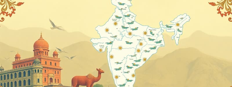
India's Internal Divisions and Features
- There are 28 states and 8 union territories in India
- India's relationship with the surrounding countries have existed for a long time, through both land and sea routes.
- Ancient trade routes have existed through passes, and later across oceans, facilitating exchange of ideas and goods
- India has a significant influence on other cultures through its ideas (e.g., Upanishads) and products (e.g, spices)
Studying That Suits You
Use AI to generate personalized quizzes and flashcards to suit your learning preferences.