Podcast
Questions and Answers
What is the latitude range that India extends between?
What is the latitude range that India extends between?
8°4'N to 37°6'N
What is the total area of India in million square kilometers?
What is the total area of India in million square kilometers?
3.28 million square km
Which major line of latitude divides India into two almost equal parts?
Which major line of latitude divides India into two almost equal parts?
The Tropic of Cancer (23° 30'N)
What happened to 'Indira Point' in 2004?
What happened to 'Indira Point' in 2004?
Name the two groups of islands located to the southeast and southwest of mainland India.
Name the two groups of islands located to the southeast and southwest of mainland India.
In which hemisphere is India located?
In which hemisphere is India located?
What percentage of the total geographical area does the content state?
What percentage of the total geographical area does the content state?
Which oceans are represented in the geographical context provided?
Which oceans are represented in the geographical context provided?
Name the continents mentioned in the content.
Name the continents mentioned in the content.
What is the significance of the 0° line in geographical terms?
What is the significance of the 0° line in geographical terms?
At what latitude does the equator lie?
At what latitude does the equator lie?
What direction does the line at 75°N represent?
What direction does the line at 75°N represent?
Which continent is located directly south of the equator and north of Antarctica?
Which continent is located directly south of the equator and north of Antarctica?
Which side of the Prime Meridian contains the majority of the continents listed?
Which side of the Prime Meridian contains the majority of the continents listed?
What geographical feature is represented by the term 'Antarctica'?
What geographical feature is represented by the term 'Antarctica'?
What are the two types of states in India before 1947?
What are the two types of states in India before 1947?
Which two countries are considered India's southern neighbors?
Which two countries are considered India's southern neighbors?
How many states and Union Territories does India have?
How many states and Union Territories does India have?
What influence can be seen in Indian architecture from West Asia?
What influence can be seen in Indian architecture from West Asia?
What is the purpose of the School Bhuvan initiative?
What is the purpose of the School Bhuvan initiative?
Which country is identified as having the smallest area among the Union Territories of India?
Which country is identified as having the smallest area among the Union Territories of India?
What is India's position in terms of its maritime contacts compared to its land routes?
What is India's position in terms of its maritime contacts compared to its land routes?
Which state in India has the largest area?
Which state in India has the largest area?
List the countries with which India shares its land boundaries.
List the countries with which India shares its land boundaries.
What significant ancient texts were exchanged with the world through India's routes?
What significant ancient texts were exchanged with the world through India's routes?
What commodities were historically exported from India to other countries?
What commodities were historically exported from India to other countries?
How did ancient travelers access India geographically?
How did ancient travelers access India geographically?
Which regions of India have states that share frontiers with Pakistan?
Which regions of India have states that share frontiers with Pakistan?
How did the Indian numeral system spread to other parts of the world?
How did the Indian numeral system spread to other parts of the world?
What role did the oceans play in India's historical trade relationships?
What role did the oceans play in India's historical trade relationships?
What is the significance of 82°30'E in India?
What is the significance of 82°30'E in India?
Why is the difference between day and night durations hardly felt at Kanniyakumari compared to Kashmir?
Why is the difference between day and night durations hardly felt at Kanniyakumari compared to Kashmir?
How does India’s geographical location enhance its strategic importance?
How does India’s geographical location enhance its strategic importance?
What key feature describes India’s coastline?
What key feature describes India’s coastline?
What influences the duration of day and night in India?
What influences the duration of day and night in India?
Why has India been referred to as having an eminent position in the Indian Ocean?
Why has India been referred to as having an eminent position in the Indian Ocean?
What is the approximate north-south extent of India?
What is the approximate north-south extent of India?
What impact did the opening of the Suez Canal have on India's distance from Europe?
What impact did the opening of the Suez Canal have on India's distance from Europe?
What geographical feature influences India's east-west extent?
What geographical feature influences India's east-west extent?
What is the total land boundary length of India?
What is the total land boundary length of India?
Flashcards
India's Location
India's Location
India's geographical location; it is entirely situated in the Northern Hemisphere.
Tropic of Cancer in India
Tropic of Cancer in India
The Tropic of Cancer divides India into almost equal halves. This imaginary line runs through the center of the country.
India's Island Territories
India's Island Territories
The Andaman and Nicobar Islands, located in the Bay of Bengal, and the Lakshadweep Islands, situated in the Arabian Sea, are part of India's territory.
India's Land Area
India's Land Area
Signup and view all the flashcards
India's Diversity
India's Diversity
Signup and view all the flashcards
India's Economic Progress
India's Economic Progress
Signup and view all the flashcards
India's Coordinates
India's Coordinates
Signup and view all the flashcards
Geographical Area
Geographical Area
Signup and view all the flashcards
North America
North America
Signup and view all the flashcards
Europe
Europe
Signup and view all the flashcards
Asia
Asia
Signup and view all the flashcards
Africa
Africa
Signup and view all the flashcards
Atlantic Ocean
Atlantic Ocean
Signup and view all the flashcards
Pacific Ocean
Pacific Ocean
Signup and view all the flashcards
Indian Ocean
Indian Ocean
Signup and view all the flashcards
Antarctica
Antarctica
Signup and view all the flashcards
Types of States in Pre-Independent India
Types of States in Pre-Independent India
Signup and view all the flashcards
India's Position in South Asia
India's Position in South Asia
Signup and view all the flashcards
India's Island Neighbors
India's Island Neighbors
Signup and view all the flashcards
India's Links to Neighbors
India's Links to Neighbors
Signup and view all the flashcards
What is School Bhuvan?
What is School Bhuvan?
Signup and view all the flashcards
India's strategic location
India's strategic location
Signup and view all the flashcards
India's latitudinal and longitudinal extent
India's latitudinal and longitudinal extent
Signup and view all the flashcards
Time difference across India
Time difference across India
Signup and view all the flashcards
Standard Meridian of India
Standard Meridian of India
Signup and view all the flashcards
Day and night duration variation in India
Day and night duration variation in India
Signup and view all the flashcards
Deccan Peninsula's strategic role
Deccan Peninsula's strategic role
Signup and view all the flashcards
India's coastline on the Indian Ocean
India's coastline on the Indian Ocean
Signup and view all the flashcards
Impact of Suez Canal on India
Impact of Suez Canal on India
Signup and view all the flashcards
India's land boundary and coastline
India's land boundary and coastline
Signup and view all the flashcards
Himalayan mountain range's significance for India
Himalayan mountain range's significance for India
Signup and view all the flashcards
India's Ancient Trade Routes
India's Ancient Trade Routes
Signup and view all the flashcards
Indian Contributions to World Knowledge
Indian Contributions to World Knowledge
Signup and view all the flashcards
Indian Goods Traded Internationally
Indian Goods Traded Internationally
Signup and view all the flashcards
India's Later Maritime Contacts
India's Later Maritime Contacts
Signup and view all the flashcards
India's Land Boundaries
India's Land Boundaries
Signup and view all the flashcards
India's Role in Regional Geopolitics
India's Role in Regional Geopolitics
Signup and view all the flashcards
Classification of Indian States
Classification of Indian States
Signup and view all the flashcards
States with International Frontiers
States with International Frontiers
Signup and view all the flashcards
Influence of Geography on India
Influence of Geography on India
Signup and view all the flashcards
Study Notes
India - Size and Location
- India is one of the world's oldest civilizations, experiencing significant socio-economic progress in recent decades.
- It's located entirely in the Northern Hemisphere.
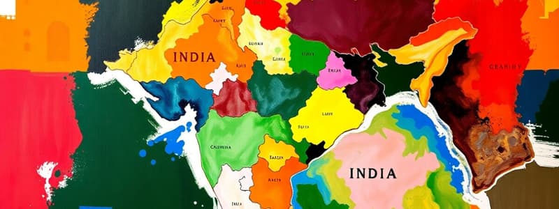
- India spans latitudes 8°4'N to 37°6'N and longitudes 68°7'E to 97°25'E.
- The Tropic of Cancer (23°30'N) divides India almost equally.
- Important island groups include Andaman and Nicobar, and Lakshadweep Islands, located southeast and southwest of the mainland, respectively.
- The southernmost point, Indira Point, was submerged in the 2004 tsunami.
- India covers an area of 3.28 million square kilometers, representing 2.4% of the world's geographical area.
- The coastline, including Andaman and Nicobar, and Lakshadweep, totals 7,516.6 km.
- India's boundary includes young fold mountains in the northwest, north, and northeast.
- It extends towards the Indian Ocean, forming the Arabian Sea on the west and the Bay of Bengal on the east.
- The latitudinal extent impacts the length of day and night, varying from south to north.
- Time is standardized across the country, using the Standard Meridian of India (82°30'E).
- India's landmass centrally located between East and West Asia.
- It's strategically positioned for trade routes across the Indian Ocean.
- India shares land boundaries with neighbours like Pakistan, Afghanistan, China, Nepal, Bhutan, Myanmar, and Bangladesh.
- India has maritime connections with countries in Southeast Asia, the East, and the West.
India's Neighbours
- India interacts with other countries across land and sea routes.
- Ancient routes across mountain passes played a role in trade and exchange of ideas.
- Ancient texts and ideas spread through these routes.
- Indian spices, textiles, and other products were traded, along with influences of different artistic styles.
- India has 28 states and 8 Union Territories.
- India occupies a strategic position in South Asia.
India's Geographical Position
- India's relationship with its neighboring countries is historically and geographically significant.
- India's position on the Indian Ocean makes it important for trade.
Studying That Suits You
Use AI to generate personalized quizzes and flashcards to suit your learning preferences.


