Podcast
Questions and Answers
Which of these are provinces in Canada: (Select all that apply)
Which of these are provinces in Canada: (Select all that apply)
- Saskatchewan (correct)
- Ontario (correct)
- Manitoba (correct)
- Alberta (correct)
- New Brunswick (correct)
- British Columbia (correct)
- Prince Edward Island (correct)
- Newfoundland and Labrador (correct)
- Nova Scotia (correct)
- Quebec (correct)
Which of the following are territories in Canada: (Select all that apply)
Which of the following are territories in Canada: (Select all that apply)
- Northwest Territories (correct)
- Nunavut (correct)
- New Brunswick
- Yukon (correct)
- Alberta
Which of the following are bodies of water in Canada: (Select all that apply)
Which of the following are bodies of water in Canada: (Select all that apply)
- St. Lawrence River (correct)
- Pacific Ocean (correct)
- Hudson Bay (correct)
- Arctic Ocean (correct)
- Atlantic Ocean (correct)
- Great Lakes (correct)
- Mississippi River
Which of the following are major cities in Canada: (Select all that apply)
Which of the following are major cities in Canada: (Select all that apply)
What are the five elements of a map?
What are the five elements of a map?
What does a legend on a map do?
What does a legend on a map do?
What is topography?
What is topography?
What is latitude referred to as?
What is latitude referred to as?
When finding latitude and longitude on a map, which is listed first?
When finding latitude and longitude on a map, which is listed first?
How many time zones are there in the world?
How many time zones are there in the world?
What is the compass degree for North?
What is the compass degree for North?
What is Pangea?
What is Pangea?
What is the difference between weather, climate, and temperature?
What is the difference between weather, climate, and temperature?
What are the two main types of climate regions?
What are the two main types of climate regions?
What are the characteristics of a continental climate?
What are the characteristics of a continental climate?
What are the characteristics of a maritime climate?
What are the characteristics of a maritime climate?
What does the acronym LOWERN stand for?
What does the acronym LOWERN stand for?
How do you calculate temperature range?
How do you calculate temperature range?
How do you calculate average temperature?
How do you calculate average temperature?
What are renewable resources?
What are renewable resources?
What are some examples of oil-rich provinces?
What are some examples of oil-rich provinces?
What are some examples of raw materials?
What are some examples of raw materials?
What two major impacts can be associated with the natural resource industry?
What two major impacts can be associated with the natural resource industry?
What are some factors that make a place a good place to live?
What are some factors that make a place a good place to live?
What does the acronym "3R's" stand for?
What does the acronym "3R's" stand for?
What are the three main logging techniques discussed in the text?
What are the three main logging techniques discussed in the text?
What is population distribution?
What is population distribution?
What is population density?
What is population density?
What is a refugee?
What is a refugee?
What is an immigrant?
What is an immigrant?
What is a citizen?
What is a citizen?
What are reserves?
What are reserves?
What is a developed country?
What is a developed country?
What is a newly industrialized country?
What is a newly industrialized country?
What is literacy rate?
What is literacy rate?
What is a tariff?
What is a tariff?
What is a baby boom?
What is a baby boom?
What do population pyramids show?
What do population pyramids show?
What is population dependency load?
What is population dependency load?
What is gender ratio?
What is gender ratio?
What are life expectancies?
What are life expectancies?
How do you calculate natural increase rate?
How do you calculate natural increase rate?
How do you calculate net migration rate?
How do you calculate net migration rate?
How do you calculate population growth rate?
How do you calculate population growth rate?
How do you calculate birth rate?
How do you calculate birth rate?
What are some location factors that can influence population distribution?
What are some location factors that can influence population distribution?
What are the three main types of economic activities?
What are the three main types of economic activities?
What does primary economic activity involve?
What does primary economic activity involve?
What does secondary economic activity involve?
What does secondary economic activity involve?
What are push factors?
What are push factors?
What are intervening obstacles?
What are intervening obstacles?
What is importing?
What is importing?
What is the HDI?
What is the HDI?
Flashcards
What is Pangea?
What is Pangea?
A supercontinent that existed around 300 million years ago before all the continents split apart.
What is latitude?
What is latitude?
The distance north or south of the equator.
What is longitude?
What is longitude?
The distance east or west of the prime meridian.
What is a diagram?
What is a diagram?
Signup and view all the flashcards
What is population distribution?
What is population distribution?
Signup and view all the flashcards
What is population density?
What is population density?
Signup and view all the flashcards
What is a refugee?
What is a refugee?
Signup and view all the flashcards
What is an immigrant?
What is an immigrant?
Signup and view all the flashcards
What is a citizen?
What is a citizen?
Signup and view all the flashcards
What are reserves?
What are reserves?
Signup and view all the flashcards
What is a developed country?
What is a developed country?
Signup and view all the flashcards
What is a developing country?
What is a developing country?
Signup and view all the flashcards
What is a newly industrialized country?
What is a newly industrialized country?
Signup and view all the flashcards
What is literacy rate?
What is literacy rate?
Signup and view all the flashcards
What is a tariff?
What is a tariff?
Signup and view all the flashcards
What is a baby boom?
What is a baby boom?
Signup and view all the flashcards
What are population pyramids?
What are population pyramids?
Signup and view all the flashcards
What is dependency load?
What is dependency load?
Signup and view all the flashcards
What is gender ratio?
What is gender ratio?
Signup and view all the flashcards
What is life expectancy?
What is life expectancy?
Signup and view all the flashcards
What is natural increase rate?
What is natural increase rate?
Signup and view all the flashcards
What is net migration rate?
What is net migration rate?
Signup and view all the flashcards
What is population growth rate?
What is population growth rate?
Signup and view all the flashcards
What is birth rate?
What is birth rate?
Signup and view all the flashcards
What is death rate?
What is death rate?
Signup and view all the flashcards
What is immigration rate?
What is immigration rate?
Signup and view all the flashcards
What is emigration rate?
What is emigration rate?
Signup and view all the flashcards
What is the primary sector?
What is the primary sector?
Signup and view all the flashcards
What is the secondary sector?
What is the secondary sector?
Signup and view all the flashcards
What is the tertiary sector?
What is the tertiary sector?
Signup and view all the flashcards
What are push factors?
What are push factors?
Signup and view all the flashcards
What are pull factors?
What are pull factors?
Signup and view all the flashcards
What are intervening obstacles?
What are intervening obstacles?
Signup and view all the flashcards
What is importing?
What is importing?
Signup and view all the flashcards
What is exporting?
What is exporting?
Signup and view all the flashcards
What is HDI?
What is HDI?
Signup and view all the flashcards
Study Notes
Grade 9 Geography Final Exam Review
- Exam format: Parts A-H, various question types (e.g., 20/U, 10/K/U, 10/App), weighted categories.
- Suggested time: 90 minutes, with review time built in.
- Exam weights: Knowledge/Understanding (25%), Thinking (25%), Application (25%), Communication (25%).
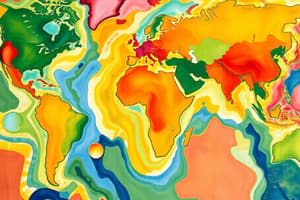
Unit 1: Mapping Skills
- Provinces/Territories: Alberta, British Columbia, Manitoba, New Brunswick, Newfoundland and Labrador, Nova Scotia, Ontario, Prince Edward Island, Quebec, Saskatchewan, Northwest Territories, Nunavut, Yukon.
- Bodies of Water: Great Lakes, St. Lawrence River, Hudson Bay, Arctic Ocean, Pacific Ocean, Atlantic Ocean.
- Major Canadian Cities: Vancouver, Toronto, Montreal, Calgary, Ottawa, Edmonton, Quebec City, Winnipeg, Halifax, Victoria, Regina, Whitehorse, Iqaluit, Yellowknife.
Unit 2 Part 1: Physical Geography
- Elements of a Map: Title, legend, scale, color, elevation.
- Maps: Tools for geographic understanding (where things are).
- Legends: Guides for map symbols and colors.
- Diagrams: Simplified representations of information.
- Topography: Description of land surfaces and layouts.
- Latitude: Distance north or south of the equator.
- Longitude: Distance east or west of the prime meridian.
- Calculating time zones: Earth divided into 24 zones, each 15 degrees of longitude apart.
- Compass directions: North, East, South, West (with corresponding degrees).
- Landform regions: Caledon, Halifax, Victoria, Winnipeg (locations).
- Pangea: Ancient supercontinent that existed millions of years ago.
Unit 2 Part 2: Climate
- Weather vs. Climate: Weather=current/short term conditions; Climate = patterns over time.
- Temperature: Measured on a scale, determines whether weather is hot or cold.
- Climate characteristics: Continental (extreme temperature changes) and Maritime (moderate temperature changes).
Unit 3: Natural Resources
- Renewable resources: resources replenished naturally, relatively quickly.
- Non-renewable resources: take millions of years to form, not replenished quickly
- Oil provinces: regions with significant oil resources (e.g. Alberta Canada, Texas USA)
- Raw materials: Basic materials (timber, iron ore) for goods production.
- Impacts of the natural resource industry (positive and negative aspects of non-renewable energy sources)
Unit 4: Human Geography
- Population Distribution/Density: Where people live and the number of people per area.
- Refugees/Immigrants/Citizens: People forced to move, those moving to a new place, and people born in a specific place respectively.
- Reserves: Land set aside for indigenous communities.
- Developed/Developing/Newly industrialized countries: different levels of economic advancement.
- Literacy rate: percentage of people who can read and write
- Tariffs: taxes on imported/exported goods, imposed for protectionist or economic policies
- Baby Boom: increase in birth rate following a significant event (WWII).
- Population pyramids: Graphical representation of age and gender structure, to study population patterns.
- Dependency load: part of the population too old/young to work.
- Gender: ratio of males to females in a population.
- Life expectancies: average estimated lifespan for a population member.
Unit 5: Migration and Globalization
- Calculating natural increase rate: birth rate minus death rate.
- Net migration rate: immigration rate minus emigration rate.
- Population Growth Rate: Natural and Net migration rates combined.
- Location factors: access to resources, climate, environment, job opportunities.
- Primary activities: Extracting raw materials (farming, fishing, mining).
- Secondary activities: Manufacturing and processing materials.
- Tertiary activities: Services (healthcare, education, retail).
- Migration push/pull factors, migration intervening obstacles
- Importing/Exporting: Buying and selling goods/services across countries.
- Human Development Index (HDI): index that measures levels of development around the world.
Studying That Suits You
Use AI to generate personalized quizzes and flashcards to suit your learning preferences.