Podcast
Questions and Answers
Which theme of geography focuses on how humans change and adapt to their surroundings?
Which theme of geography focuses on how humans change and adapt to their surroundings?
- Human-Environment Interaction (correct)
- Movement
- Region
- Location
What is the primary difference between absolute and relative location?
What is the primary difference between absolute and relative location?
- Absolute location refers to physical features, relative location to human features.
- Absolute location is dynamic and relative location is fixed.
- Absolute location is approximate, while relative location is exact.
- Absolute location uses coordinates, while relative location uses descriptive placement. (correct)
Which of the following is NOT considered a cardinal direction on a compass rose?
Which of the following is NOT considered a cardinal direction on a compass rose?
- Northwest (correct)
- South
- East
- North
If a map's title reads 'Population Density of Ontario', what component of a map does this represent?
If a map's title reads 'Population Density of Ontario', what component of a map does this represent?
Which of the following is an example of a human feature within human geography?
Which of the following is an example of a human feature within human geography?
Which Canadian province has Toronto as its capital city?
Which Canadian province has Toronto as its capital city?
What does the theme of 'region' primarily explore in geography?
What does the theme of 'region' primarily explore in geography?
If describing a city as 'south of the lake', what type of location is being used?
If describing a city as 'south of the lake', what type of location is being used?
If one is traveling in a direction that is between North and East, what direction are they heading?
If one is traveling in a direction that is between North and East, what direction are they heading?
Which of the following is an example of physical geography?
Which of the following is an example of physical geography?
What is the purpose of a legend on a map?
What is the purpose of a legend on a map?
Which type of map emphasizes specific themes such as population or climate?
Which type of map emphasizes specific themes such as population or climate?
In an alphanumeric grid system, which of the following is the correct way to write the grid reference?
In an alphanumeric grid system, which of the following is the correct way to write the grid reference?
Which of the following best describes lines of latitude?
Which of the following best describes lines of latitude?
How do you correctly combine latitude and longitude coordinates?
How do you correctly combine latitude and longitude coordinates?
If you travel east through Canada, how does the time change?
If you travel east through Canada, how does the time change?
Which of the following best describes the Earth's mantle?
Which of the following best describes the Earth's mantle?
Which layer of the earth has the highest temperature?
Which layer of the earth has the highest temperature?
Which of the following is NOT a tectonic plate?
Which of the following is NOT a tectonic plate?
Based on the information what is the purpose of the compass on a map?
Based on the information what is the purpose of the compass on a map?
Which of the following best describes the sequence of heat transfer and plate movement?
Which of the following best describes the sequence of heat transfer and plate movement?
Which type of plate boundary is primarily associated with the formation of mountain ranges and volcanic activity?
Which type of plate boundary is primarily associated with the formation of mountain ranges and volcanic activity?
What geological feature is most commonly associated with transform plate boundaries?
What geological feature is most commonly associated with transform plate boundaries?
According to Wegener's theory, what evidence is used to suggest that continents were once connected?
According to Wegener's theory, what evidence is used to suggest that continents were once connected?
What type of rock is formed when magma cools slowly beneath the Earth’s surface?
What type of rock is formed when magma cools slowly beneath the Earth’s surface?
Which of these is a characteristic of extrusive igneous rocks?
Which of these is a characteristic of extrusive igneous rocks?
What is a defining feature of sedimentary rocks?
What is a defining feature of sedimentary rocks?
What causes the formation of metamorphic rocks?
What causes the formation of metamorphic rocks?
What is the name given to layered appearance in metamorphic rocks?
What is the name given to layered appearance in metamorphic rocks?
Which process describes a heavy oceanic plate sliding beneath a continental plate?
Which process describes a heavy oceanic plate sliding beneath a continental plate?
Which of the following best describes a 'maritime climate'?
Which of the following best describes a 'maritime climate'?
What does the line graph on a climate graph represent?
What does the line graph on a climate graph represent?
Which of these is considered a non-renewable resource?
Which of these is considered a non-renewable resource?
Which economic sector is primarily involved in transforming raw materials into finished goods?
Which economic sector is primarily involved in transforming raw materials into finished goods?
If a city has a birth rate of 15 per 1000 and a death rate of 7 per 1000, what is the natural increase rate?
If a city has a birth rate of 15 per 1000 and a death rate of 7 per 1000, what is the natural increase rate?
What is a 'pull factor' in the context of immigration?
What is a 'pull factor' in the context of immigration?
In the context of the 3Rs, what does 'reuse' refer to?
In the context of the 3Rs, what does 'reuse' refer to?
Which of the following defines the term 'climate'?
Which of the following defines the term 'climate'?
What is the primary role of the tertiary sector in an economy?
What is the primary role of the tertiary sector in an economy?
Which of these is a key factor in calculating population growth rate?
Which of these is a key factor in calculating population growth rate?
Flashcards
Physical Geography
Physical Geography
The study of Earth's natural features like mountains, rivers, and forests.
Human Geography
Human Geography
The study of how humans interact with and shape the Earth, including cities, cultures, and economies.
Absolute Location
Absolute Location
The exact position of a place using coordinates, like latitude and longitude.
Relative Location
Relative Location
Signup and view all the flashcards
Movement (Geography Theme)
Movement (Geography Theme)
Signup and view all the flashcards
Human-Environment Interaction (Geography Theme)
Human-Environment Interaction (Geography Theme)
Signup and view all the flashcards
Region (Geography Theme)
Region (Geography Theme)
Signup and view all the flashcards
Place (Geography Theme)
Place (Geography Theme)
Signup and view all the flashcards
Location (Geography Theme)
Location (Geography Theme)
Signup and view all the flashcards
Map Title
Map Title
Signup and view all the flashcards
Convection Currents in the Mantle
Convection Currents in the Mantle
Signup and view all the flashcards
Continental Drift
Continental Drift
Signup and view all the flashcards
Subduction
Subduction
Signup and view all the flashcards
Divergent Plate Boundary
Divergent Plate Boundary
Signup and view all the flashcards
Transform Plate Boundary
Transform Plate Boundary
Signup and view all the flashcards
Convergent Plate Boundary
Convergent Plate Boundary
Signup and view all the flashcards
Igneous Rocks
Igneous Rocks
Signup and view all the flashcards
Sedimentary Rocks
Sedimentary Rocks
Signup and view all the flashcards
Metamorphic Rocks
Metamorphic Rocks
Signup and view all the flashcards
Rock Cycle
Rock Cycle
Signup and view all the flashcards
What is Scale (On a Map)?
What is Scale (On a Map)?
Signup and view all the flashcards
What is Thematic Map?
What is Thematic Map?
Signup and view all the flashcards
What are Lines of Latitude?
What are Lines of Latitude?
Signup and view all the flashcards
What are Lines of Longitude?
What are Lines of Longitude?
Signup and view all the flashcards
What is the Crust (Earth's Layer)?
What is the Crust (Earth's Layer)?
Signup and view all the flashcards
What is the Mantle (Earth's Layer)?
What is the Mantle (Earth's Layer)?
Signup and view all the flashcards
What is an Alphanumeric Grid System?
What is an Alphanumeric Grid System?
Signup and view all the flashcards
What are Tectonic Plates?
What are Tectonic Plates?
Signup and view all the flashcards
What are Contour Lines?
What are Contour Lines?
Signup and view all the flashcards
What is a Political Map?
What is a Political Map?
Signup and view all the flashcards
Weather
Weather
Signup and view all the flashcards
Climate
Climate
Signup and view all the flashcards
Latitude and Climate
Latitude and Climate
Signup and view all the flashcards
Ocean Currents and Climate
Ocean Currents and Climate
Signup and view all the flashcards
Winds and Air Masses and Climate
Winds and Air Masses and Climate
Signup and view all the flashcards
Elevation and Climate
Elevation and Climate
Signup and view all the flashcards
Relief and Climate
Relief and Climate
Signup and view all the flashcards
Nearness to Water and Climate
Nearness to Water and Climate
Signup and view all the flashcards
Climate Graph
Climate Graph
Signup and view all the flashcards
Renewable Resources
Renewable Resources
Signup and view all the flashcards
Study Notes
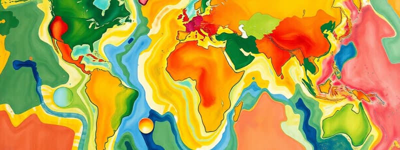
Unit 1: Intro to Geography, Mapping Skills
- Themes of Geography:
- Movement: How and why people move
- Region: A group of places with similar physical or human characteristics (e.g., climate, language)
- Human-Environment Interaction: How humans adapt to and change the environment (positive and negative impacts)
- Location: Absolute and relative location
- Place: Physical and human characteristics that make up an environment
- Physical vs. Human Geography:
- Physical Geography: Natural features of the Earth
- Human Geography: Man-made features of the Earth
- Absolute vs. Relative Location:
- Absolute Location: Exact location of something (e.g., room number 163)
- Relative Location: Location of something in comparison to another (e.g., next to Mrs. Thomas' class)
- Compass Rose:
- 4 Cardinal Points: North, East, South, West
- 4 Ordinal/Inter Cardinal Points: Northeast, Northwest, Southeast, Southwest
Canada's Provinces, Territories, and Capital Cities
- Provides a list of Canadian provinces/territories and their respective capital cities.
Components of a Map
- Title: Identifies the area and topic.
- Borders: Limits the scope of the information.
- Compass: Provides orientation and direction.
- Legend: Explains symbols and colors.
- Date of Publication: Indicates map's recency.
- Scale: Compares map distances to real-life distances.
- Types of Maps:
- Political Map: Shows political borders, important towns, and cities.
- Topographic Map: Shows physical features using contour lines to highlight elevation.
- Thematic Map: Emphasizes specific themes (e.g., population, climate).
- Historical Map: Shows how things were in the past.
- Grid Systems:
- Alphanumeric: Uses letters and numbers to identify locations.
- Military: Uses a combination of numbers.
- Latitude and Longitude: Measures distance using degrees.
- Latitude: Horizontal lines, measuring distance north and south of the equator.
- Longitude: Vertical lines, measuring distance east and west of the Prime Meridian.
Time Zones of Canada
- Canada has six time zones.
- Time increases one hour as you move east, with an exception for Newfoundland which increases by 30 minutes.
Unit 2: Landforms, Geology, Human Activities
- Layers of the Earth:
- Crust: Outer shell, thick, cold, and fragile
- Mantle: Thick zone of magma, hot and molten.
- Outer Core: 2000 km thick, 3000-4000 degrees Celsius.
- Inner Core: 1400 km thick, 5000-6000 degrees Celsius.
- Tectonic Plates:
- Massive rock slabs that make up Earth
- Seven (7) major plates
- Plate Movement: Driven by heat from Earth's core, heat and convection currents
- Divergent: Plates move apart.
- Convergent: Plates move together.
- Transform: Plates slide past each other.
Unit 3: Climate
- Weather: Short-term atmospheric conditions
- Climate: Long-term atmospheric conditions
- Factors Affecting Climate:
- Latitude: Distance from the equator affects temperatures.
- Ocean Currents: Transfer heat around the globe.
- Winds and Air Masses: Large bodies of air with specific characteristics.
- Elevation: Higher elevations have lower temperatures.
- Relief: Shape of the land influences precipitation.
- Nearness to Water: Maritime climates are influenced by large bodies of water.
Unit 4: Population, Resources, Industries
- Types of Resources:
- Renewable: Regenerate if used carefully (e.g., fish, forests)
- Non-renewable: Limited and cannot be replaced (e.g., gold, coal)
- Flow: Resources replaced by natural processes (e.g., sunlight, water)
- Other: Do not fit into the above categories (e.g., Niagara Falls)
- 3 Rs:
- Reduce: Minimize waste at the source
- Reuse: Repurpose items.
- Recycle: Turn waste into new materials
- Canada's Economy: Three sectors:
- Primary: Collects resources directly from nature (agriculture, fishing, mining).
- Secondary: Turns raw materials into finished products (manufacturing, construction).
- Tertiary: Provides services to people and businesses (education, healthcare, transportation).
Demography
- Demography: The study of human populations.
- Birth Rate: Number of births per 1000 people
- Death Rate: Number of deaths per 1,000 people
- Natural Increase Rate: Birth rate - Death rate
- Immigration Rate: Number of immigrants per 1,000 people
- Emigration Rate: Number of emigrants per 1,000 people
- Net Migration Rate: Immigration rate - Emigration rate
- Population Growth Rate: Natural increase rate + Net migration rate
- Migration: Movement into or out of an area
- Immigrants: Move into a country
- Internal Migration: Movement within a country
- External Migration: Movement out of one's country
- Pull Factors: Factors that draw people into an area (e.g., jobs, better opportunities).
- Push Factors: Factors that drive people away from an area (e.g., violence, poverty)
- Sponsorship: Canadian citizens supporting families to immigrate.
Studying That Suits You
Use AI to generate personalized quizzes and flashcards to suit your learning preferences.