Podcast
Questions and Answers
What is the primary goal of the GRACE mission's measurement principle?
What is the primary goal of the GRACE mission's measurement principle?
- To derive mass/gravity variations from changes in inter-satellite distance. (correct)
- To directly measure the Earth's gravity potential using GPS signals.
- To accurately calculate GPS satellite orbits for improved navigation.
- To monitor the Earth's magnetic field using inter-satellite ranging.
In the GRACE mission, what type of measurement configuration is utilized to achieve its objectives?
In the GRACE mission, what type of measurement configuration is utilized to achieve its objectives?
- Satellite laser ranging
- Satellite altimetry
- Satellite-to-satellite tracking (low-low) (correct)
- Satellite-to-satellite tracking (high-low)
Which of the following best describes the mathematical relationship between inter-satellite distance change and gravity in the GRACE mission?
Which of the following best describes the mathematical relationship between inter-satellite distance change and gravity in the GRACE mission?
- Directly proportional and linear, but difficult to measure.
- Directly proportional and linear.
- Not a direct functional relationship and highly non-linear. (correct)
- Inversely proportional and linear.
In the context of GRACE measurements, what do $Vi(2) - Vi(1)$ and $x(j2) - x(j1)$ represent, respectively?
In the context of GRACE measurements, what do $Vi(2) - Vi(1)$ and $x(j2) - x(j1)$ represent, respectively?
What role do GPS satellites play in the GRACE mission?
What role do GPS satellites play in the GRACE mission?
What is the primary observable measured directly by Satellite Gravity Gradiometry (SGG) missions?
What is the primary observable measured directly by Satellite Gravity Gradiometry (SGG) missions?
The formula $\lim_{\Delta x_j \to 0} \frac{V_i(2) - V_i(1)}{x_j(2) - x_j(1)} \approx \frac{\partial^2 V}{\partial x_i \partial x_j} = V_{ij}$ represents which concept in the context of Satellite Gravity Gradiometry?
The formula $\lim_{\Delta x_j \to 0} \frac{V_i(2) - V_i(1)}{x_j(2) - x_j(1)} \approx \frac{\partial^2 V}{\partial x_i \partial x_j} = V_{ij}$ represents which concept in the context of Satellite Gravity Gradiometry?
Why are observation equations in Satellite Gravity Gradiometry considered linear?
Why are observation equations in Satellite Gravity Gradiometry considered linear?
Which of the following is a key advantage of using Satellite Gravity Gradiometry (SGG) over satellite-to-satellite tracking (SST) techniques like GRACE?
Which of the following is a key advantage of using Satellite Gravity Gradiometry (SGG) over satellite-to-satellite tracking (SST) techniques like GRACE?
Based on the information provided, how does the GOCE mission compare with the GRACE mission in terms of the wavelengths of the gravity signals they are designed to capture?
Based on the information provided, how does the GOCE mission compare with the GRACE mission in terms of the wavelengths of the gravity signals they are designed to capture?
Based on the provided data, what is the approximate sea level rise contribution from Antarctica's ice mass loss per year, according to the 'rule of thumb'?
Based on the provided data, what is the approximate sea level rise contribution from Antarctica's ice mass loss per year, according to the 'rule of thumb'?
Based on the simulation results, how do Bender pairs generally compare to single-pair concepts like in-line or pendulum configurations in terms of performance?
Based on the simulation results, how do Bender pairs generally compare to single-pair concepts like in-line or pendulum configurations in terms of performance?
What is the main measured effect contributing to total sea level rise, and which technology is primarily used to measure it?
What is the main measured effect contributing to total sea level rise, and which technology is primarily used to measure it?
What is the approximate rate of total sea level rise per year?
What is the approximate rate of total sea level rise per year?
According to the simulation results, what is the impact of including a pendulum pair as part of a Bender-type constellation on its overall performance?
According to the simulation results, what is the impact of including a pendulum pair as part of a Bender-type constellation on its overall performance?
What role does the inclination of the second satellite pair play in a Bender-type constellation, particularly concerning de-aliasing capabilities?
What role does the inclination of the second satellite pair play in a Bender-type constellation, particularly concerning de-aliasing capabilities?
Based on the data provided, what was the approximate change in ice mass balance in West Antarctica between 1992-2001 and 2010-2015?
Based on the data provided, what was the approximate change in ice mass balance in West Antarctica between 1992-2001 and 2010-2015?
Which of the following factors directly contribute to sea level changes as described in the content?
Which of the following factors directly contribute to sea level changes as described in the content?
Based on the simulation results, which of the following factors is identified as the dominant source of error affecting the accuracy of the gravity field solutions?
Based on the simulation results, which of the following factors is identified as the dominant source of error affecting the accuracy of the gravity field solutions?
If the ice mass loss from West Antarctica were to double from its 2010-2015 rate, what approximate contribution to sea level rise would this represent, according to the provided 'rule of thumb'?
If the ice mass loss from West Antarctica were to double from its 2010-2015 rate, what approximate contribution to sea level rise would this represent, according to the provided 'rule of thumb'?
Considering the simulation results with 'G' and 'N' type noise, which statement best describes the relative impact of these noise levels on the performance of different satellite configurations?
Considering the simulation results with 'G' and 'N' type noise, which statement best describes the relative impact of these noise levels on the performance of different satellite configurations?
Based on the data, what is a key difference between the ice mass balance of West Antarctica and East Antarctica?
Based on the data, what is a key difference between the ice mass balance of West Antarctica and East Antarctica?
What two methods are used to measure the mass effect?
What two methods are used to measure the mass effect?
How does the GOCE mission contribute to refining our understanding of the Earth's gravity field?
How does the GOCE mission contribute to refining our understanding of the Earth's gravity field?
What is the geoid, and how does it relate to understanding ocean dynamics?
What is the geoid, and how does it relate to understanding ocean dynamics?
If altimetry measures the height (H) of the sea surface and N represents the geoid height, what does 'H = h - N' calculate?
If altimetry measures the height (H) of the sea surface and N represents the geoid height, what does 'H = h - N' calculate?
Which observation technique is most directly used to determine the geometric shape of the sea surface?
Which observation technique is most directly used to determine the geometric shape of the sea surface?
How are spherical harmonic coefficients used in gravity modelling?
How are spherical harmonic coefficients used in gravity modelling?
What is the primary purpose of determining the Mean Dynamic Topography (MDT)?
What is the primary purpose of determining the Mean Dynamic Topography (MDT)?
Given the gravitational potential equation: $V (r ,\theta , \lambda ) = \frac{GM}{R} \sum_{n=0}^{n_{max}} (\frac{R}{r})^{n+1} \sum_{m=0}^{n}P_{nm} (cos \theta ) \cdot [C_{nm} cos( m \lambda ) + S_{nm} sin( m \lambda )]$, what do $C_{nm}$ and $S_{nm}$ represent?
Given the gravitational potential equation: $V (r ,\theta , \lambda ) = \frac{GM}{R} \sum_{n=0}^{n_{max}} (\frac{R}{r})^{n+1} \sum_{m=0}^{n}P_{nm} (cos \theta ) \cdot [C_{nm} cos( m \lambda ) + S_{nm} sin( m \lambda )]$, what do $C_{nm}$ and $S_{nm}$ represent?
How does satellite orbit information contribute to determining the gravity field parameters?
How does satellite orbit information contribute to determining the gravity field parameters?
What is the primary purpose of the Mass-change And Geoscience International Constellation (MAGIC) Mission Requirement Document (MRD)?
What is the primary purpose of the Mass-change And Geoscience International Constellation (MAGIC) Mission Requirement Document (MRD)?
Within the context of the MAGIC science study, what is the purpose of exploring different satellite constellations?
Within the context of the MAGIC science study, what is the purpose of exploring different satellite constellations?
Which of the following constellation types is explicitly mentioned as being part of the MAGIC science study?
Which of the following constellation types is explicitly mentioned as being part of the MAGIC science study?
In the MAGIC science study, what are some of the 'key parameters' considered when evaluating different constellation options?
In the MAGIC science study, what are some of the 'key parameters' considered when evaluating different constellation options?
What is the role of the 'retrieval periods' parameter in the context of the MAGIC science study?
What is the role of the 'retrieval periods' parameter in the context of the MAGIC science study?
Considering the goals of the MAGIC science study, how do the parallel system Phase A studies contribute to the project?
Considering the goals of the MAGIC science study, how do the parallel system Phase A studies contribute to the project?
According to the information provided, what is the altitude and inclination of the 'HH' single-pair constellation?
According to the information provided, what is the altitude and inclination of the 'HH' single-pair constellation?
Why is it important to consider 'technical feasibility' when identifying the optimum constellation setup for the MAGIC mission?
Why is it important to consider 'technical feasibility' when identifying the optimum constellation setup for the MAGIC mission?
Flashcards
SST-ll
SST-ll
Satellite-to-satellite tracking in a low-low configuration
SST-hl
SST-hl
Satellite-to-satellite tracking in a high-low configuration
GPS satellites
GPS satellites
GPS satellites provide precise positioning information
Inter-satellite ranging
Inter-satellite ranging
Signup and view all the flashcards
GPS orbits
GPS orbits
Signup and view all the flashcards
Satellite Gravity Gradiometry (SGG)
Satellite Gravity Gradiometry (SGG)
Signup and view all the flashcards
Role of GPS in SGG
Role of GPS in SGG
Signup and view all the flashcards
Gravity Gradients
Gravity Gradients
Signup and view all the flashcards
GOCE Mission
GOCE Mission
Signup and view all the flashcards
GOCE
GOCE
Signup and view all the flashcards
Spherical harmonics
Spherical harmonics
Signup and view all the flashcards
Gravity field parameters
Gravity field parameters
Signup and view all the flashcards
Mean Dynamic Topography (MDT)
Mean Dynamic Topography (MDT)
Signup and view all the flashcards
Altimetry
Altimetry
Signup and view all the flashcards
Mean Sea Surface
Mean Sea Surface
Signup and view all the flashcards
Geoid
Geoid
Signup and view all the flashcards
Mean dynamic topography
Mean dynamic topography
Signup and view all the flashcards
Full-Noise Simulations
Full-Noise Simulations
Signup and view all the flashcards
G (GRACE) Noise
G (GRACE) Noise
Signup and view all the flashcards
N (NGGM) Noise
N (NGGM) Noise
Signup and view all the flashcards
In-line Satellite Pair
In-line Satellite Pair
Signup and view all the flashcards
Bender Satellite Pairs
Bender Satellite Pairs
Signup and view all the flashcards
West Antarctic Ice Loss
West Antarctic Ice Loss
Signup and view all the flashcards
East Antarctica Ice Balance
East Antarctica Ice Balance
Signup and view all the flashcards
360 Gt to Sea Level
360 Gt to Sea Level
Signup and view all the flashcards
Sea Level Drivers
Sea Level Drivers
Signup and view all the flashcards
Cryosphere's Sea Level Link
Cryosphere's Sea Level Link
Signup and view all the flashcards
Total Sea Level Rise Rate
Total Sea Level Rise Rate
Signup and view all the flashcards
Sea Level Rise (Mass)
Sea Level Rise (Mass)
Signup and view all the flashcards
Sea Level Rise (Thermal)
Sea Level Rise (Thermal)
Signup and view all the flashcards
MAGIC Mission
MAGIC Mission
Signup and view all the flashcards
Mission Requirement Document (MRD)
Mission Requirement Document (MRD)
Signup and view all the flashcards
MAGIC Constellation Options
MAGIC Constellation Options
Signup and view all the flashcards
Pendulum Formation
Pendulum Formation
Signup and view all the flashcards
Bender Double-Pair
Bender Double-Pair
Signup and view all the flashcards
MAGIC Key Parameters
MAGIC Key Parameters
Signup and view all the flashcards
MAGIC Goals
MAGIC Goals
Signup and view all the flashcards
MAGIC Constellation IDs
MAGIC Constellation IDs
Signup and view all the flashcards
Study Notes
- Study notes on Physical and Space Geodesy, focusing on Earth's gravity field
- Prepared by Roland Pail, Chair of Astronomical and Physical Geodesy
About Roland Pail
- Full professor and head of Chair of Astronomical and Physical Geodesy at TUM since 2010
- Assistant Professor at Graz University of Technology (TUG) from 2002–2009
- Studied Geophysics from 1991–1995
- PhD from TUG in 1999
- Vice-Dean of Department Civil, Geo and Environmental Engineering (CGE), TUM from 2013-2014 and 2016-2019
- Dean of CGE, TUM from 2014-2016
- Vice-Dean of Department of Aerospace and Geodesy from 2020-2021
- Vice Department Head ASG, current role
- President of Commission 2 “Gravity Field” of IAG (International Association of Geodesy) from 2015-2019
- Board Member of Research Group Satellite Geodesy (FGS) since 2010
- Member of the Bavarian Academy of Sciences (BAdW) since 2022
- Programme Director of Study Programme ESPACE
Three Pillars of Modern Geodesy
- Geometry and Kinematics: includes point positions, deformations, and sea surface
- Rotation & Orientation: includes angular velocity and orientation of rotation axis
- Gravity field: both static and time-variable
- Consistent reference system is need for all
Geodetic Observing Systems
- Utilizes VLBI (Very-long-baseline interferometry), Remote sensing, DORIS (Doppler Orbitography and Radiopositioning Integrated by Satellite)and SLR (Satellite laser ranging)
- Geometry and Kinematics: includes point positions, deformations, and sea surface
- Rotation & Orientation: includes angular velocity and orientation of rotation axis
- Gravity field: both static and time-variable
- A consistent reference system is need for all
- Space systems used GPS, Altimetry, Ice Altimetry and Gravity field
Processes in Earth System & Geodetic Observation
- Geometry & Kinematics are involved: Positions, Deformation, Sea level
- Continental Hydrology is involved: Global water cycle, Water storage, Freshwater availability, Floods/droughts
- Cryosphere is involved: Ice mass melting, Ice mass balance, Ice dynamics, Interaction with ocean
- Rotation is involved: Orientation, Angular rate
- Gravity field is involved: static and time-variable
- Solid Earth is involved: Mantle convection, plumes, Dynamic topography, Loading, isostacy, Lithospheric modelling
- Oceans are involved: Global ocean circulation, Ocean currents, Atmosphere interaction, Sea level rise
Temporal Gravity
- Measures mass transport from space
- Missions include:
- CHAMP (GFZ, 2000-2010)
- GRACE (NASA/DLR, 2002-2017)
- GRACE-FO (NASA/German Research Centre for Geosciences)
- GOCE (ESA, 2009-2013)
- Gravity field observations are unique measures of mass and mass transport
- Water is critical and geopolitically important
- Sustained gravity field observation contributes significantly to Essential Climate Variables (ECVs), as defined by GCOS
Contributions of Mass Change Monitoring to Essential Climate Variables (ECVs)
- Atmospheric domain concerns surface (air temperature, wind, water vapour, pressure, precipitation, surface radiation budget) and upper-air (temperature, wind, water vapour, cloud properties, Earth radiation budget)
- The composition concerns carbon dioxide, methane, and other long-lived greenhouse gases as well as Ozone and aerosol
- Oceanic domain includes both Surface (sea-surface temperature, sea-surface salinity, sea level, sea state, sea ice, surface current, ocean color, etc.) and Sub-surface data (temperature, salinity, current, nutrients, carbon dioxide, oxygen, tracers, etc.)
- River discharge, water use, groundwater, lakes, snow cover, glaciers, and ice caps all fall under Terrestrial domain
Earth's Gravity Field Observations from Space
- Basics of Earth's gravity field: static, time-variable
- Observation techniques
Mass and Gravity
- Observed gravitational acceleration varies with position
- Static gravity field:
- Signals include Gebirge (mountains), Tiefseegräben (deep sea trenches), Subduktionszonen (subduction zones), and Mittelozeanische Rücken (mid-ocean ridges)
- Patterns of global ocean circulation involve Agulhas, Kuroshio, ACC (Antarctic Circumpolar Current), and Golfstrom (Gulf Stream)
- Temporal gravity field is related to equivalent water height
- Water decrease or increase
Constituents of 'g'
- Earth as sphere -> 10^0
- Earth Flattening & rotation -> 10^-2
- Mountains & Ocean trenches -> 10^-3
- Internal mass distribution-> 10^-4
- Ground water changes -> 10^-5
- Earth & Ocean tides -> 10^-6 -Nearby Large Buildings -> 10^-7 - Flattening -Irregular mass distrib. in Earth's interior -Tides
Gravity Observing Techniques
- Terrestrial Data Bases: Includes heterogeneous data distribution and accuracy with high-frequency signals with 10 535 654 marine data & 2 113 592 land data measurements
- Altimetric Gravity Includes indirect method to derive gravity from Mean Sea surface with MDT corrections which covers oceans and contains high-frequency signal
- Gravity is measured using satellite orbits satellite orbit differences
- Acceleration differences (direct gravity functional)
Satellite-to-Satellite Tracking (SST) in High-Low Mode
- Key Observables: GPS orbits with 3-D accelerometer
- Aims to derives a gravity value from a geometrical value: Orbit perturbation
- Is not a direct functional of gravity potential
- It is highly non-linear
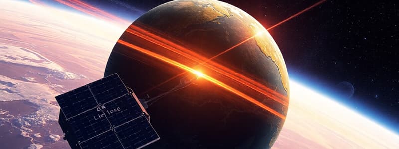
GRACE (Gravity Recovery and Climate Experiment) Measurement Principle
- Key Observables: Inter-satellite ranging and GPS orbits
- We want to derive a physical quantity (mass/gravity) from a geometrical quantity (inter-satellite distance [change])
- It is not a direct functional of gravity potential
- It is highly non-linear
Satellite Gravity Gradiometry
- Key observables are gravity gradients and GPS orbits
- Direct functional of gravity potential (second order derivative)
- Linear observation equation
Mission Performance
- Missions compared include GRIM1 (1976), CHAMP, GRACE, GRIM5c (1999), and GOCE
- Compared using Degree Error Median and Wavelength
Static vs. Time-Variable Gravity Field
- Static: GOCE (Gravity field and steady-state Ocean Circulation Explorer):
- Spatial resolution is higher than >70 km
- Globally homogeneous accuracy
- Time-variable: GRACE/GRACE-FO
- Long-wavelength measured
- Weekly to monthly measurement
Past and Current Satellite Gravity Missions and Applications
- Missions:
- Gravity Recovery and Climate Experiment (GRACE)
- GRACE-Follow On
- Gravity field and steady-state Ocean Circulation Explorer (GOCE)
GRACE mission
- Launch: March 17, 2002 (Plesetsk)
- Orbit inclination: i = 89°
- Initial orbit altitude: 485 km, decreasing
- Measurement period: up until 2017
- Measure distance between two satellites with K-band microwave link
- Measurement accurancy approximately ~μm
- Distance between satellites is ca. 200 km
- Key components: K-Band Microwave Ranging System (KBR), SuperStar Accelerometer, GPS BlackJack Receiver, Laser-Retroreflector, Star trackers, Ultra-stable oscillator, Coarse Earth and Sun sensor, CoM trim assembly
GRACE Follow-On
- Launch: May 22, 2018
- Mission Period: 5 years (nominal), 10 years (target)
- Co-funded by NASA, Germany
- Build on heritage of GRACE with some technological advancements
- Laser interferometer (~10 nm) is parallel to microwave system as demonstrator.
GRACE and GRACE-Follow On
- GRACE/GRACE-FO mapped a water storage every month since 2002
Water Balance Equation
- P - R - ET = ΔS, Precipitation - Runoff - Evapotranspiration = Storage Change
- Gravity field satellites can measure storage change.
- They are the only observation technique the directly right-hand side of water balances
- Sensitive to ground water changes
Global Hydrology
- Temporal gravity measures long-term trends
- Indicates water decreasing in places such as california ,theMiddle east and North-China
- Indicates water increasing in places such as Nord-India and NW-Australia
- Global (water) mass redistribution relates to equivalent water height
Hydrology in North India
- Monitors loss of non-renewable freshwater reservoirs from space
Climate-Induced Trends
- Examples of climate induced trends include
- Ice-sheet loss, glacier and ice-cap loss and glaciers retreating
- Groundwater depletion and drought
- Precipitation increase or drying
Droughts in Central Europe
- Droughts in Central Europe in 2015, and Europe in 2022 have been monitored
Temporal gravity: long-term trends
- In 2002-2004
- Measured in equivalent water height
- Water decreasing in Antarctica
- Water increasing in Alaska and Greenland
Ice Mass Changes: Greenland
- Analyzed with GRACE and GRACE-FO
- Observations of Greenland Land Ice Mass Changes
- Graph for Mass Change (Gigatons) starting from 2002 to 2022
- Average Mass Loss: 269 Gigatons/year
Ice Mass Changes: Antarctica
- Analyzed with GRACE and GRACE-FO
- Observations of Antarctic Ice Mass Changes
- Graph for Mass Change (Gigatons) from 2002-2020
- Average Mass Loss: 149 Gigatons/year
IMBIE-2; Ice Mass Balance for Antarctica
- 1992-2001: -53 ± 29 Gt/yr
- 2010-2015: –159 ± 26 Gt/yr
- 25 years average: 5 ± 46 Gt/yr
Ice Mass
- Analyzed Glacier Systems including Alaska, Arctic Canada, Iceland and Southern Andes
- Cumulative mass change & sea level contribution: Antarctica with a simple approximation Rule of thumb
- Rule of thumb: 360 Gt/year ≈ 1 mm/year global sea level rise
Sea Level Change
- Cryosphere measures ice mass
- Hydrology calculates water discharge
- Solar irradiation calculates Heat Volume
Global Sea Level Rise
- Rate: ~3.2mm/year
- Total sea level at ~3 mm/year
- Mass effect was ~2 mm/year
- Thermosteric effect at ~1 mm/year
- Measured by: Global sea level (Altimetry) Mass change (GRACE), Volume change (ARGO), measured from year 2004 to 2006
- Sea level can be affected by Ice masses and Hydrology
GOCE
- Gravity field and steady-state Ocean Circulation Explorer
GOCE: Satellite Gravity Gradiometry
- GOCE's gradiometer measures 6 independent components of gravity field using pairs of proof masses
GOCE Mission Parameters
- Launch: March 17 2009 (Plesetsk)
- Orbit inclination: i=96.5° (sunsynchronous)
- Orbit altitude: 254.9 km -> 225km
- Mission period: 2009-2013
Innovations from GOCE mission was for the first time
- Dfac-Drag Free and Attitude Control
GOCE Mission Profile
- Starts in 2009, End Nominal Mission was 2011 and Ended in 2013 to the GOCE Swan Song
- Step-wise lowering of orbit altitude
- Higher sensitivity for detail of Earth's gravity field.
- Atmosphere density
- Drage compensation
- Fuel Consumption
- Re-entry predictions
GOCE Gravity Modelling
- The goal is to understand the gravity field parameters with satellite measurements
- Measurements include Satellite obit and Gradiometry
- gravity modeling involved using AIUB: Astronomical Institute University Bern and CNES, Spatiale GRGAS
- Used spherical harmonics coefficients
Mean Dynamic Ocean Topography
- Calculated based on the formula Altimetry reading = Height - Geold reading
- Mean Sea Surface: time-averaged and geometric
- Geoid physical reference that „Ideal" ocean ONLY gravity driven
- Mean dynamic(MDT) Deviation of real ocean surface from Ideal one
Ocean Current Velocities
- Current is Derived from GOCE
- Involves the Agulas Current, the Kurshio current ACC (antartic cicrulation current and gulf stream
Future Initiatives for Modern Geodesy
- Two major upcoming goals
- Science requirements and mission proposals
- Magic mass change for geosciece International Constellation
Consolidated Science and User Needs
- Addresses the problem of seperation form natural
- Improve temporary resolution to applications through the usage of a Leap Forward
- Increases Spatial/ Temporary time resolution for Science
Future Missions: Cooperation ESA+NASA
- New e Motion double pair
- Mobile high low tracking for the NASA ESAS for inter agency gravity
Mass-Change and Geoscience International Constellation (MAGIC)
- MAGIC and MCDO are mass observatories
- A document by the TUM describes its parameters and document names
- The overall Joint is for cooperation
Best Performing Constellation
- Constellations are in a variety of formations
- These can be - Single pair - Pendulum single pair - Marvels sets
Satellite formations-Pendulum and Bender double-pair
Studying That Suits You
Use AI to generate personalized quizzes and flashcards to suit your learning preferences.
Related Documents
Description
This covers the GRACE mission's measurement principles, configuration, and mathematical relationships. It also explains the role of GPS in GRACE and Satellite Gravity Gradiometry (SGG) missions, including the observable measured and advantages over satellite-to-satellite tracking.