Podcast
Questions and Answers
What geographical feature divides India into almost two equal parts?
What geographical feature divides India into almost two equal parts?
The Tropic of Cancer.
What is the total area of India?
What is the total area of India?
India has a total area of 3.28 million square kilometers.
What are the two types of states in India prior to 1947 and how were they governed?
What are the two types of states in India prior to 1947 and how were they governed?
The two types of states were provinces and princely states. Provinces were ruled by British officials, while princely states were governed by local hereditary rulers who acknowledged British sovereignty.
Which two groups of islands are associated with India, and where are they located?
Which two groups of islands are associated with India, and where are they located?
What is the geographical extent of India in terms of latitudes and longitudes?
What is the geographical extent of India in terms of latitudes and longitudes?
Describe the geographical proximity of Sri Lanka and Maldives to India.
Describe the geographical proximity of Sri Lanka and Maldives to India.
What significant event occurred at Indira Point in 2004?
What significant event occurred at Indira Point in 2004?
What influence can be seen in the architecture of India from its neighboring regions?
What influence can be seen in the architecture of India from its neighboring regions?
How many states and union territories does India currently have?
How many states and union territories does India currently have?
In which hemisphere does India lie entirely?
In which hemisphere does India lie entirely?
What socio-economic progress has India achieved in the last five decades?
What socio-economic progress has India achieved in the last five decades?
What is the purpose of the School Bhuvan portal?
What is the purpose of the School Bhuvan portal?
What percentage of the total geographical area does the area mentioned represent?
What percentage of the total geographical area does the area mentioned represent?
Identify three major oceans represented on the map.
Identify three major oceans represented on the map.
Which continent is positioned to the left of Europe on the map?
Which continent is positioned to the left of Europe on the map?
What geographical feature is located at 75°N latitude?
What geographical feature is located at 75°N latitude?
Which continent is directly south of Europe on the map?
Which continent is directly south of Europe on the map?
What is the significance of the 0° longitude line?
What is the significance of the 0° longitude line?
At what latitude does Australia appear on the map?
At what latitude does Australia appear on the map?
How is India represented in the context of this geographical area?
How is India represented in the context of this geographical area?
What is the significance of 82°30'E in relation to India's timekeeping?
What is the significance of 82°30'E in relation to India's timekeeping?
How does India's latitude and longitude influence the duration of day and night?
How does India's latitude and longitude influence the duration of day and night?
Why is India's position in the Indian Ocean considered strategic?
Why is India's position in the Indian Ocean considered strategic?
Discuss the importance of the Deccan Peninsula in India's geography.
Discuss the importance of the Deccan Peninsula in India's geography.
What is the total length of India's coastline, including its islands?
What is the total length of India's coastline, including its islands?
How does the time lag from Gujarat to Arunachal Pradesh manifest?
How does the time lag from Gujarat to Arunachal Pradesh manifest?
Explain why Kanniyakumari experiences less variation in day and night compared to Kashmir.
Explain why Kanniyakumari experiences less variation in day and night compared to Kashmir.
What geographical features bound India?
What geographical features bound India?
Why was the Suez Canal's opening significant for India?
Why was the Suez Canal's opening significant for India?
Describe the factors that determine India's prominent position in the Indian Ocean.
Describe the factors that determine India's prominent position in the Indian Ocean.
What role did mountain passes play in India's ancient interactions with the world?
What role did mountain passes play in India's ancient interactions with the world?
Which geographical features have restricted maritime interactions for India over time?
Which geographical features have restricted maritime interactions for India over time?
Identify the smallest Union Territory in India.
Identify the smallest Union Territory in India.
Which states in India share a border with Pakistan?
Which states in India share a border with Pakistan?
Classify India's neighboring countries into categories based on its borders.
Classify India's neighboring countries into categories based on its borders.
What contributions did ancient Indian texts and stories make to global culture?
What contributions did ancient Indian texts and stories make to global culture?
How did trade routes influence the exchange of commodities from India?
How did trade routes influence the exchange of commodities from India?
List the countries that India shares land boundaries with to the northeast.
List the countries that India shares land boundaries with to the northeast.
What significant historical figures or texts from India are mentioned as influencing global culture?
What significant historical figures or texts from India are mentioned as influencing global culture?
What was the significance of ancient trade routes for India?
What was the significance of ancient trade routes for India?
Flashcards
Geographical Area
Geographical Area
The total area of land and water on Earth, including continents, oceans, and islands.
India's Geographical Area Percentage
India's Geographical Area Percentage
The percentage of the Earth's total geographical area that India occupies.
World Map
World Map
A geographical representation of the Earth's continents and oceans, usually shown on a flat surface.
North America
North America
Signup and view all the flashcards
Europe
Europe
Signup and view all the flashcards
Asia
Asia
Signup and view all the flashcards
South America
South America
Signup and view all the flashcards
Pacific Ocean
Pacific Ocean
Signup and view all the flashcards
Atlantic Ocean
Atlantic Ocean
Signup and view all the flashcards
India's Southern Neighbors
India's Southern Neighbors
Signup and view all the flashcards
Palk Strait and Gulf of Mannar
Palk Strait and Gulf of Mannar
Signup and view all the flashcards
Lakshadweep Islands
Lakshadweep Islands
Signup and view all the flashcards
Provinces and Princely States in Pre-Independence India
Provinces and Princely States in Pre-Independence India
Signup and view all the flashcards
Viceroy of India
Viceroy of India
Signup and view all the flashcards
India's Progress
India's Progress
Signup and view all the flashcards
Tropic of Cancer in India
Tropic of Cancer in India
Signup and view all the flashcards
Island Groups of India
Island Groups of India
Signup and view all the flashcards
Indira Point
Indira Point
Signup and view all the flashcards
India's Landmass
India's Landmass
Signup and view all the flashcards
India's Geographical Coordinates
India's Geographical Coordinates
Signup and view all the flashcards
India's Location in the Hemisphere
India's Location in the Hemisphere
Signup and view all the flashcards
India's Location
India's Location
Signup and view all the flashcards
Standard Meridian
Standard Meridian
Signup and view all the flashcards
International Highway of Trade and Commerce
International Highway of Trade and Commerce
Signup and view all the flashcards
Upanishads
Upanishads
Signup and view all the flashcards
Panchtantra
Panchtantra
Signup and view all the flashcards
Indian Numerals
Indian Numerals
Signup and view all the flashcards
Decimal System
Decimal System
Signup and view all the flashcards
Merchandise from India
Merchandise from India
Signup and view all the flashcards
India's Land Routes
India's Land Routes
Signup and view all the flashcards
India's Contacts with the World
India's Contacts with the World
Signup and view all the flashcards
Why is 82°30'E the Standard Meridian of India?
Why is 82°30'E the Standard Meridian of India?
Signup and view all the flashcards
What is India's central location?
What is India's central location?
Signup and view all the flashcards
How does the Deccan Peninsula contribute to India's position?
How does the Deccan Peninsula contribute to India's position?
Signup and view all the flashcards
What makes India significant in the Indian Ocean?
What makes India significant in the Indian Ocean?
Signup and view all the flashcards
How did the Suez Canal impact India?
How did the Suez Canal impact India?
Signup and view all the flashcards
How does India's latitudinal extent impact day and night length?
How does India's latitudinal extent impact day and night length?
Signup and view all the flashcards
Why is India divided into various time zones?
Why is India divided into various time zones?
Signup and view all the flashcards
Why is there a difference in day and night durations between Kashmir and Kanniyakumari?
Why is there a difference in day and night durations between Kashmir and Kanniyakumari?
Signup and view all the flashcards
What is India's total land boundary?
What is India's total land boundary?
Signup and view all the flashcards
What is the total coastline length of India?
What is the total coastline length of India?
Signup and view all the flashcards
Study Notes
India - Size and Location
- India is one of the oldest civilizations, experiencing significant socio-economic progress in recent decades.
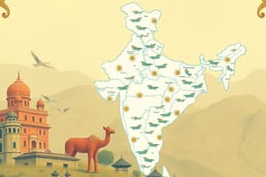
- India's landmass lies entirely in the Northern Hemisphere, extending between latitudes 8°4'N and 37°6'N, and longitudes 68°7'E and 97°25'E.
- The Tropic of Cancer (23° 30'N) divides India almost equally.
- The Andaman and Nicobar islands lie southeast of the mainland, and the Lakshadweep islands are southwest.
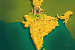
- India's total land area is approximately 3.28 million square kilometers, representing about 2.4% of the world's total geographical area.
- The coastline, including the Andaman and Nicobar, and Lakshadweep Islands, totals around 7,516.6 kilometers.
- India is bordered by young fold mountains in the northwest, north, and northeast.
- South of approximately 22° North latitude, India tapers towards the Indian Ocean, forming the Arabian Sea on the west and the Bay of Bengal on the east.
- The east-west extent of India is smaller than its north-south extent, despite a longitudinal extent of about 30 degrees.
- Time varies across India, with a two-hour difference between Gujarat and Arunachal Pradesh, using the Standard Meridian of India (82°30'E).
- India's latitudinal extent influences day and night lengths.
India's Position in the World
- India is centrally located between East and West Asia, acting as a crossroads for trade routes.
- By extending into the Indian Ocean, India facilitates connections with West Asia, Africa, and Europe through its west coast, and with Southeast and East Asia through its east coast.
- India is the seventh-largest country in the world.
- The Suez Canal reduction in travel time from Europe to India by 7,000 km.
India's Neighbors
- India shares land boundaries with Pakistan, Afghanistan, China (Tibet), Nepal, Bhutan, Myanmar, and Bangladesh.
- India's southern neighbors include Sri Lanka and the Maldives, with maritime (sea) boundaries.
- Historically, India has had strong economic ties with its neighbors.
- India's strategic geographic location in South Asia is important.
Studying That Suits You
Use AI to generate personalized quizzes and flashcards to suit your learning preferences.