Podcast
Questions and Answers
How does the map scale change between Map A and Map B?
How does the map scale change between Map A and Map B?
- Map scale alternates between large and small.
- Map scale remains the same.
- Map scale becomes larger, zooming in.
- Map scale becomes smaller, zooming out. (correct)
What is an advantage of a Robinson map projection?
What is an advantage of a Robinson map projection?
- Shows land areas accurately but distorts shape.
- Represents the world as a perfect sphere.
- Simplifies the representation of polar regions.
- Shows continents truest to size and shape. (correct)
What is a disadvantage of the Goode Homolosine map?
What is a disadvantage of the Goode Homolosine map?
- Distorts/separates bodies of water. (correct)
- Presents an overly simplified view of the world.
- Exaggerates the area of continents.
- Fails to show political boundaries effectively.
How does technology affect time space compression?
How does technology affect time space compression?
Why is absolute location preferred over relative location?
Why is absolute location preferred over relative location?
What type of culture is exemplified by the widespread use of the word 'demure'?
What type of culture is exemplified by the widespread use of the word 'demure'?
What type of diffusion is demonstrated when Frances opens a crawfish stand after moving?
What type of diffusion is demonstrated when Frances opens a crawfish stand after moving?
Which building is associated with Judaism?
Which building is associated with Judaism?
Flashcards
Robinson Map Projection
Robinson Map Projection
A map projection where continents appear closer to their true size and shape, often used in schools.
Goode Homolosine Projection
Goode Homolosine Projection
A type of map projection that shows continents accurate to size and shape but distorts the poles.
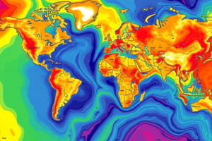
Isoline Map
Isoline Map
A map that uses lines to connect points of equal value, like temperature or elevation.
Dot Density Map
Dot Density Map
Signup and view all the flashcards
Time-Space Compression
Time-Space Compression
Signup and view all the flashcards
Relative Location
Relative Location
Signup and view all the flashcards
Absolute Location
Absolute Location
Signup and view all the flashcards
Popular Culture
Popular Culture
Signup and view all the flashcards
Study Notes
Map Scale Change
- Map A shows a city, while Map B shows a state
- Map scale becomes smaller when zooming out
Robinson Map Projection
- Advantage: Shows continents truest to size and shape
- Disadvantage: The North and South Poles are flatlined
Goode Homolosine Projection
- Disadvantage: Distorts/separates bodies of water
COVID-19 Cases Map
- The map shows the number of confirmed COVID-19 cases
- A state with the lowest number of cases is not identifiable
Isoline Map
- Lines connect points of equal value
- The coloring is not defined by borders
Dot Density Map
- A type of map using dots to represent data density in a geographic area
Time-Space Compression
- Technology increases time-space compression
- Makes the world feel smaller
Relative Location of Central High School
- Examples vary: Down the road from Walmart, across the street from Misuraca Orthodontics
Absolute vs. Relative Location
- Absolute location is more specific
Texas Map
- The map shows Interstate highways in Texas
Popular Culture
- People all over the world using the word "demure" is an example of popular culture
Universalizing Religion
- Jaylen's summer mission trip is part of a universalizing religion
Synagogue
- Synagogue is the associated religious building for Judaism
Relocation Diffusion
- Frances moving with her family from Louisiana to New York and opening a crawfish stand is an example of relocation diffusion
Globalization and Diffusion
- Globalization leads to diffusion through technological advancements
- People have access to other cultures via social media and cell phones
High Population Density Physical Features
- Access to rivers
- Fertile soil
- Temperate climate
- Rich vegetation
Low Population Density Human Features
- Lack of job opportunities
- War and conflict
- Lack of accessibility (no roads)
Population Pyramid
- A visualization representing a population by age and gender
- Used to determine MDC or LDC statuses
- Includes CBR, life expectancy, future population changes, and dependency ratios
Traditional Woman
- A woman in Country Y with eight children who stays home to care for them is a traditional woman
Demographic Transition Model Stage 5
- Stage 5 is declining
- Birth rates drop below death rates for the first time
Death Rates in DTM Stage 2
- Death rates drop for the first time in stage 2
- Access to clean water is an environmental factor explaining this decrease
MDC or LDC in DTM Stage 5
- A country in stage 5 of the DTM is an MDC
- Japan is an example of a country reaching stage 5
Studying That Suits You
Use AI to generate personalized quizzes and flashcards to suit your learning preferences.


