Podcast
Questions and Answers
What is the primary challenge in Geographic Information Systems (GIS)?
What is the primary challenge in Geographic Information Systems (GIS)?
- Collecting real-time geographic data
- Simplifying geographic data for map depiction (correct)
- Creating highly detailed 3D representations
- Linking geographic positions with their attributes
Which of the following is an example of a nominal scale attribute?
Which of the following is an example of a nominal scale attribute?
- Distance measurements in kilometers
- Temperature in Celsius
- Species names in an ecosystem (correct)
- Soil quality ranked as low, medium, high
What characteristic defines an ordinal scale attribute?
What characteristic defines an ordinal scale attribute?
- The intervals between values are meaningful.
- Categories have a specific order but not equidistant intervals. (correct)
- Values are cyclical and repeat over time.
- There is a true zero point.
Which scale type is characterized by having an absolute zero?
Which scale type is characterized by having an absolute zero?
Which of the following statements about interval scale attributes is correct?
Which of the following statements about interval scale attributes is correct?
Which type of attribute is defined as cyclical in nature?
Which type of attribute is defined as cyclical in nature?
Which scale type includes categories that are ranked but lacks a meaningful distance between each rank?
Which scale type includes categories that are ranked but lacks a meaningful distance between each rank?
What is a key feature of geographic datum?
What is a key feature of geographic datum?
What is one of the main advantages of using discrete objects in GIS?
What is one of the main advantages of using discrete objects in GIS?
How does pixel size affect the representation of geographic data?
How does pixel size affect the representation of geographic data?
What is a limitation of representing 3D objects in GIS?
What is a limitation of representing 3D objects in GIS?
Which of the following accurately describes how raster data assigns values to cells?
Which of the following accurately describes how raster data assigns values to cells?
What are polygons in vector data primarily used for?
What are polygons in vector data primarily used for?
Which characteristic distinguishes raster data from vector data?
Which characteristic distinguishes raster data from vector data?
What is one reason why vector data may be preferred for administrative purposes?
What is one reason why vector data may be preferred for administrative purposes?
Which method is commonly used for the generalization of vector data?
Which method is commonly used for the generalization of vector data?
Continuous fields in GIS differ from discrete objects primarily in that they:
Continuous fields in GIS differ from discrete objects primarily in that they:
What is the significance of the scale in paper maps compared to digital maps?
What is the significance of the scale in paper maps compared to digital maps?
What is a primary feature of polylines in vector data?
What is a primary feature of polylines in vector data?
Why is raster data considered more suited for statistical analysis?
Why is raster data considered more suited for statistical analysis?
Which type of variable can continuously change between locations in continuous fields?
Which type of variable can continuously change between locations in continuous fields?
One challenge of representing natural features in GIS systems is that:
One challenge of representing natural features in GIS systems is that:
Flashcards
Geographic Datum
Geographic Datum
Links a geographic position (in space and time) with descriptive information (properties).
Geographic Attribute
Geographic Attribute
A descriptive property of a geographic object or location.
Nominal Attribute
Nominal Attribute
Descriptive categories with no inherent order.
Ordinal Attribute
Ordinal Attribute
Signup and view all the flashcards
Interval Attribute
Interval Attribute
Signup and view all the flashcards
Ratio Attribute
Ratio Attribute
Signup and view all the flashcards
Cyclic Attribute
Cyclic Attribute
Signup and view all the flashcards
GIS Fundamental Problem
GIS Fundamental Problem
Signup and view all the flashcards
Spatial averaging
Spatial averaging
Signup and view all the flashcards
Pixel
Pixel
Signup and view all the flashcards
Tessellation
Tessellation
Signup and view all the flashcards
Pixel Size and Resolution
Pixel Size and Resolution
Signup and view all the flashcards
Raster Data
Raster Data
Signup and view all the flashcards
Discrete Objects
Discrete Objects
Signup and view all the flashcards
Boundaries (Discrete Objects)
Boundaries (Discrete Objects)
Signup and view all the flashcards
Continuous Fields
Continuous Fields
Signup and view all the flashcards
Scalar Fields
Scalar Fields
Signup and view all the flashcards
Vector Data
Vector Data
Signup and view all the flashcards
Vector Representation (Curves)
Vector Representation (Curves)
Signup and view all the flashcards
Vector Representation (Polygons)
Vector Representation (Polygons)
Signup and view all the flashcards
Raster vs. Vector
Raster vs. Vector
Signup and view all the flashcards
Generalization (Maps)
Generalization (Maps)
Signup and view all the flashcards
WEEDING (Generalization)
WEEDING (Generalization)
Signup and view all the flashcards
Study Notes
Geographic Representation
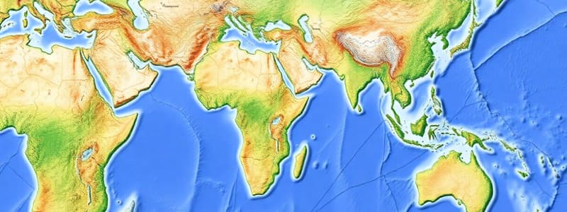
- Fundamental Problem: Simplifying geographic data for map representation (raster and vector). Reducing the Earth's complexity to a map projection.
- Representing Data: Creating digital maps of the Earth's surface for visualization beyond our immediate experience.
Geographic Data
- Geographic Datum: Links a location and its descriptive properties (attributes) over time.
- Attributes: Descriptive elements of geographic objects. Example: "arable land" can be categorized as "tilled" or "fallow."
- Attribute Classification:
- Nominal: Unordered categories (e.g., land cover types, species).
- Ordinal: Ordered categories with non-uniform intervals (e.g., soil quality: low, medium, high; study grades A-D).
- Interval: Numerical data with meaningful intervals but no absolute zero (e.g., temperature in Celsius).
- Ratio: Numerical data with meaningful intervals and an absolute zero point (e.g., distance, concentrations).
- Cyclic: Geographic attributes with repeating values (e.g., compass directions). Hierarchical structure; each level builds on the previous.
Solving the Fundamental Problem: Simplification
- Spatial Averaging: Assigning a constant value to pixel/tessellation areas (regardless of size). The impact of pixel size (dpi) dictates detail : Smaller pixels (high resolution) vs larger pixels (general overview).
- Raster Data:
- Pixel: Constant value; significant space consumption due to large ocean areas having the same value.
- Tessellation: Mosaicing the Earth's surface; large areas of constant values.
- Raster Data:
- Discrete Objects: Objects occupy space; clear boundaries.
- Identifying Objects: Based on dimensionality (points, lines, areas)
- Limitations: Difficulty in representing truly 3D objects and continuous natural features (e.g., rivers, mountains).
- Continuous Fields: Variables measured across the entire surface; values vary continuously. Examples include population density, traffic density, and elevation.
- Types of Variables: Nominal, ordinal, interval, ratio, cyclic.
- Scalar fields: One variable per point
- Vector fields: Two variables(e.g. magnitude and direction) per point
- Types of Variables: Nominal, ordinal, interval, ratio, cyclic.
Raster and Vector Data
- Raster: Finite set of continuous surface info; used for elevation, soil types, etc. Derived from remote sensing images. Values are assigned by central point or largest share (largest share more common).
- Vector: Finite set of object information.
- Representing Curves: Using connected points(vertices).
- Polygons: Closed shapes; representing areas (e.g., parks, lakes)
- Polylines: Representing curves using connected straight line segments. Efficiency in space compared to raster depictions of curves.
- Dimensionality: Points (0D), lines (1D), polylines (2D), polygons (2D)
- Points, lines, polylines, and polygons, each with identities and coordinates.
- Raster vs. Vector:
- Precision: Vector is precise, raster is approximate(suited to statistical randomness)
- Storage: Vector more space-efficient with large details; raster good for statistical analysis.
- Paper Maps vs. Digital Maps: Paper maps have scales; digital maps can be zoomed in.
Generalization
- Simplification: Reducing complexity; various methods, such as "weeding" (removing points on vector lines).
Sampling and Uncertainty
- Sampling: Geographic data often sampled rather than complete. Uncertainty exists between samples.
- Statistical Tools: Measures and minimizes errors. Statistical standard errors relevant.
- Autocorrelation: Similar values in geographically proximate areas; important for predicting missing data.
Autocorrelation
- Importance: Modelling and interpolation of missing data, along with relationships and distances between readings.
- Applications: Modeling and data interpolation in geographic analysis. Improves data accuracy by considering positional relationships and consistency.
Studying That Suits You
Use AI to generate personalized quizzes and flashcards to suit your learning preferences.