Podcast
Questions and Answers
What is the primary reason for using imaginary lines on the globe, and what are these lines called?
What is the primary reason for using imaginary lines on the globe, and what are these lines called?
The primary reason is to locate a place on the earth's surface, and the lines are called latitudes and longitudes.
Who is credited with devising the concept of lines of latitude and longitude, and what else did he achieve?
Who is credited with devising the concept of lines of latitude and longitude, and what else did he achieve?
Erastosthenes, the Greek philosopher, who had also calculated the circumference of the earth.
What is the significance of the intersection of latitudes and longitudes, and what is this framework called?
What is the significance of the intersection of latitudes and longitudes, and what is this framework called?
The intersection of latitudes and longitudes pinpoints a place on the earth's surface, and this framework is called the Geographic Grid.
What is the difference between the lines of latitude and longitude, and how do they run?
What is the difference between the lines of latitude and longitude, and how do they run?
What is the analogy between the Geographic Grid on the globe and a system of coordinates on a graph paper?
What is the analogy between the Geographic Grid on the globe and a system of coordinates on a graph paper?
What is the angular distance of a place north or south of the Equator?
What is the angular distance of a place north or south of the Equator?
What is the term used to describe the imaginary lines that join all places having the same latitude towards north or south of the Equator?
What is the term used to describe the imaginary lines that join all places having the same latitude towards north or south of the Equator?
What is the term used to describe the circle that is formed by a line of latitude?
What is the term used to describe the circle that is formed by a line of latitude?
How are latitudes calculated?
How are latitudes calculated?
What is the name given to the lines that run from the North Pole to the South Pole?
What is the name given to the lines that run from the North Pole to the South Pole?
Flashcards are hidden until you start studying
Study Notes
Geographical Grid
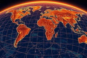
- The Earth's surface is vast, making it essential to use a mathematical method to locate a place on it.
- Imaginary lines, called latitudes and longitudes, are drawn on the globe to form a framework known as the Geographical Grid.
Latitudes
- Lines of Latitude are imaginary lines joining all places having the same latitude towards north or south of the Equator.
- A latitude is the angular distance of a place north or south of the Equator.
- Latitudes are marked in degrees, with the Equator being 0 degrees.
- Each parallel of latitude is a full circle, but only the Equator is a Great Circle.
- Parallels of latitude are parallel to the Equator and each other.
Longitudes
- Lines of Longitude are imaginary lines running north to south, passing through the poles.
- The intersection of latitudes and longitudes pinpoints a place on the Earth's surface.
Prime Meridian and Time
- The Prime Meridian passes through Greenwich, England, and is designated as 0° longitude.
- Time is calculated based on the difference between local time and Greenwich Mean Time (GMT).
- The International Date Line (IDL) is an imaginary line that runs roughly north to south through the middle of the Pacific Ocean and separates two consecutive calendar days.
Hemispheres
- The Eastern Hemisphere lies east of the Prime Meridian, and the Western Hemisphere lies west of it.
Great Circles
- A Great Circle is an imaginary circle on the Earth's surface, with the center of the circle being the center of the Earth.
- Great Circles are used to calculate the shortest distance between two points on the Earth's surface.
Studying That Suits You
Use AI to generate personalized quizzes and flashcards to suit your learning preferences.