Podcast
Questions and Answers
What differentiates the Equator from other parallels of latitude?
What differentiates the Equator from other parallels of latitude?
- The Equator is the only parallel of latitude that is a Great Circle. (correct)
- The Equator is the only parallel of latitude that is used to measure distances from the North Pole.
- The Equator is the only parallel of latitude that divides the earth into two hemispheres.
- The Equator is the only parallel of latitude that is exactly 111 kilometers long.
Which of these statements about the Arctic Circle is correct?
Which of these statements about the Arctic Circle is correct?
- The Arctic Circle is located at 23°N latitude and is a region experiencing the midnight sun phenomenon.
- The Arctic Circle is located at 23°S latitude and is responsible for the varying hours of daylight throughout the year.
- The Arctic Circle is located at 66°S latitude and marks the limit of the south polar region.
- The Arctic Circle is located at 66°N latitude and marks the limit of the north polar region. (correct)
If a place is located at 45°S latitude, what can be inferred about its position?
If a place is located at 45°S latitude, what can be inferred about its position?
- The place is located in the Northern Hemisphere and is closer to the North Pole than the Equator.
- The place is located in the Northern Hemisphere and is closer to the Equator than the South Pole.
- The place is located in the Southern Hemisphere and is closer to the South Pole than the Equator. (correct)
- The place is located in the Southern Hemisphere and could be experiencing warmer temperatures than the Equator.
What is the significance of the Tropic of Cancer in relation to the Equator?
What is the significance of the Tropic of Cancer in relation to the Equator?
How are lines of latitude used to measure the distance of a place?
How are lines of latitude used to measure the distance of a place?
What is the approximate distance between two locations that are 1° apart in latitude?
What is the approximate distance between two locations that are 1° apart in latitude?
Which line of latitude marks the boundary between the Northern Hemisphere and the Southern Hemisphere?
Which line of latitude marks the boundary between the Northern Hemisphere and the Southern Hemisphere?
Which of the following statements is TRUE regarding the relationship between latitude and longitude?
Which of the following statements is TRUE regarding the relationship between latitude and longitude?
Which of these options correctly illustrates the angular distance of the Tropic of Capricorn from the Equator?
Which of these options correctly illustrates the angular distance of the Tropic of Capricorn from the Equator?
What is the primary use of lines of latitude in determining the location of a place?
What is the primary use of lines of latitude in determining the location of a place?
If it is 12 Noon at 0° longitude, what time would it be at 180° longitude?
If it is 12 Noon at 0° longitude, what time would it be at 180° longitude?
Which of the following statements about lines of longitude is TRUE?
Which of the following statements about lines of longitude is TRUE?
Why are the Temperate Zones considered "temperate"?
Why are the Temperate Zones considered "temperate"?
How do lines of latitude impact the climate of different regions?
How do lines of latitude impact the climate of different regions?
Which of the following locations would experience the most consistent temperature throughout the year?
Which of the following locations would experience the most consistent temperature throughout the year?
The EGA-WLS formula is used to help remember:
The EGA-WLS formula is used to help remember:
What is the primary difference between the North Temperate Zone and the South Temperate Zone?
What is the primary difference between the North Temperate Zone and the South Temperate Zone?
If you travel from the Equator towards the North Pole, what happens to the distance between lines of longitude?
If you travel from the Equator towards the North Pole, what happens to the distance between lines of longitude?
Which of these is NOT a characteristic of the Frigid Zones?
Which of these is NOT a characteristic of the Frigid Zones?
The Torrid Zone is also known as the __________.
The Torrid Zone is also known as the __________.
If a traveler crosses the International Date Line from west to east at 10:00 AM, what time would it be immediately after crossing the line?
If a traveler crosses the International Date Line from west to east at 10:00 AM, what time would it be immediately after crossing the line?
Which of these coordinates represents a location that is closer to the equator than Mumbai?
Which of these coordinates represents a location that is closer to the equator than Mumbai?
Which of the following is a true statement about Standard Time?
Which of the following is a true statement about Standard Time?
Imagine you are standing at 82°30'E longitude. Which of the following could be the local time at your location if the sun is directly overhead (noon) at a location 15° to the west of you?
Imagine you are standing at 82°30'E longitude. Which of the following could be the local time at your location if the sun is directly overhead (noon) at a location 15° to the west of you?
If you are at 180° longitude and cross the International Date Line traveling east, which of the following would be true?
If you are at 180° longitude and cross the International Date Line traveling east, which of the following would be true?
Which of the following is NOT a characteristic of a Great Circle?
Which of the following is NOT a characteristic of a Great Circle?
What is the primary reason for the zigzag pattern of the International Date Line?
What is the primary reason for the zigzag pattern of the International Date Line?
If a location is at 10°N latitude and 85°E longitude, which of the following statements is true about its position on the Earth?
If a location is at 10°N latitude and 85°E longitude, which of the following statements is true about its position on the Earth?
Imagine a location at 50°S latitude and 10°W longitude. Another location is at 50°S latitude and 170°E longitude. Which of the following accurately describes their relative positions?
Imagine a location at 50°S latitude and 10°W longitude. Another location is at 50°S latitude and 170°E longitude. Which of the following accurately describes their relative positions?
Flashcards
Lines of Latitude
Lines of Latitude
Imaginary lines running east to west, parallel to the Equator.
Equator
Equator
The longest line of latitude, representing 0° latitude.
Main Latitudes
Main Latitudes
Key parallels of latitude including Tropics and Poles.
Tropic of Cancer
Tropic of Cancer
Signup and view all the flashcards
Tropic of Capricorn
Tropic of Capricorn
Signup and view all the flashcards
Arctic Circle
Arctic Circle
Signup and view all the flashcards
Antarctic Circle
Antarctic Circle
Signup and view all the flashcards
Northern Hemisphere
Northern Hemisphere
Signup and view all the flashcards
Southern Hemisphere
Southern Hemisphere
Signup and view all the flashcards
Geographic Grid
Geographic Grid
Signup and view all the flashcards
Latitude
Latitude
Signup and view all the flashcards
Heat Zones
Heat Zones
Signup and view all the flashcards
Torrid Zone
Torrid Zone
Signup and view all the flashcards
Temperate Zones
Temperate Zones
Signup and view all the flashcards
Frigid Zones
Frigid Zones
Signup and view all the flashcards
Longitude
Longitude
Signup and view all the flashcards
Prime Meridian
Prime Meridian
Signup and view all the flashcards
Meridians
Meridians
Signup and view all the flashcards
Great Circle
Great Circle
Signup and view all the flashcards
Longitude and Time
Longitude and Time
Signup and view all the flashcards
EGA
EGA
Signup and view all the flashcards
WLS
WLS
Signup and view all the flashcards
Local Time
Local Time
Signup and view all the flashcards
Time Zones
Time Zones
Signup and view all the flashcards
Standard Time
Standard Time
Signup and view all the flashcards
Greenwich Mean Time (GMT)
Greenwich Mean Time (GMT)
Signup and view all the flashcards
Indian Standard Time (IST)
Indian Standard Time (IST)
Signup and view all the flashcards
International Date Line
International Date Line
Signup and view all the flashcards
Study Notes
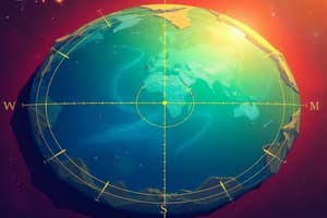
Geographic Grid: Latitudes and Longitudes
- Lines of latitude are imaginary lines parallel to the Equator.
- Lines of longitude run north-south, passing through the poles.
- The intersection of latitude and longitude lines defines a location on Earth.
- Latitude measures angular distance north or south of the Equator.
- Latitude is measured in degrees, with the Equator being 0 degrees.
- Latitude is calculated based on the angle a location makes with the Earth's center.
- Parallels of latitude are full circles, except for the Equator, which is considered a Great Circle.
- There are 181 parallels of latitude at 1° intervals.
- Key latitudes include:
- The Equator (0°)
- The North Pole (90°N)
- The South Pole (90°S)
- The Tropic of Cancer (23.5°N)
- The Tropic of Capricorn (23.5°S)
Lines of Latitude
- Lines of latitude are imaginary lines that connect points on Earth having the same latitude, running parallel to the Equator.
- A latitude is the angular distance, measured in degrees, of a location north or south of the Equator.
- Latitudes are parallel to the equator and each other.
Main Latitudes
- The equator is the largest latitude line.
- The north pole is at 90°N
- The south pole at 90°S
- The tropics of cancer and capricorn are located 23.5° north and 23.5° south of the equator, respectively.
Northern and Southern Hemispheres
- The Equator divides the Earth into the Northern Hemisphere and the Southern Hemisphere.
- Each hemisphere is equal in area.
Uses of Latitudes
- Use latitudes to determine locations' position relative to the equator.
- Use latitudes to measure distances from the Equator.
- Use latitudes to divide the Earth into temperature zones.
Lines of Longitude
- Longitude is the angular distance east or west of the Prime Meridian.
- The Prime Meridian is the line of longitude at 0°.
- It passes through Greenwich, England.
- There are 360 lines of longitude at 1° intervals.
- A longitude line is a meridian.
- Longitude lines meet at the poles.
Longitude and Time
- Longitude is used to determine local time.
- If it's noon at a specific longitude, it's also noon at all locations on that same longitude.
- East of the Prime Meridian, gain time, west, subtract time.
- Earth is divided into time zones based on 15° longitude intervals, with a 24-hour standard time system.
International Date Line
- The 180° meridian is the International Date Line.
- Crossing the line eastward subtracts a day, westward adds a day.
- The date line is not a perfectly straight line, it zigzags to avoid countries having different dates.
Locating Places
- Places can be located using latitude and longitude coordinates.
- The latitude and longitude for a specific location can be used to find it on a map or globe.
Great and Small circles
- A great circle is a circle drawn on a sphere that passes through the sphere's center.
- The smallest distance between two points on a sphere is along a great circle.
- Great Circles are used to determine shortest distance between two points on a sphere.
Studying That Suits You
Use AI to generate personalized quizzes and flashcards to suit your learning preferences.