Podcast
Play an AI-generated podcast conversation about this lesson
Download our mobile app to listen on the go
Get App
Questions and Answers
Which term refers to the system of intersecting lines used to locate points on a map or globe?
Which term refers to the system of intersecting lines used to locate points on a map or globe?
- Equator
- Latitude
- Geographic grid (correct)
- Longitude
What are the two main components of the geographic grid?
What are the two main components of the geographic grid?
- Equator and Prime Meridian
- Latitude and longitude (correct)
- Tropics and Polar Circles
- Hemispheres and continents
Which line of latitude is located at 0 degrees and divides the Earth into the Northern and Southern Hemispheres?
Which line of latitude is located at 0 degrees and divides the Earth into the Northern and Southern Hemispheres?
- Tropic of Capricorn
- Prime Meridian
- Tropic of Cancer
- Equator (correct)
Explain what the geographic grid is and how it is used.
Explain what the geographic grid is and how it is used.
Signup and view all the answers
What is the purpose of using a geographic grid?
What is the purpose of using a geographic grid?
Signup and view all the answers
How does the geographic grid divide the Earth?
How does the geographic grid divide the Earth?
Signup and view all the answers
Flashcards are hidden until you start studying
Study Notes
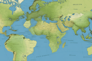
Geographic Grid
- The system of intersecting lines used to locate points on a map or globe is called the geographic grid.
Components of the Geographic Grid
- The two main components of the geographic grid are:
- Lines of latitude (running east-west, parallel to the equator)
- Lines of longitude (running north-south, intersecting at the poles)
Equator and Hemispheres
- The line of latitude located at 0 degrees is the Equator, which divides the Earth into the Northern and Southern Hemispheres.
Geographic Grid Purpose and Function
- The geographic grid is a system used to accurately locate and identify points on the Earth's surface.
- It is used to organize and reference spatial data, facilitating navigation, mapping, and geographic analysis.
- The purpose of using a geographic grid is to provide a standardized method for communicating location information and to enable accurate distance and direction calculations.
Geographic Grid Division
- The geographic grid divides the Earth into a network of squares or rectangles, allowing for precise location identification using coordinates (latitude and longitude).
Studying That Suits You
Use AI to generate personalized quizzes and flashcards to suit your learning preferences.