Podcast
Questions and Answers
Which of the following characteristics is the primary reason Earth is classified as an oblate spheroid rather than a perfect sphere?
Which of the following characteristics is the primary reason Earth is classified as an oblate spheroid rather than a perfect sphere?
- The gravitational pull of the moon.
- The varying density of Earth's crust
- The uneven distribution of landmasses and oceans.
- Flattening at the poles and bulging at the Equator due to its rotation. (correct)
The International Date Line is another name for the Prime Meridian.
The International Date Line is another name for the Prime Meridian.
False (B)
Explain how Earth's axial tilt contributes to the phenomenon of seasons.
Explain how Earth's axial tilt contributes to the phenomenon of seasons.
The 23.5° tilt of Earth's axis causes different hemispheres to receive more direct sunlight at different times of the year, leading to variations in temperature and day length that define the seasons.
The layer of the atmosphere where most weather phenomena occur is the __________.
The layer of the atmosphere where most weather phenomena occur is the __________.
Match the atmospheric layer with its defining characteristic:
Match the atmospheric layer with its defining characteristic:
Which of the following best describes the effect of cloud cover on insolation?
Which of the following best describes the effect of cloud cover on insolation?
Regions at higher latitudes generally receive more direct sunlight and therefore have higher average annual insolation than regions near the Equator.
Regions at higher latitudes generally receive more direct sunlight and therefore have higher average annual insolation than regions near the Equator.
Explain the significance of the ozone layer within the stratosphere.
Explain the significance of the ozone layer within the stratosphere.
The geographic coordinate 0° latitude is known as the ___________.
The geographic coordinate 0° latitude is known as the ___________.
How does Earth rotating on its axis result in day and night
How does Earth rotating on its axis result in day and night
Flashcards
Geography
Geography
The study of the Earth's surface, atmosphere, and human-environment interactions.
Oblate spheroid
Oblate spheroid
Earth's shape is a sphere slightly flattened at the poles and bulging at the Equator.
Geographic Grid
Geographic Grid
A coordinate system using latitude and longitude to locate points on Earth.
Latitude
Latitude
Signup and view all the flashcards
Longitude
Longitude
Signup and view all the flashcards
Earth's Rotation
Earth's Rotation
Signup and view all the flashcards
Earth's Revolution
Earth's Revolution
Signup and view all the flashcards
Atmosphere
Atmosphere
Signup and view all the flashcards
Troposphere
Troposphere
Signup and view all the flashcards
Insolation
Insolation
Signup and view all the flashcards
Study Notes
- Geography studies Earth's surface and atmosphere, including human-environment interactions.
Earth as a Planet
- Earth, the third planet from the Sun, is the largest terrestrial planet.
- Its shape is an oblate spheroid, being spherical but flattened at the poles and bulging at the Equator.
- Earth's layers consist of the crust, mantle, outer core, and inner core.
- Earth remains the only known planet to support life.
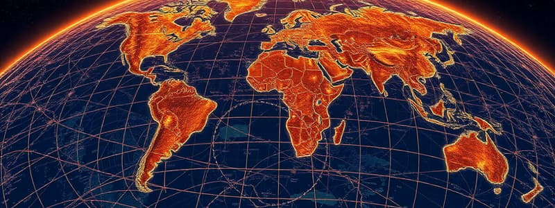
Geographic Grid
- The geographic grid is a coordinate system for locating any point on Earth.
- This system uses lines of latitude and longitude.
- Latitude lines run east to west, parallel to the Equator, measuring distances north or south of it.
- The Equator is 0° latitude, while the North and South Poles are 90° N and 90° S.
- Longitude lines run north to south, converging at the poles, measuring distances east or west of the Prime Meridian.
- The Prime Meridian is 0° longitude, passing through Greenwich, England.
- Latitude and longitude coordinates specify locations on Earth.
Rotation and Revolution
- Earth's rotation is its spin on its axis, an imaginary line through the North and South Poles.
- One rotation takes about 24 hours, defining a day.
- Rotation causes the cycle of day and night.
- Earth's revolution is its orbit around the Sun.
- One revolution takes about 365.25 days, defining a year.
- The 23.5° tilt of Earth's axis results in varying sunlight amounts, causing seasons.
Composition and Structure of Atmosphere
- The atmosphere is a layer of gases held by gravity.
- Major components include approximately 78% nitrogen, 21% oxygen, with smaller amounts of argon, carbon dioxide, and other trace gases.
- The atmosphere has layers, divided by temperature gradients.
- From the surface up, these layers are the troposphere, stratosphere, mesosphere, thermosphere, and exosphere.
- The troposphere, the lowest layer, is where weather occurs.
- The stratosphere contains the ozone layer, which absorbs ultraviolet radiation.
- The mesosphere is where meteors burn up.
- The thermosphere is the orbit location of the International Space Station; auroras also occur here.
- The exosphere is the outermost layer, fading into space.
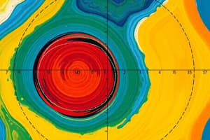
Insolation
- Insolation is incoming solar radiation, the solar energy received per unit area on Earth's surface.
- Factors affecting insolation include:
- Angle of incidence: Direct sunlight (90°) concentrates energy, increasing insolation, while oblique angles spread energy, reducing insolation.
- Latitude: Regions near the Equator receive more direct sunlight, resulting in higher insolation, compared to higher latitudes.
- Atmospheric conditions: Clouds, dust, and gases can absorb, reflect, or scatter solar radiation, decreasing insolation.
- Day length: Longer days increase total insolation per day.
- Earth's orbit: Earth's elliptical orbit causes slight variations in distance from the Sun, affecting solar radiation received.
- Insolation drives Earth's climate system, influencing temperature, weather, and ecosystem distribution.
Studying That Suits You
Use AI to generate personalized quizzes and flashcards to suit your learning preferences.