Podcast
Questions and Answers
What type of map focuses on illustrating the distribution of rocks, minerals, and soil types?
What type of map focuses on illustrating the distribution of rocks, minerals, and soil types?
- Geological Maps (correct)
- Thematic Maps
- Cognitive Maps
- Road Maps
Which type of map is designed for navigating transportation networks?
Which type of map is designed for navigating transportation networks?
- Economic Maps
- Topographic Maps
- Road Maps (correct)
- Geological Maps
What do thematic maps focus on?
What do thematic maps focus on?
- Weather patterns and temperature ranges
- Climate changes
- Population density (correct)
- Economic activities
Which type of map provides detailed representations of the Earth's surface, including elevation changes and physical features?
Which type of map provides detailed representations of the Earth's surface, including elevation changes and physical features?
What do cognitive maps represent?
What do cognitive maps represent?
Which type of map projection maintains right angles and preserves true directions but distorts the sizes of areas and distances?
Which type of map projection maintains right angles and preserves true directions but distorts the sizes of areas and distances?
What type of scale covers large areas but does not represent details in great detail?
What type of scale covers large areas but does not represent details in great detail?
What is the purpose of a legend on a map?
What is the purpose of a legend on a map?
Which map type shows more detail than small-scale maps and covers a more limited area?
Which map type shows more detail than small-scale maps and covers a more limited area?
What do contour lines on a map represent?
What do contour lines on a map represent?
Study Notes
Mapping Our World: An Introduction to Geographic Concepts
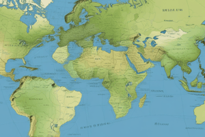
When you think of geography, you might envision globes, atlases, or a detailed topographical map. These visual aids, known as maps, play a crucial role in helping us understand the physical, cultural, and environmental aspects of our world. In this article, we'll delve into various types of maps, map projections, scale, legends, and contour maps—foundational concepts for interpreting and creating geographic information.
Types of Maps
Maps are versatile tools that represent different aspects of Earth, and come in various types:
- Topographic Maps: Detailed representations of the Earth's surface, showing elevation changes, land forms, and physical features.
- Road Maps: Designed for navigating transportation networks, depicting roads, highways, and sometimes points of interest.
- Thematic Maps: Focused on a single theme, such as climate, vegetation, or population density.
- Cognitive Maps: Abstract mental representations of an environment, used to find one's way around a physical or social space.
- Geological Maps: Used to illustrate the distribution of rocks, minerals, and soil types.
- Economic Maps: Showing data related to economic activities, industries, or resources.
- Climate Maps: Representing weather patterns, temperature ranges, and precipitation levels.
Map Projections
One of the most challenging aspects of mapping is displaying the three-dimensional surface of Earth on a two-dimensional map. Map projections are mathematical methods of transforming the spherical Earth into a flat image. There are numerous map projections, each with its strengths and weaknesses:
- Cylindrical Projections: Maintain right angles and preserve true directions, but distort the sizes of areas and distances.
- Conic Projections: Represent a portion of the globe as a cone, with distorted shapes and sizes.
- Azimuthal Projections: Show the entire globe centered on a point, with distortions in shapes and sizes.
- Equal-Area Projections: Preserve areas accurately but distort shapes and distances.
Scale
Scale refers to the ratio between distances on a map and their corresponding distances on the Earth's surface. Maps can be classified into four main types of scale:
- Small Scale: Maps with large areas covered, where details are not represented in great detail, such as road maps and world maps.
- Medium Scale: Shows more detail than small-scale maps and covers a more limited area, such as state maps or large-scale county maps.
- Large Scale: Highly detailed maps, showing features such as buildings, roads, and land cover, covering smaller areas like city maps.
- Very Large Scale: Highly detailed maps, showing features such as buildings and individual trees, covering minute areas like cadastral maps.
Legend
A legend is a key that helps the reader understand and interpret the symbols and colors used on a map. Legends include information about the map's scale, contour intervals, and the meanings behind the map's colors, shapes, and symbols.
Contour Maps
Contour maps represent elevation changes on a topographic map, with contour lines connecting points of equal elevation. Contour lines can indicate the steepness, direction, and shape of a terrain's surface and are used to represent elevation changes more clearly than using shades of gray.
In summary, maps are essential tools for understanding and navigating our world. By understanding the types of maps, map projections, scale, legend, and contour maps, you can interpret geographic information more accurately and confidently. The next time you refer to a map, remember these concepts and use them to better understand the representations of our planet.
Studying That Suits You
Use AI to generate personalized quizzes and flashcards to suit your learning preferences.
Description
Explore foundational concepts in geography such as types of maps (topographic, road, thematic, etc.), map projections, scale, legends, and contour maps. Gain insights into how maps represent physical, cultural, and environmental aspects of our world, helping us navigate and understand our planet better.