Podcast
Play an AI-generated podcast conversation about this lesson
Download our mobile app to listen on the go
Get App
Questions and Answers
What is the purpose of using a map projection?
What is the purpose of using a map projection?
- To represent all features of the earth's surface in their true size and form
- To ensure that each point on the paper corresponds to the actual ground position
- To draw a map at a reduced scale (correct)
- To simplify the representation of different features using symbols, colours, and shades
Why is it impossible to draw a map of the school campus in its actual size?
Why is it impossible to draw a map of the school campus in its actual size?
- Because the actual size of the campus is too large to fit on a map
- Because the school campus cannot be accurately represented on a map
- Because drawing the actual size of the campus is not feasible due to limitations in technology
- Because a map drawn in actual size would be impractical and unwieldy (correct)
What is the defining characteristic of a map?
What is the defining characteristic of a map?
- Drawing maps at a reduced scale
- Drawing each point on the paper at the actual ground position
- Selective, symbolised, and generalised representation (correct)
- Accurate representation of all features of the earth's surface
How are different features represented on a map?
How are different features represented on a map?
Signup and view all the answers
Why are maps drawn at a reduced scale?
Why are maps drawn at a reduced scale?
Signup and view all the answers
What is the purpose of using symbols, colours, and shades in map representation?
What is the purpose of using symbols, colours, and shades in map representation?
Signup and view all the answers
Why is it impossible to draw a map of the school campus in its actual size?
Why is it impossible to draw a map of the school campus in its actual size?
Signup and view all the answers
What makes a map a selective, symbolised, and generalised representation?
What makes a map a selective, symbolised, and generalised representation?
Signup and view all the answers
Flashcards are hidden until you start studying
Study Notes
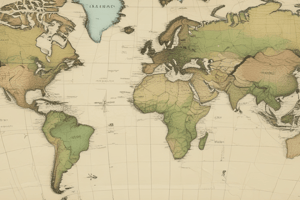
Importance of Map Projections
- The purpose of using a map projection is to represent the curved surface of the Earth on a flat surface.
Limitations of Mapping
- It is impossible to draw a map of the school campus in its actual size because it would be impractical and unwieldy.
Characteristics of Maps
- A map is defined as a selective, symbolized, and generalized representation of the real world.
- The defining characteristic of a map is that it is a representation of a larger area on a smaller scale.
Representing Features on Maps
- Different features on a map are represented using various techniques, such as symbols, colours, and shades.
Purpose of Symbols and Colours
- Symbols, colours, and shades are used in map representation to convey information about different features, making it easier to understand and interpret.
Importance of Scale
- Maps are drawn at a reduced scale to make it possible to represent a large area in a smaller format, making it easier to comprehend and use.
Studying That Suits You
Use AI to generate personalized quizzes and flashcards to suit your learning preferences.