Podcast
Questions and Answers
What is mass wasting primarily driven by?
What is mass wasting primarily driven by?
Which of the following factors reduces shear strength in saturated soil?
Which of the following factors reduces shear strength in saturated soil?
What happens when shear resistance is less than shear force?
What happens when shear resistance is less than shear force?
Which of the following is NOT a common trigger of mass wasting?
Which of the following is NOT a common trigger of mass wasting?
Signup and view all the answers
How does gravity affect shear forces on steep slopes?
How does gravity affect shear forces on steep slopes?
Signup and view all the answers
What role does a small amount of water play in soil movement?
What role does a small amount of water play in soil movement?
Signup and view all the answers
What is the most avoidable major geologic hazard mentioned?
What is the most avoidable major geologic hazard mentioned?
Signup and view all the answers
Which of the following terms is associated with resistance to movement in mass wasting?
Which of the following terms is associated with resistance to movement in mass wasting?
Signup and view all the answers
What characterizes the movement of bedrock, rock debris, or soil in mass wasting?
What characterizes the movement of bedrock, rock debris, or soil in mass wasting?
Signup and view all the answers
Which condition can lead to an increase in shear force during mass wasting?
Which condition can lead to an increase in shear force during mass wasting?
Signup and view all the answers
What role does vegetation play in the stability of soil during mass wasting events?
What role does vegetation play in the stability of soil during mass wasting events?
Signup and view all the answers
Which of the following is a direct trigger of mass wasting?
Which of the following is a direct trigger of mass wasting?
Signup and view all the answers
How does saturated soil affect its shear strength?
How does saturated soil affect its shear strength?
Signup and view all the answers
What happens when shear resistance is equal to shear force in the context of mass wasting?
What happens when shear resistance is equal to shear force in the context of mass wasting?
Signup and view all the answers
Which factor is considered the primary driving force behind mass wasting?
Which factor is considered the primary driving force behind mass wasting?
Signup and view all the answers
What effect does heavy rainfall have on mass wasting?
What effect does heavy rainfall have on mass wasting?
Signup and view all the answers
Study Notes
Exogenic Processes of the Earth: Mass Wasting
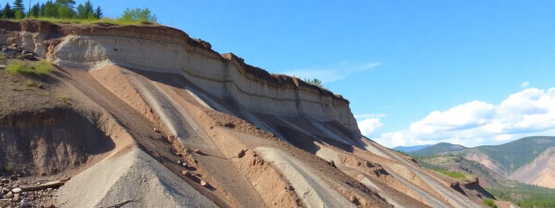
- Mass wasting is the downhill movement of bedrock, rock debris, or soil caused by gravity.
- It's a major geologic hazard.
Controlling Factors in Mass Wasting
-
Driving Force: Gravity
- Slope angle: Steep slopes increase instability.
- Local relief: High relief regions are more prone to mass wasting.
- Bedrock thickness: Thick layers of soil increase instability.
- Orientation of planes of weakness in bedrock: Planes parallel to the slope are more stable.
-
Contributing Factors
- Thickness of soil over bedrock
- Orientation of planes of weakness in bedrock
- Climatic factors (ice in the ground, water in soil, precipitation)
- Vegetation
-
Stable Situations
- Gentle slopes or horizontal surfaces
- Low thickness of soil
- Planes at right angles to the slope
-
Unstable Situations
- Steep or vertical slopes
- High thickness of soil
- Planes parallel to the slope
Shear Strength and Water
- Shear strength is the resistance to movement or deformation.
- Saturated soil has reduced shear strength due to increased pore pressure.
- A small amount of water can prevent downslope movement (e.g., building a sandcastle).
Mass Wasting Triggers
- Seismic activity
- Heavy rainfall
- Construction
- Lack of vegetation
Classification of Mass Wasting
- Rate of movement: from <1 cm/year to 100 km/hour.
- Type of material: Solid bedrock or debris (unconsolidated material).
Types of Mass Wasting
- Flow: Mass movement where material moves as a viscous fluid. (examples: earthflow, debris flow, mudflow)
- Slide: Mass movement where material moves along a well-defined surface. (examples: translational slide, rotational slide)
- Fall: Mass movement where material freely falls. (examples: rockfall, rockslide)
Preventing Landslides
- Remove loose material
- Stitch slopes together
- Construct retaining walls with drains
Streams and Floods: Hydrologic Cycle
- Movement and interchange of water between the sea, air, and land.
- Includes Evaporation, Precipitation, Transpiration, Runoff, Infiltration.
Streams and Floods: Running Water
- Stream: A confined body of running water, flowing under gravity.
- Headwaters: Upper portion near the source, often in mountains.
- Mouth: Where a stream enters a larger body of water(e.g., lake, ocean).
- Channel: Narrow eroded depression.
- Stream banks: Sides of a channel.
- Streambed: Bottom of the channel.
- Floodplain: Flat area created by sediments deposited during floods.
Drainage Basins
- Total area drained by a stream and its tributaries (smaller streams that join the main one).
- Divides (high ground) separate drainage basins.
Drainage Patterns
- Dendritic: Branching pattern resembling a tree.
- Radial: Streams diverge outward like spokes from a center point.
- Rectangular: Streams often intersect at right angles.
- Trellis: Parallel streams with tributaries meeting at right angles.
Factors Affecting Stream Erosion and Deposition
- Velocity
- Discharge
- Gradient
- Channel shape and roughness
Stream Transportation of Sediment
- Bed load: Large, heavy particles moving along the streambed.
- Suspended load: Smaller, lighter particles suspended in the flowing water
- Dissolved load: Dissolved minerals carried in solution.
Stream Deposition
- Bars: Temporary sediment deposits along the stream course.
- Place deposits: Concentrated heavy sediment at a location.
Braided Streams
- Interconnected rivulets (small streams) with numerous bars around which water flows.
- Common in areas with high sediment loads.
Meandering Streams
- Pronounced sinuous curves (meanders).
- Erosion on the outside of bends creating cutbanks
- Deposition on the inside creating point bars.
Meandering Cutoffs
- When a new, shorter channel cuts across the neck of a meander, creating an oxbow lake.
Floodplains
- Broad areas of land built up by sediments deposited on either side of a stream channel
- Form during floods when water overflows from its channel
- Natural levees slightly raised areas along the main channel
Deltas
- Deposits of sediment at the mouth of a river when the flow velocity decreases.
- Shape depends on whether wave, tide or stream-dominated.
Alluvial Fans
- Fan-shaped sediment deposit where a stream flows from a steep slope onto a flatter surface.
Stream Valley Development
- Downcutting: Deepening of the valley by stream erosion
- Headward erosion: Uphill extension of a valley.
- Grading: A balanced state where sediment load matches transporting ability.
- Terraces: Step-like landforms above a stream and its floodplain
Floods
- Occurs when water levels rise and overflow stream banks due to increased volume or discharge.
- Natural process but can cause significant damage in populated areas.
Flooding and Urbanization
- Urbanization increases runoff and speeds up waterflow to streams thus increasing flash flood potential.
Flash Flooding
- Sudden, high-volume, short-duration flood often caused by heavy thunderstorms.
Reducing Flood Risk
- Dams to store water and regulate release.
- Artificial levees but need management to avoid downstream risk.
- Wise land-use planning, including avoidance of development near floodplains.
Impact of Dams
- Social benefits (electricity, water supply).
- Environmental concerns (sediment trapping, habitat loss).
the Importance of Groundwater
- Lies beneath the surface, filling pores in sediments and rocks.
- Important resource for drinking water, agriculture, and industry.
- Supplies approximately 1.7% of the hydrosphere.
Contaminants in Groundwater
- Infiltrating water carries pollutants like pesticides, fertilizers, heavy metals, and industrial chemicals.
Balancing Withdrawal and Recharge
- Crucial to sustain groundwater resources for future use. Should never be withdrawn faster than replenished.
Geologic Effects of Groundwater
- Dissolves soluble rocks (e.g., limestone, creating caves, sinkholes)
- Subsidence: Ground sinking due to the removal of groundwater
- Changes in the base level
- Creates karst formations
Porosity and Permeability
- Porosity: Percentage of void space in a rock.
- Permeability: Rock's ability to transmit fluid through its pores.
Aquifers and Aquitards
- Aquifer: Permeable rock layer containing groundwater used for wells.
- Aquitard: Impermeable rock layer that restricts groundwater flow.
Movement of Groundwater
- Groundwater moves through pores and fractures at a relatively slow rate (cm to meters per day).
- Rates increase in highly permeable materials like caves and fissures.
Wells
- Deep holes dug or drilled to access groundwater in aquifers to obtain water.
- Water level in an unconfined aquifer is at the water table.
- Pumping can lower the water table (drawdown).
Glaciers and Glaciation
- Large, long-lasting masses of ice that move under their own weight.
- Types: Alpine (mountain valleys) and Continental (large, ice sheets).
Distribution of Glaciers
- Most extensive in polar regions but can occur wherever snow accumulation exceeds loss throughout the year.
Formation and Growth of Glaciers
- Snowfall is compacted and recrystallized into granules and then firn before forming glacial ice.
- Gravity moves glaciers downslope.
Glacial Budget
- Advances or retreats based on relative accumulation and ablation or ice loss.
Movement of Valley Glaciers
- Move downslope due to gravity, including Basal sliding and plastic flow patterns.
Movement of Ice Sheets
- Move downslope and outward from a central high area due to both basal sliding and plastic flow.
Glacial Erosion
- Glaciers erode rocks and other material as they move, including Plucking and Abrasion, forming U-shaped valleys and polishing rocks
Glacial Deposits
- Glacial till: Unsorted and unlayered sediment deposited by the glacier. Includes Moraines that form at the sides of or at the terminus of the glacier.
- Outwash: Sediment transported and deposited by meltwater from a glacier, usually found as braided stream deposits.
- Varves: Alternating layers of coarse and fine sediment in glacial lakes.
Glacial Valleys
- U shaped valleys formed by deep glacial erosion.
- Associated with alpine glaciation.
- Features include hanging valleys, truncated spurs, cirques, horns and arêtes
Landscapes Associated With Continental Glaciation
- Rounded topography, grooved or striated rock surfaces are common features formed by moving glaciers.
Glacial Deposition: Outwash
- Sediment deposited by glacial meltwater.
- Forms braided stream patterns and features like eskers, kettles, and kames
Past Glaciation
- Extensive ice ages in the Earth's past. Evidenced by tillites, moraines and glacial-carved landscapes
- Hypothesized by scientists like Louis Agassiz.
Deserts and Wind Action
- Deserts: Receive less than 25 cm of precipitation per year and are primarily shaped by wind and infrequent water erosion
- Wind: Principal erosional and depositional agent. Transports sediment, leading to features like blowouts, desert pavement, or loess.
- Types of Desert Landscapes: Based on rainfall and climate characteristics.
Wind Erosion and Transportation
- Wind can keep dust in suspension at low speeds, but higher winds cause saltation or sand grains move by bouncing or skipping along.
- Sandblasting rocks by suspended grains, creating ventifacts.
- Deflation: Removal of fine sediments
- Desert paving: Remaining coarse material after fine sediments have eroded.
Wind Deposition: Loess
- Unweathered grains of quartz, feldspar, etc.
- Often fertile due to mineral content but is easily eroded.
Wind Deposition: Sand Dunes
- Mounds of loose sand, shaped and moved by wind.
- Types: Barchan (crescent), Transverse(straight), Parabolic (U-shaped)
- Crosswinds shape them.
Studying That Suits You
Use AI to generate personalized quizzes and flashcards to suit your learning preferences.
Related Documents
Description
Test your knowledge on mass wasting, a significant geologic hazard caused by gravity. This quiz covers the driving and contributing factors of mass wasting, along with stable and unstable situations. Understand how these processes affect our environment.


