Podcast
Questions and Answers
What is the primary reason the majority of Ethiopian rivers end at seas and oceans?
What is the primary reason the majority of Ethiopian rivers end at seas and oceans?
- They flow towards lowland regions
- They are limited by the mountainous terrain
- They originate from highland areas (correct)
- They are trans-boundary rivers
Which of the following statements about Ethiopian rivers is true regarding their seasonal behavior?
Which of the following statements about Ethiopian rivers is true regarding their seasonal behavior?
- They remain constant throughout the year
- They experience flooding during the dry season
- They dry up entirely in the wet season
- They experience extreme fluctuations due to marked seasonality of rainfall (correct)
Which river in Ethiopia has the largest catchment area?
Which river in Ethiopia has the largest catchment area?
- Tekeze
- Abay
- Wabishebelle (correct)
- Genale Dawa
What common natural feature is characteristic of Ethiopian rivers due to surface ruggedness?
What common natural feature is characteristic of Ethiopian rivers due to surface ruggedness?
Which Ethiopian river flows towards the Indian Ocean?
Which Ethiopian river flows towards the Indian Ocean?
What geological process is responsible for the formation of Ethiopian lakes?
What geological process is responsible for the formation of Ethiopian lakes?
Which of the following rivers serves as a boundary for administrative units in Ethiopia?
Which of the following rivers serves as a boundary for administrative units in Ethiopia?
During which season do Ethiopian rivers typically experience flooding and higher runoff?
During which season do Ethiopian rivers typically experience flooding and higher runoff?
What notable characteristic describes the valleys formed by Ethiopian rivers?
What notable characteristic describes the valleys formed by Ethiopian rivers?
Why are most Ethiopian lakes found clustered in rift valley systems?
Why are most Ethiopian lakes found clustered in rift valley systems?
What is the primary reason for the irregular distribution of lakes in Ethiopia?
What is the primary reason for the irregular distribution of lakes in Ethiopia?
Which lake is identified as the largest in Ethiopia?
Which lake is identified as the largest in Ethiopia?
What is the estimated hydroelectric power potential of Ethiopia?
What is the estimated hydroelectric power potential of Ethiopia?
What is the main obstacle for using Ethiopian rivers for irrigation?
What is the main obstacle for using Ethiopian rivers for irrigation?
Which of the following lakes is considered a crater lake in Ethiopia?
Which of the following lakes is considered a crater lake in Ethiopia?
How much potential groundwater resource is estimated for Ethiopia?
How much potential groundwater resource is estimated for Ethiopia?
Which river system in Ethiopia is claimed to have large irrigation potential?
Which river system in Ethiopia is claimed to have large irrigation potential?
Which of the following lakes is reported to be the most used for transportation?
Which of the following lakes is reported to be the most used for transportation?
What major environmental issue is facing the fishing potential in Ethiopian lakes?
What major environmental issue is facing the fishing potential in Ethiopian lakes?
What is the annual fish production estimate from Lake Tana?
What is the annual fish production estimate from Lake Tana?
Flashcards
Ethiopian Rivers: Transboundary
Ethiopian Rivers: Transboundary
The majority of Ethiopian rivers originate from highland areas in the country and flow beyond its borders.
Outward Inclination of Ethiopian Highlands
Outward Inclination of Ethiopian Highlands
The Ethiopian Highlands are inclined outwards, causing rivers to flow towards surrounding seas and oceans.
Highland Origin of Ethiopian Rivers
Highland Origin of Ethiopian Rivers
The Ethiopian Highlands have elevations greater than 1500 meters above sea level, making them the source for numerous rivers.
Seasonal Fluctuations in Ethiopian Rivers
Seasonal Fluctuations in Ethiopian Rivers
Signup and view all the flashcards
Rapids and Waterfalls in Ethiopian Rivers
Rapids and Waterfalls in Ethiopian Rivers
Signup and view all the flashcards
Valleys and Canyons in Ethiopian Rivers
Valleys and Canyons in Ethiopian Rivers
Signup and view all the flashcards
Steep Profiles of Ethiopian Rivers
Steep Profiles of Ethiopian Rivers
Signup and view all the flashcards
Tectonic Origins of Ethiopian Lakes
Tectonic Origins of Ethiopian Lakes
Signup and view all the flashcards
Ethiopian Lakes: Rift Valley System
Ethiopian Lakes: Rift Valley System
Signup and view all the flashcards
Drying Ethiopian Lakes
Drying Ethiopian Lakes
Signup and view all the flashcards
Lakes in Ethiopia
Lakes in Ethiopia
Signup and view all the flashcards
Lake Tana's Formation
Lake Tana's Formation
Signup and view all the flashcards
Crater Lakes in Ethiopia
Crater Lakes in Ethiopia
Signup and view all the flashcards
Ethiopian Groundwater
Ethiopian Groundwater
Signup and view all the flashcards
Challenges to Water Resource Utilization
Challenges to Water Resource Utilization
Signup and view all the flashcards
Hydroelectric Potential in Ethiopia
Hydroelectric Potential in Ethiopia
Signup and view all the flashcards
Terrain Challenges for Water Use
Terrain Challenges for Water Use
Signup and view all the flashcards
Irrigation Potential in Ethiopia
Irrigation Potential in Ethiopia
Signup and view all the flashcards
Transportation by Rivers and Lakes
Transportation by Rivers and Lakes
Signup and view all the flashcards
Fish Production in Ethiopian Lakes
Fish Production in Ethiopian Lakes
Signup and view all the flashcards
Study Notes
Ethiopian Water Resources
- Ethiopian rivers originate primarily from the highlands (over 1500 meters above sea level).
- The rivers flow outward from the highlands due to their elevation and inclination.
- The majority of Ethiopian rivers cross international boundaries.
- River flow is highly seasonal, fluctuating dramatically with rainfall. Wet seasons bring high water levels, while dry seasons see rivers dwindle or dry up.
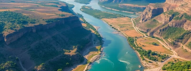
- Rapid currents, waterfalls, and steep-valleyed courses are common features.
- Some rivers serve as international or domestic administrative borders.
- 12 major watersheds are identified, separating the Mediterranean and Indian Ocean drainage systems.
Major Rivers and Tributaries
- Abay River: 199,812 km² catchment area, 54.5 BMC annual volume, flows to the Mediterranean; major tributaries include Dabus, Dedessa, Fincha, Guder, Muger, Jema, and Beshilo.
- Wabishebelle River: 202,697 km² catchment area, 3.4 BMC annual volume, flows to the Indian Ocean; major tributaries include Ramis and Erer.
- Genale Dawa River: 171,042 km² catchment area, 6 BMC annual volume, flows to the Indian Ocean; major tributaries include Dawa, Weyb, Welmel, and Mena.
- Awash River: 114,123 km² catchment area, 4.9 BMC annual volume, flows inland (within Ethiopia). Major tributaries include Akaki, Kesem, Borkena, and Mile.
- Tekeze River: 87,733 km² catchment area, 8.2 BMC annual volume, flows to the Mediterranean; major tributaries include Goang and Angereb.
- Gibe (Omo) River: 79,000 km² catchment area, 16.6 BMC annual volume, flows to Lake Turkana. Major tributary is Gojeb.
- Baro-Akobo River:~75,912 km2 catchment area, 23.23 BMC annual volume, flows to the Mediterranean; major tributary is Akobo.
Ethiopian Lakes
- Most Ethiopian lakes are situated within the Rift Valley system, formed in faulted depressions.
- Lake Tana is the largest, occupying a shallow depression in the highlands possibly formed by sinking and lava flows.
- Other lakes include Crater lakes (e.g., around Bishoftu, Wonchi, Hayk) and Lake Ashenge (on a tectonic basin).
- Lake Abaya is amongst the largest in the Rift Valley.
- Man-made lakes (e.g., Koka, Fincha, Melka Wakena) are also present, often created for hydropower.
- The Chew Bahir, a marshy area at the southern tip of the Rift Valley, is drained by the Segan and Woito rivers.
- Ziway and Shala are significant lakes in the central Ethiopian Rift, notable for different depths.
Subsurface Water
- Ethiopia's groundwater potential is lower than surface water resources.
- However, the total exploitable groundwater potential is significant (estimated 12 - 30 BMC).
- Existing estimates (2.6-6.5 BMC) are viewed as underestimations.
Water Resources Development
- Ethiopia's water resources are largely underutilized.
- Hydropower Potential: Significant hydropower potential (estimated 45,000 megawatts). GERD (6,400 megawatts), Gilgel Gibe III (1,870 megawatts), and other plants contribute around 4,000 megawatts, with exports to neighboring countries. Challenges include seasonal flow variations and reservoir sedimentation.
- Irrigation: Irrigation potential is estimated at 5.3 million hectares. Baro-Akobo and Genale Dawa river systems have high irrigation potential. Most existing irrigation is in the Rift Valley.
- Transportation: Rivers are typically unsuitable for transportation due to rapids, waterfalls, and terrain. Baro River (lower course) is the only navigable river; lakes (like Tana and Abaya), better suited.
- Fishing: Estimated 31.5 thousand tons annual fish production. Lake Tana has high potential (8,000-10,000 tons/year) and Chamo (4,500 tons/year), Rift Valley lakes are most significant. Threats include sedimentation, invasive species, & overfishing.
- Recreation and Tourism: Rivers, Lakes, waterfalls, and landscape offer significant recreation and tourism potential. Scientific value is high due to unique and endemic species. The rugged terrain of the Ethiopian highlands limits the use of rivers for irrigation and transportation despite their high potential.
Studying That Suits You
Use AI to generate personalized quizzes and flashcards to suit your learning preferences.


