Podcast
Questions and Answers
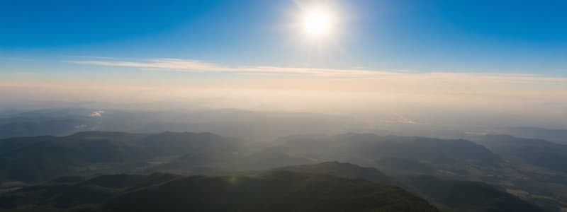
Which of the following statements best explains why deserts are typically not found at the equator?
Which of the following statements best explains why deserts are typically not found at the equator?
- High rainfall and low pressure systems predominate at the equator. (correct)
- The Coriolis effect is strongest at the equator, disrupting desert formation.
- Equatorial regions have a consistently low rate of evaporation due to cloud cover.
- The equator experiences consistently high atmospheric pressure systems.
The Milankovitch cycles, specifically the eccentricity cycle, directly influences daily weather patterns rather than long-term climate shifts.
The Milankovitch cycles, specifically the eccentricity cycle, directly influences daily weather patterns rather than long-term climate shifts.
False (B)
Explain how volcanic eruptions can have both short-term and long-term impacts on global temperatures.
Explain how volcanic eruptions can have both short-term and long-term impacts on global temperatures.
Volcanic ash blocks sunlight for short-term cooling, while sulfur dioxide converts into sulfuric acid, reflecting solar radiation for a long-term cooling effect.
Scientists use indirect data, such as ice cores and tree rings, which serve as ______, to reconstruct past temperatures.
Scientists use indirect data, such as ice cores and tree rings, which serve as ______, to reconstruct past temperatures.
Match each factor with its primary effect on global climate:
Match each factor with its primary effect on global climate:
Which of the following is a critical limitation when using historical documents to understand past climates?
Which of the following is a critical limitation when using historical documents to understand past climates?
An increase in deforestation would likely decrease the concentration of greenhouse gases in the atmosphere.
An increase in deforestation would likely decrease the concentration of greenhouse gases in the atmosphere.
Explain how thermal expansion contributes to sea level rise.
Explain how thermal expansion contributes to sea level rise.
The Saffir-Simpson scale classifies tropical storms based on their ______, providing a standardized measure of storm intensity.
The Saffir-Simpson scale classifies tropical storms based on their ______, providing a standardized measure of storm intensity.
Match the following tropical storm hazards with their typical environmental impacts:
Match the following tropical storm hazards with their typical environmental impacts:
Which forecasting method for tropical storms is most limited by its reliance on local readings over vast ocean areas?
Which forecasting method for tropical storms is most limited by its reliance on local readings over vast ocean areas?
Developed countries are generally less vulnerable to the impacts of tropical storms due to stronger infrastructure, better resources, and advanced technology.
Developed countries are generally less vulnerable to the impacts of tropical storms due to stronger infrastructure, better resources, and advanced technology.
Briefly explain why the city of New Orleans was so severely affected by Hurricane Katrina.
Briefly explain why the city of New Orleans was so severely affected by Hurricane Katrina.
Earthquakes originate at a point within the Earth called the ______, from which seismic waves radiate outward.
Earthquakes originate at a point within the Earth called the ______, from which seismic waves radiate outward.
Match each term related to earthquake measurement with its definition:
Match each term related to earthquake measurement with its definition:
Which of the following accurately reflects a key difference in the impacts of the 2011 Sendai earthquake in Japan (developed country) versus the 2015 Nepal earthquake (developing country)?
Which of the following accurately reflects a key difference in the impacts of the 2011 Sendai earthquake in Japan (developed country) versus the 2015 Nepal earthquake (developing country)?
Earthquakes can currently be predicted with accuracy, allowing for timely evacuations and minimized damage.
Earthquakes can currently be predicted with accuracy, allowing for timely evacuations and minimized damage.
Name two secondary hazards that can be triggered by earthquakes.
Name two secondary hazards that can be triggered by earthquakes.
Composite volcanoes are typically associated with ______ plate boundaries, known for their explosive eruptions.
Composite volcanoes are typically associated with ______ plate boundaries, known for their explosive eruptions.
Match the following factors with their role in determining a country's vulnerability to natural disasters:
Match the following factors with their role in determining a country's vulnerability to natural disasters:
Why are earthquake drills conducted frequently in Japan?
Why are earthquake drills conducted frequently in Japan?
During the Quaternary Period, the Earth’s climate has remained consistently warm and stable.
During the Quaternary Period, the Earth’s climate has remained consistently warm and stable.
What role do oceans play in the redistribution of heat energy around the Earth?
What role do oceans play in the redistribution of heat energy around the Earth?
The cyclical changes in solar energy output, linked to the number of sunspots over an approximately 11-year cycle, are known as the ______.
The cyclical changes in solar energy output, linked to the number of sunspots over an approximately 11-year cycle, are known as the ______.
Match the following climate change evidence types with the information they provide:
Match the following climate change evidence types with the information they provide:
Which human activity contributes the most to the increase of greenhouse gases in the atmosphere?
Which human activity contributes the most to the increase of greenhouse gases in the atmosphere?
Tropical storms can form at the equator due to high sea temperatures.
Tropical storms can form at the equator due to high sea temperatures.
Describe the role of warm ocean water in the formation of tropical storms.
Describe the role of warm ocean water in the formation of tropical storms.
A ______ is a rapid rise in sea level caused by low atmospheric pressure and strong winds associated with a tropical storm.
A ______ is a rapid rise in sea level caused by low atmospheric pressure and strong winds associated with a tropical storm.
Match each preparation/response action to its most relevant effect on mitigating tropical storm impacts:
Match each preparation/response action to its most relevant effect on mitigating tropical storm impacts:
What criticism was leveled against authorities in the aftermath of Hurricane Katrina in New Orleans?
What criticism was leveled against authorities in the aftermath of Hurricane Katrina in New Orleans?
Developed countries and developing countries face identical challenges in preparing for and responding to events like Typhoon Haiyan.
Developed countries and developing countries face identical challenges in preparing for and responding to events like Typhoon Haiyan.
Explain how the focus and epicenter of an earthquake are related.
Explain how the focus and epicenter of an earthquake are related.
The ______ is an instrument that measures the size of seismic waves produced by an earthquake.
The ______ is an instrument that measures the size of seismic waves produced by an earthquake.
Match the following responses with their effects in developed vs developing countries after natural disasters:
Match the following responses with their effects in developed vs developing countries after natural disasters:
What is a major factor that contributed to the extensive economic damage caused by the 2011 Sendai earthquake in Japan?
What is a major factor that contributed to the extensive economic damage caused by the 2011 Sendai earthquake in Japan?
Volcanic activity only has negative impacts on the environment.
Volcanic activity only has negative impacts on the environment.
Explain why the impacts of tectonic hazards are often greater in developing countries compared to developed countries.
Explain why the impacts of tectonic hazards are often greater in developing countries compared to developed countries.
The gross domestic product (GDP) per capita and the Human Development Index (HDI) are examples of ______ used to assess a country's level of development.
The gross domestic product (GDP) per capita and the Human Development Index (HDI) are examples of ______ used to assess a country's level of development.
Match the following terms with their appropriate definitions:
Match the following terms with their appropriate definitions:
Flashcards
Latitude
Latitude
The north-south position of a point on the Earth's surface.
Solar Insolation
Solar Insolation
The amount of solar energy received per unit area per unit time.
Air Pressure
Air Pressure
The force exerted on a surface by the air above it.
Low Atmospheric Pressure
Low Atmospheric Pressure
Signup and view all the flashcards
High Atmospheric Pressure
High Atmospheric Pressure
Signup and view all the flashcards
Equator Temperatures
Equator Temperatures
Signup and view all the flashcards
Poles Temperatures
Poles Temperatures
Signup and view all the flashcards
Ocean Currents
Ocean Currents
Signup and view all the flashcards
Climate Change
Climate Change
Signup and view all the flashcards
Quaternary Period
Quaternary Period
Signup and view all the flashcards
Global Warming
Global Warming
Signup and view all the flashcards
Natural Causes of Climate Change
Natural Causes of Climate Change
Signup and view all the flashcards
Milankovitch Cycles
Milankovitch Cycles
Signup and view all the flashcards
Eccentricity
Eccentricity
Signup and view all the flashcards
Sunspot Cycle
Sunspot Cycle
Signup and view all the flashcards
Volcanic Winter
Volcanic Winter
Signup and view all the flashcards
Ice Cores
Ice Cores
Signup and view all the flashcards
Tree Rings
Tree Rings
Signup and view all the flashcards
Greenhouse Effect
Greenhouse Effect
Signup and view all the flashcards
Human Activities & Greenhouse Gases
Human Activities & Greenhouse Gases
Signup and view all the flashcards
Sea Level Rise
Sea Level Rise
Signup and view all the flashcards
Thermal Expansion
Thermal Expansion
Signup and view all the flashcards
Landfall
Landfall
Signup and view all the flashcards
Tropical Storm Season(N)
Tropical Storm Season(N)
Signup and view all the flashcards
Storm Surge
Storm Surge
Signup and view all the flashcards
Saffir-Simpson Scale
Saffir-Simpson Scale
Signup and view all the flashcards
Atmospheric Pressure readings
Atmospheric Pressure readings
Signup and view all the flashcards
Satellite Tracking
Satellite Tracking
Signup and view all the flashcards
Katrina (2005) Storm Surge
Katrina (2005) Storm Surge
Signup and view all the flashcards
Typhoon Haiyan (2013)
Typhoon Haiyan (2013)
Signup and view all the flashcards
Earthquake Prediction
Earthquake Prediction
Signup and view all the flashcards
Magnitude
Magnitude
Signup and view all the flashcards
Seismograph
Seismograph
Signup and view all the flashcards
Richter Scale
Richter Scale
Signup and view all the flashcards
Focus
Focus
Signup and view all the flashcards
Epicenter
Epicenter
Signup and view all the flashcards
GDP
GDP
Signup and view all the flashcards
Economic Development (Nepal)
Economic Development (Nepal)
Signup and view all the flashcards
Study Notes
- Heat energy redistributes around the Earth through various mechanisms
Latitude
- A geographic coordinate that specifies the north-south position of a point on the Earth's surface.
Solar Insolation
- Measurement of the amount of solar energy received per unit area per unit time.
Air Pressure
- The force exerted on a surface by the air above it as gravity pulls it to Earth.
Air Movement and Pressure
- Low atmospheric pressure causes air to move upwards, often leading to precipitation
- High atmospheric pressure causes air to move downwards, often leading to dry conditions
Global Temperature Variation
- Equator has high solar insolation which heats up a small, concentrated area, resulting in higher temperatures
- Poles have lower solar insolation spread over a larger area due to the curvature of the Earth, resulting in lower temperatures
Atmospheric Cells
- Types include Hadley, Ferrel, and Polar cells
Deserts and Atmospheric Pressure
- Deserts are not found at the equator due to high rainfall and low pressure systems
- Deserts usually form where there is high pressure.
Ocean Currents
- Redistribute heat energy around the Earth, transferring about 25% of global heat
- They have a significant influence on climate
- Oceans heat up more slowly than land but retain heat for longer
- Winds on the Earth's surface create friction with surface water, setting up ocean currents (gyres)
- The Coriolis effect deflects ocean currents
Past Causes of Climate Change
- Climate change constitutes any significant change in the Earth's climate over a long period
- The climate constantly changes
- Quaternary Period spans from 2.6 million years ago to the present day
- Global temperature has shifted between cold glacial periods (around 100,000 years) and warmer interglacial periods (around 10,000 years)
- The last glacial period ended around 15,000 years ago
- Before the Quaternary, the Earth's climate was warmer and more stable
- Global warming is the most recent indication of climate change
- Since 1880, the average global temperature has risen by 0.85°C, mostly since the mid-1970s
Natural Causes of Climate Change
- Changes in the Earth's orbit
- Variations in heat output from the Sun
- Volcanic activity & asteroid impacts
Milankovitch Cycles (Orbital Change)
- Identified by Milutin Milankovitch
- They affect the timings and seasons of the Earth's climate
- The 100,000-year eccentricity cycle coincides with alternating glacial and inter-glacial periods
- Eccentricity describes how the Earth's orbit changes from almost circular to mildly elliptical every 100,000 years
Sunspots
- Cyclical changes in solar energy output are linked to sunspots
- Sunspot Cycle describes how the number of sunspots increases to a maximum and back to a minimum over about 11 years
- Maximum sunspot activity means the Sun gives off more heat, while minimum activity reduces solar output, leading to lower temperatures on Earth
- Few sunspots between 1645 and 1715 coincided with the Little Ice Age
Volcanic Eruptions & Asteroid Impacts
- Violent eruptions blast ash, gases, and liquids into the atmosphere
- Volcanic ash blocks sunlight, reducing temperatures (short-term impact)
- Sulphur dioxide converts to sulphuric acid, acting like tiny mirrors reflecting radiation from the Sun (long-term impact)
- Volcanic Winter describes the cooling of the lower atmosphere and reduction of surface temperatures
Evidence for Natural Climate Change
- Thermometers provide direct measurements, but reliable records only go back about a hundred years
- Scientists use indirect data and proxies for past temperatures
Ice Cores
- Ice has built up over hundreds of thousands of years in polar regions
- Ice forms in layers annually, trapping tiny air bubbles
- Air bubbles contain a sample of the atmosphere from the time they were frozen, recording carbon dioxide levels
Tree Rings
- Growth rings are wider in warmer, wetter climates and narrower in colder, drier climates
- Analyzing rings tells what the climate was like throughout a tree's history
- Past climates can be reconstructed from old buildings and fossilized trees
Historical Sources
- Historical documents, such as personal diaries, paintings, and religious records, provide descriptions of past climates
- The Anglo-Saxon Chronicles record years of drought or heavy rain
Human Activities and Global Warming
- Air in the atmosphere consists of:
- Nitrogen
- Oxygen
- Argon
- Neon
- Carbon Dioxide
- Water Vapor
- Carbon dioxide helps to regulate temperatures on Earth and is one of the greenhouse gases
The Greenhouse Effect
- Describes the way that gases in the atmosphere trap heat from the Sun
- The gases act like the glass in a greenhouse, letting heat in, but prevent most of it from getting out
Human Activities that Add Greenhouse Gases
- Burning Fossil Fuels (coal, oil, and natural gas)
- Deforestation
- Agriculture
Evidence for Human-Induced Climate Change
- Global Temperature Rise: Measurements show a steep rise from around the 1950s to the present
- Sea levels have risen by about 20cm since 1900, with the rate of increase risen to 3.2mm a year
- Caused by melting glaciers and ice caps
- Thermal Expansion: Water expands as it gets warmer
- Warmer global temperatures have meant more ice has melted in the Arctic
Projections for Global Temperature Change and Sea Level Rise
- Predictions of future global temperatures and sea level rise are subject to a degree of uncertainty because scientists can not be certain how civilization will react to climate change
Tropical Storm Formation and Decay
- Tropical storms require specific conditions to form and dissipate under certain circumstances
Conditions for Formation
- Warm ocean water, at least 26.5 degrees C, to act as a fuel source
- Winds blowing in a similar direction
- Formation between the tropics
Reasons for Decay
- Landfall: Loss of the warm water fuel source as the storm moves over land
- Colder Water: Movement over ocean waters below 26.5 degrees C
- Conflicting Weather Systems: Encountering weather systems with winds blowing in different directions
Distribution of Tropical Storms
- Tropical storms do not form at the equator
- They form over deep oceans and dissipate over land
- Tropical storms only form between the tropics due to the necessary atmospheric conditions and sea temperatures
- Occur between:
- June and November in the northern tropics
- April and November in the southern tropics
Impact of Climate Change
- There is a direct relationship between the warmth of the oceans and the intensity of tropical storms
- Climate scientists predict that increasing global temperatures will lead to more intense tropical storms
Tropical Storm Hazards and Impacts
- Tropical storms pose significant natural hazards to people and the environment
- Key Terms:
- Track is the path a tropical storm takes
- Storm Surge is a rapid rise in sea level caused by low atmospheric pressure and strong winds
- Saffir-Simpson Hurricane Scale is a classification system for tropical storms based on wind speed
Physical Hazards and Impacts
- High Winds can cause injury or loss of life, damage to property, disruption of services, deforestation, habitat destruction, and damage to ecosystems
- Intense Rainfall can cause displacement, waterborne diseases, damage to property, disruption of infrastructure, soil erosion, landslides, and contamination of water sources
- Storm Surges can cause flooding, displacement, loss of life, damage to property, coastal erosion, saltwater intrusion, and destruction of coastal habitats
- Coastal Flooding can cause displacement, damage to property, disruption of services, spread of waterborne diseases, contamination of ecosystems, and destruction of habitats
- Landslides can cause injury or loss of life, damage to property, disruption of transportation routes, destruction of vegetation, and alteration of landscapes
Preparing for and Responding to Tropical Storms
- Effective preparation and response strategies are crucial to mitigating the impacts of tropical storms
Vulnerability Factors
- Countries are more vulnerable to the impacts of tropical storms due to physical, social, and economic factors
Forecasting Methods
- Atmospheric Pressure monitoring provides early information on potential tropical storm formation, requiring local readings over vast ocean areas, necessitating buoys and ship recordings
- Satellite Tracking and Radar monitors large ocean areas for cloud formations and tracks storm progress in real-time, but can be difficult to distinguish early-stage cyclones from other weather systems
- Modeling generates estimates of likely tracks, landfall points, and patterns using atmospheric and seawater data, but the models depend on good data
Communication and Protection Strategies
- Warnings, such as Hurricane Watch and Hurricane Warning, advise the public
- Emergency Measures include activating defenses like barriers, ordering evacuations, and preparing emergency services
- Public Awareness involves providing information and training on securing property, preparing emergency packs, and evacuation routes
- Infrastructure strategies include reinforcing buildings, constructing storm drains, building sea walls, and elevating houses on stilts
- Raising individual and community awareness educates people about potential dangers and how to respond
Response Actions
- Rescue Operations search for people trapped in collapsed buildings
- Aid Distribution provides food, clean water, medical care, and shelter to victims
- Infrastructure Repair restores things like power and water, and clearing roads
Hurricane Katrina Case Study (2005)
- Impacts:
- Category 4 storm causing storm surges over 6 meters
- New Orleans was severely affected due to being below sea level and levee failures
- 1 million people were made homeless
- Approximately 1,200 deaths
- Damage to oil facilities led to increased petrol prices
- Responses:
- Criticism of authorities for slow evacuation and leaving behind the poorest
- $50 billion in aid from the government as well as international aid
- Mobilization of the National Guard to restore order
- Raising levee heights around New Orleans
Typhoon Haiyan Case Study (2013)
- Impacts:
- Category 5 storm
- Tacloban was the most severely affected city
- 6,000+ deaths and millions displaced
- Widespread destruction of infrastructure
- Responses
- International assistance
- Challenges in delivering aid due to damaged infrastructure
- Issues with coordination and communication
Comparative Analysis
- Hurricane Katrina that hit the USA in 2005 caused 1800 deaths with an economic cost of $100 billion
- Typhoon Haiyan that hit the Philippines in 2013 caused 7000 deaths with an economic cost of $3 billion
Vulnerability
- Developed countries like the USA can better prepare for and respond to tropical storms due to stronger infrastructure, better resources, advanced technology, and effective governance
Earthquake Onset and Prediction
- Earthquakes happen quickly and cannot be predicted
Measuring Earthquakes
- Magnitude measures the size of an earthquake
- The size of seismic waves is measured using a seismograph
- The Richter scale is used to measure the magnitude of earthquakes
Focus and Epicenter
- The Focus is the point within the Earth where the earthquake originates
- The Epicenter is the point on the Earth's surface directly above the focus
Retrieval Questions
- Sendai 2011 (Japan) is a developed country case study
- Nepal 2015 is a developing country case study
- The Magnitude of Sendai Earthquake was 9.0
- The Sendai earthquake caused billions of dollars in damage
- Examples of secondary hazards of earthquakes include tsunamis
- Japan does frequent earthquake drills
Key Facts About the Nepal Earthquake
- Magnitude: 8.1
Development Indicators
- Gross Domestic Product (GDP) per capita is $39,285.16 in Japan and $47,334.36 in the UK
- Human Development Index (HDI) is 0.919 in Japan and 0.932 in the UK
- The UK and Japan are considered developed countries
Studying That Suits You
Use AI to generate personalized quizzes and flashcards to suit your learning preferences.


