Podcast
Questions and Answers
What is the minimum obstacle clearance altitude (MOCA) to ensure in this mission?
What is the minimum obstacle clearance altitude (MOCA) to ensure in this mission?
- 25 ft (correct)
- 10 ft
- 100 ft
- 50 ft
Why is it important to maintain line of sight during the mission?
Why is it important to maintain line of sight during the mission?
- To achieve the correct flight altitude
- To avoid losing the drone
- To ensure proper camera settings
- To prevent running into trees and structures (correct)
What is the purpose of flying two drones at different altitudes in this mission?
What is the purpose of flying two drones at different altitudes in this mission?
- To ensure visual line of sight and prevent collisions (correct)
- To test the drone's maximum speed
- To reduce the flight time
- To increase the flight area
What is the recommended white balance setting for the camera in this mission?
What is the recommended white balance setting for the camera in this mission?
What should you do if a hawk is spotted during the mission?
What should you do if a hawk is spotted during the mission?
Study Notes
Comprehensive Mapping Class
- Today's mission involves:
- Creating double grids with orbits of the whole area
- Performing free flights of a building
- Performing orbits of another building
- Merging all data sets together
- Due to tree coverage, a quad grid and orbits of the whole facility will be done
- Minimum obstacle clearance altitude (MOCA) must be checked to ensure clearance by at least 25 ft
Line of Sight and Tree Coverage
- Main issue with trees and structures:
- Losing line of sight
- Running into them during flight
- To counteract tree coverage:
- Fly up higher and do it all in one grid
- Use a higher altitude to maintain line of sight
Mapping Area and Grid Setup
- Mapping area: the whole property, from one street corner to another, including part of the church parking lot
- Grid setup:
- Double grid through Pix4D Capture
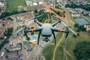
- Use DJI Phantom 4 Advanced drone
- Camera settings: Apple Maps, units in feet, upload resolution: no, auto download images: off
- Drone speed: middle (not too slow, not too fast)
- Angle of camera: 70°
- Front overlap: 70°
- Max speed on drone: fine as long as flying a Phantom
Safety and Altitude
- Safety checks:
- Maintain line of sight
- Watch out for hawks and pause mission if necessary
- Turn into atti mode and descend if hawk is close
- Determine altitude by flying to the furthest corner of the mapping area and checking visibility
- Minimum altitude: 191 ft to maintain visual line of sight
- Flights: two drones in the air at a time, one at 200 ft, one at 240 ft, with a separation of at least 40 ft
Camera Settings and Picture Mode
- Camera settings:
- Angle of camera: 70°
- Front overlap: 70°
- White balance: sunny
- Picture mode:
- Safe mode recommended for Mavic 2 Pro
- Safe mode adds time to the flight but prevents rolling shutter effect
- Fast drone speed acceptable in safe mode
Landing and Mission Completion
- Landing: do not go straight down, landing mode engages at 300 feet
- Mission completion:
- Wait for checklist to complete
- Hit start to begin the mission
Comprehensive Mapping Mission
- The mission involves creating double grids with orbits of the whole area, performing free flights of a building, performing orbits of another building, and merging all data sets together.
Line of Sight and Tree Coverage
- Tree coverage poses two main issues: losing line of sight and running into trees during flight.
- To counteract tree coverage, flying higher and using a higher altitude to maintain line of sight is recommended.
Mapping Area and Grid Setup
- The mapping area covers the whole property, from one street corner to another, including part of the church parking lot.
- Grid setup involves using a double grid through Pix4D Capture, a DJI Phantom 4 Advanced drone, and specific camera settings:
- Apple Maps, units in feet, upload resolution: no, auto download images: off.
- Drone settings:
- Speed: middle (not too slow, not too fast).
- Angle of camera: 70°.
- Front overlap: 70°.
Safety and Altitude
- Safety checks include maintaining line of sight and watching out for hawks, with a plan to turn into atti mode and descend if necessary.
- Determining altitude involves flying to the furthest corner of the mapping area and checking visibility.
- Minimum altitude: 191 ft to maintain visual line of sight.
- Flights: two drones in the air at a time, one at 200 ft, one at 240 ft, with a separation of at least 40 ft.
Camera Settings and Picture Mode
- Camera settings:
- Angle of camera: 70°.
- Front overlap: 70°.
- White balance: sunny.
- Picture mode:
- Safe mode recommended for Mavic 2 Pro to prevent rolling shutter effect.
- Safe mode adds time to the flight but allows for fast drone speed.
Landing and Mission Completion
- Landing: do not go straight down, as landing mode engages at 300 feet.
- Mission completion involves waiting for the checklist to complete and hitting start to begin the mission.
Studying That Suits You
Use AI to generate personalized quizzes and flashcards to suit your learning preferences.
Description
Learn about creating double grids, performing free flights, and merging data sets for comprehensive mapping. Understand the importance of tree coverage and minimum obstacle clearance altitude (MOCA) in aerial mapping.
