Podcast
Questions and Answers
What is the maximum Nordicity value at the North Pole?
What is the maximum Nordicity value at the North Pole?
Which of the following is considered a human characteristic of the cold environment?
Which of the following is considered a human characteristic of the cold environment?
What factor contributes to the high cost of living in northern regions?
What factor contributes to the high cost of living in northern regions?
What is a significant challenge faced by populations in the northern regions?
What is a significant challenge faced by populations in the northern regions?
Signup and view all the answers
Which latitude range is associated with the maximum number of units set by Hamelin?
Which latitude range is associated with the maximum number of units set by Hamelin?
Signup and view all the answers
What significant geographic feature was created during the Wisconsin Glaciation episode?
What significant geographic feature was created during the Wisconsin Glaciation episode?
Signup and view all the answers
How much did sea levels drop during glaciation periods?
How much did sea levels drop during glaciation periods?
Signup and view all the answers
What role did the Bering Strait Land Bridge play in prehistoric migration?
What role did the Bering Strait Land Bridge play in prehistoric migration?
Signup and view all the answers
What characterized the landscape of Beringia compared to the rest of North America during the glaciation period?
What characterized the landscape of Beringia compared to the rest of North America during the glaciation period?
Signup and view all the answers
Which prehistoric creature is mentioned as having roamed the cold grassy plains of Beringia?
Which prehistoric creature is mentioned as having roamed the cold grassy plains of Beringia?
Signup and view all the answers
What percentage of glacier ice in Canada is found in the higher lands of the islands?
What percentage of glacier ice in Canada is found in the higher lands of the islands?
Signup and view all the answers
Which age range characterizes the Paleozoic rock found in the Canadian Shield?
Which age range characterizes the Paleozoic rock found in the Canadian Shield?
Signup and view all the answers
What is a key feature of the polynyas in the eastern archipelago during winter?
What is a key feature of the polynyas in the eastern archipelago during winter?
Signup and view all the answers
Who introduced the concept of Nordicity in 1979?
Who introduced the concept of Nordicity in 1979?
Signup and view all the answers
What combination is used to measure the degree of 'northernness' in the concept of Nordicity?
What combination is used to measure the degree of 'northernness' in the concept of Nordicity?
Signup and view all the answers
What kind of ecosystem characterized the Yukon area before the arrival of glaciers?
What kind of ecosystem characterized the Yukon area before the arrival of glaciers?
Signup and view all the answers
Approximately how long ago did the first people migrate from Asia to the Yukon region?
Approximately how long ago did the first people migrate from Asia to the Yukon region?
Signup and view all the answers
Which site is known for containing important evidence of ice age communities in Beringia?
Which site is known for containing important evidence of ice age communities in Beringia?
Signup and view all the answers
Which language group do the ancestors of Yukon’s First Nations belong to?
Which language group do the ancestors of Yukon’s First Nations belong to?
Signup and view all the answers
What geological feature is primarily shaped by glaciers?
What geological feature is primarily shaped by glaciers?
Signup and view all the answers
What is believed to be the earliest evidence of humans in the Arctic?
What is believed to be the earliest evidence of humans in the Arctic?
Signup and view all the answers
What is the primary reason for the disappearance of boreal forests in ancient Yukon?
What is the primary reason for the disappearance of boreal forests in ancient Yukon?
Signup and view all the answers
What type of sediments reflect the conditions present in Yukon since the end of the Ice Age?
What type of sediments reflect the conditions present in Yukon since the end of the Ice Age?
Signup and view all the answers
What role do eskers play in the ecosystem for caribou?
What role do eskers play in the ecosystem for caribou?
Signup and view all the answers
What are De Geer moraines commonly known for?
What are De Geer moraines commonly known for?
Signup and view all the answers
What is the current rate of isostatic rebound in the Hudson's Bay area?
What is the current rate of isostatic rebound in the Hudson's Bay area?
Signup and view all the answers
What are skerries?
What are skerries?
Signup and view all the answers
Which ecozones range from high arctic to plains in the Yukon?
Which ecozones range from high arctic to plains in the Yukon?
Signup and view all the answers
What geological features can be found in the Canadian Shield?
What geological features can be found in the Canadian Shield?
Signup and view all the answers
How does the Hudson’s Bay raised beaches relate to isostatic rebound?
How does the Hudson’s Bay raised beaches relate to isostatic rebound?
Signup and view all the answers
Which of the following islands are among the largest in the Arctic Archipelago?
Which of the following islands are among the largest in the Arctic Archipelago?
Signup and view all the answers
Which type of terrain is created by the geological processes in the Canadian Shield?
Which type of terrain is created by the geological processes in the Canadian Shield?
Signup and view all the answers
What climate feature is indicated by the mean annual temperatures listed?
What climate feature is indicated by the mean annual temperatures listed?
Signup and view all the answers
Study Notes
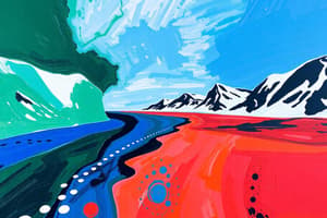
### Arctic and Subarctic
- The Arctic is the northernmost region of the Earth
- The Subarctic lies between the Arctic and the temperate regions
- The Wisconsin Glaciation episode left vast glacial landscapes in the Arctic
- Ice-free Beringia had a different landscape than the rest of North America during glaciation
- Beringia was a land bridge between Siberia and Alaska due to lower sea levels during glaciation
- Beringia was a vast grassy plain with a diverse ecosystem including mammoths, steppe bison, and early humans
- The first humans in Yukon migrated from Asia near the end of the last ice age, about 15,000 years ago
- The Bluefish Cave in Yukon is an important source of information about Ice Age communities, containing stone tools and fossilized bones dating back to 14,000 BCE
- The ancestors of Yukon's First Nations, known as Dene or Athapaskan language speakers, arrived during the Holocene
- Stratified soil layers at Bluefish Cave provide evidence of warmer, moister conditions since the end of the Ice Age
### Glacial Landforms
- Glaciers are a powerful force in shaping the landscape, creating unique landforms
- Eskers are raised ridges formed by glacial meltwater deposits. They are rich in sediments and often used as burial sites.
- Outwash plains are flat, often sandy areas created by meltwater flowing from glaciers.
- De Geer moraines are thin, parallel ridges formed by the retreat of glaciers. They appear as a washboard pattern and provide evidence of glacial movement
- Isostatic rebound is the uplift of land following the removal of glacial ice. Hudson Bay is still recovering from glacial rebound and is expected to rise another 100 meters.
### Hudson's Bay
- Hudson's Bay is a large inland sea in Canada. It's a key example of isostatic rebound.
- The area is characterized by raised beaches, which are elevated shorelines that were once at sea level but have since been lifted by the rebound.
- The coastline of Hudson's Bay features unique landforms shaped by glaciation.
### Canadian Geography
- Canada's major drainage basins include the Arctic Basin, the Hudson Bay System, and the Atlantic Basin.
- Permafrost zones indicate areas where the ground remains frozen for at least two consecutive years.
- Yukon has seven ecozones ranging from high arctic to the plains of central Yukon.
- The Northwest Territories are home to 94 major islands larger than 1,302 km2 and thousands of smaller islands.
- The Arctic Archipelago contains six of the world's 30 largest islands, including Baffin Island, Victoria Island, Ellesmere Island, Banks Island, Devon Island, Axel Heiberg Island, Melville Island, and Prince of Wales Island.
### Geology and Mineral Deposits
- The Canadian Arctic is a variety of landscapes with rugged mountains, deep fjords, and plains.
- The Canadian Shield contains vast mineral deposits, including gold and diamonds.
- Sedimentary rocks, like the Sverdrup Basin, hold oil and natural gas reserves.
### Eastern Arctic & Sea Ice
- The eastern Arctic islands of Baffin, Devon, Ellesmere, and Alex Heiberg are mountainous, rising to over 2,000 meters.
- These islands contain the majority of Canada's glacial ice.
- The eastern Arctic is the northernmost extent of the Canadian Shield, forming a base of Paleozoic rock.
- The Queen Elizabeth Islands are younger and formed from heavily folded sedimentary rocks.
- The eastern Arctic is characterized by deep channels separating the islands.
- Sea ice in the Eastern Arctic can be 1.5-2 meters thick in winter.
- Recurring polynyas, open areas of water surrounded by sea ice, exist in the region. The largest is North of Baffin Island in the southeastern Beaufort Sea.
### Nordicity
- Nordicity is a concept measuring the degree of "northernness", accounting for physical and human factors.
- The concept was developed by Louis-Edmond Hamelin and involves 10 variables, each measured in “polar units.”
- The North Pole has the maximum Nordicity value of 1,000, while the southern limit is set at 200.
- Variables include latitude, natural vegetation, summer heat, accessibility, types of ice, population, economic activity, and precipitation.
### Characteristics of the North
- The North is characterized by cold environments, sparse populations, limited biodiversity, wilderness, remoteness, permafrost, and resource-based economies.
- The north faces challenges including high cost of living, limited infrastructure, fragile ecosystems, and the impacts of climate change.
- Traditional lifestyles and cultural practices are intertwined with the unique physical environment of the Canadian North.
Studying That Suits You
Use AI to generate personalized quizzes and flashcards to suit your learning preferences.
Related Documents
Description
Explore the fascinating geography and human history of the Arctic and Subarctic regions. Learn about glaciation, the land bridge of Beringia, and the early inhabitants of Yukon. This quiz delves into the ecosystems, migration patterns, and archaeological findings from the Ice Age.