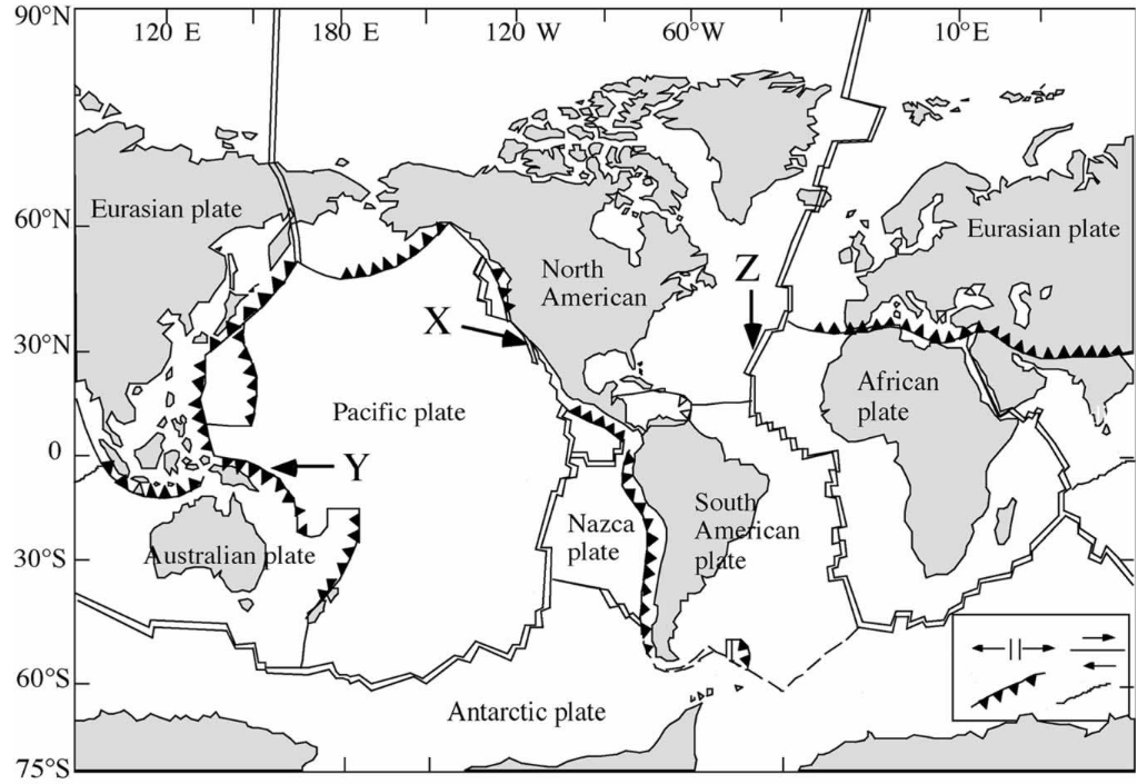
What do the labels X, Y, and Z represent on the tectonic plate map?
Understand the Problem
The question relates to understanding the tectonic plates depicted in the image and possibly identifying the labels X, Y, and Z on the map.
Answer
X: Boundary on Pacific Plate, Y: Boundary on Australian Plate, Z: Near African-Eurasian Plates.
The labels likely represent specific tectonic plate features or boundaries: X and Y are on the Pacific and Australian plates, possibly indicating a boundary. Z is near the African and Eurasian plates. Consult specific map legends for exact details.
Answer for screen readers
The labels likely represent specific tectonic plate features or boundaries: X and Y are on the Pacific and Australian plates, possibly indicating a boundary. Z is near the African and Eurasian plates. Consult specific map legends for exact details.
More Information
Tectonic maps often use points to indicate boundaries or notable geological features, like mid-ocean ridges or subduction zones.
Tips
Ensure to reference the map legend or accompanying documentation for specific labeling meanings.
AI-generated content may contain errors. Please verify critical information