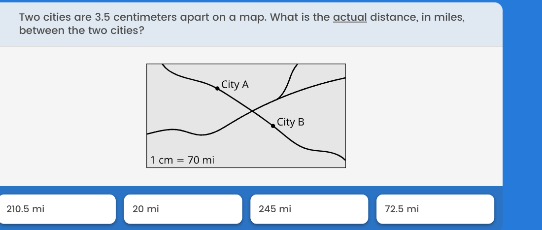
Two cities are 3.5 centimeters apart on a map. What is the actual distance, in miles, between the two cities?

Understand the Problem
The question is asking for the real distance in miles between two cities that are 3.5 centimeters apart on a map, using the given scale of 1 cm = 70 mi. To solve this, we need to convert the distance in centimeters to miles using the provided scale.
Answer
The actual distance between the two cities is 245 mi.
Answer for screen readers
The actual distance between the two cities is 245 miles.
Steps to Solve
-
Identify the distance on the map The distance between the two cities on the map is given as 3.5 centimeters.
-
Understand the scale The scale provided is 1 cm = 70 miles. This means that for every centimeter on the map, the actual distance is 70 miles.
-
Calculate the actual distance To find the actual distance, multiply the distance on the map by the scale factor: $$ \text{Actual distance} = \text{Distance on map} \times \text{Scale} $$ Substituting the values: $$ \text{Actual distance} = 3.5 , \text{cm} \times 70 , \text{mi/cm} $$
-
Perform the multiplication Calculating the actual distance: $$ \text{Actual distance} = 3.5 \times 70 = 245 , \text{mi} $$
The actual distance between the two cities is 245 miles.
More Information
This calculation shows how map scales can be used to determine real distances. In this case, a distance of just 3.5 cm on a map corresponds to a significant real-world distance.
Tips
- Multiplying the distance by the scale incorrectly, for example by mixing up the units or the numbers.
- Forgetting to convert from centimeters to miles if the scale used different units.
AI-generated content may contain errors. Please verify critical information