DO: Interpret Plate Boundaries.
Understand the Problem
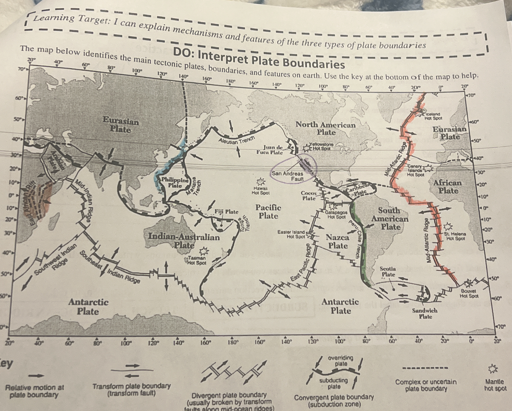
The question is likely asking for an interpretation or analysis of the plate boundaries depicted in the provided map, identifying their types and the geological features associated with them.
Answer
The map displays divergent, convergent, and transform plate boundaries using symbols and colors.
The map shows divergent boundaries (plates moving apart), convergent boundaries (subduction zones), and transform boundaries (sliding). Key features like trenches and ridges are also indicated.
Answer for screen readers
The map shows divergent boundaries (plates moving apart), convergent boundaries (subduction zones), and transform boundaries (sliding). Key features like trenches and ridges are also indicated.
More Information
The map uses a key to help identify the types of plate boundaries, showing how tectonic plates interact through movements such as spreading, colliding, or sliding past each other.
Tips
Be sure to match the symbols and patterns on the map with those in the legend to correctly interpret the boundaries.
Sources
- What are the different types of plate tectonic boundaries? - oceanexplorer.noaa.gov
- Plate Boundaries - National Geographic Education - education.nationalgeographic.org
- Understanding plate motions [This Dynamic Earth, USGS] - pubs.usgs.gov
AI-generated content may contain errors. Please verify critical information